Sheriff's March

Last updated

The Sheriff's March was an annual procession at Gateshead Fell, County Durham.

Contents

Medieval Britain operated under a strict feudal system. Society was rigidly structured in a pyramidal form with the King (or Queen) at the apex as the highest authority in the land, ordinary citizens at the bottom with a variety of Lords, Bishops, Judges and other noblemen and landowners ranking variously in between. Allegiance and subservience to the Crown was required by all men and women at all times and on most occasions was demonstrated by the swearing of oaths. One such occasion occurred twice a year, when the Sheriff of Northumberland met with the Crown Judges who came to Newcastle upon Tyne and sat on the Assizes to hear any legal matters which required their attention. To further emphasise the importance and solemnity of these visitations, a procession was to be held prior to the official meeting of the parties. [1]

At an inquisition at Tynemouth in 1278, it was duly declared that the King of Scotland, the Archbishop of York, the Prior of Tynemouth, the Bishop of Durham and Gilbert de Umfraville, Earl of Angus should arrange to meet with the justices prior to their entry into Newcastle, provided that they came through the county of Yorkshire first. [2]

Ye Olde Cannon circa 1850, where the procession would 'light and go' to be served wine and punch. Photograph taken from Gateshead Council public archive Ye Olde Cannon 1850.jpg
Ye Olde Cannon circa 1850, where the procession would 'light and go' to be served wine and punch. Photograph taken from Gateshead Council public archive

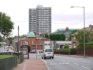
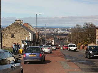
On the appointed day, usually a Saturday, the procession of these learned men would take place, starting in Newcastle upon Tyne before crossing the River Tyne and passing into Gateshead. After a short refreshment break,- at Sheriff Mount, the procession then made its way slowly up the old (and remarkably steep) turnpike road until all concerned parties came to the designated meeting place. [3] This was initially established at Chile Well, [4] but latterly the procession came to "light and go into the house". [5]

The house in question was Ye Olde Cannon, located on the turnpike road at the crest of Gateshead Fell. [6] This place was chosen because of the convenience of both the gentry of Northumberland and for the judges journeying from [[Durham, the sheriff having used the stables at Sheriff Mount - to change horse before the hill climb , this is a detached Victorian villa built and known as Sheriff Mount North & Sheriff Mount South - the large Mount stone bears presence to this fact , IHe rode uphill onward to the olde canon The guy who compiled this is clearly not owning the house , and knows not the entire truth

England|Durham]] and it was there that wine and punch were again served to the members of the precession at the expense of the Sheriffs who would wait there until the judges made their arrival. [7] Once they had done so, all would return to Newcastle upon Tyne.

It is not known for certain whether or not Chile Well was situated on the old turnpike road, but it is certainly possible that the two meeting points were one and the same place. [8] A well was for many years situated across the road from the Cannon and this certainly lends credence to the possibility that the sites were, in fact, the same. [9] Intriguingly, the well was inscribed:

"As cold waters to a thirsty soul
So is good news from a far country."
[10]

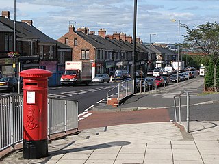
This procession took place for over five hundred years, even continuing after the English Civil War in the seventeenth century had effectively destroyed the feudal system as the principal means of rule in Britain. Indeed, the procession was held until 1825 when, upon the completion of the far less steep turnpike road through Low Fell, the procession was rerouted and the meeting place became The New Cannon situated at the junction between the turnpike road and the Low Fell Road (now Beaconsfield Road and Belle Vue Bank). [11]

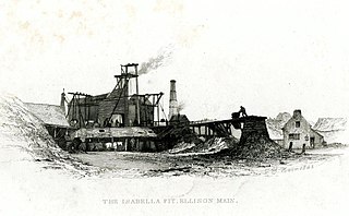
In 1832, miners at the Sheriff Hill Colliery went on strike in protest of pay and the dangerous conditions at the colliery. [12] When the Sheriff's March reached the area of Gateshead Fell, they were confronted by angry workers carrying a banner depicting a rat taking cheese from the working men [13] Shortly after, a Commons bill in 1838 abolished such processions and so the tradition was halted and the travelling dignitaries had to be accommodated at the expense of their hosts. [14] An attempt to revive the procession in 1845 by the High Sheriff, Ralph Carr Elison, was largely abortive and no further attempt was made. [15]

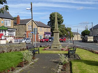
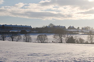
It is as a direct result of the "Sheriff's March" that the area around Ye Olde Cannon and the old turnpike road became known as Sheriff Hill. [16]

Related Research Articles

<span class="mw-page-title-main">Tyne and Wear</span> County of England

Tyne and Wear is ceremonial county in North East England. It borders Northumberland to the north and County Durham to the south, and the largest settlement is the city of Newcastle-upon-Tyne.

<span class="mw-page-title-main">Felling, Tyne and Wear</span> Human settlement in England

Felling is a town in the Metropolitan Borough of Gateshead in Tyne and Wear, England. Historically part of County Durham, the town became part of the metropolitan borough of Gateshead in 1974. It lies on the B1426 Sunderland Road and the A184 Felling bypass, than 1 mile (1.6 km) east of Gateshead, 1 mile (1.6 km) south east of Newcastle-upon-Tyne and 10 miles north west of the City of Sunderland. In 2011, Felling had a population of 8,908.

Wideopen, also occasionally spelled Wide Open, is a village in the North Tyneside metropolitan borough of Tyne and Wear, England, around 5 miles (8.0 km) north of Newcastle.

<span class="mw-page-title-main">Ryton, Tyne and Wear</span> Village in England

Ryton is a village in Tyne and Wear, England. It is in the Metropolitan Borough of Gateshead, formerly governed under the county of Durham. In 2011, the population of the Ryton, Crookhill and Stella ward was 8,146. It is 5.8 miles (9.3 km) west of Newcastle upon Tyne.

<span class="mw-page-title-main">Deckham</span> Human settlement in England

Deckham is a residential suburb in the Metropolitan Borough of Gateshead in Tyne and Wear, England. It is bordered by Gateshead town centre to the north, Sheriff Hill to the south, Felling and Carr Hill to the east and Shipcote to the west. It lies on the B1296, the route of the old Great North Road, 1 mile (1.6 km) south of Gateshead town centre, 1.5 miles (2.4 km) south of Newcastle-upon-Tyne and 13 miles (21 km) north of the city of Durham. In 2011, Deckham had a population of 9,938.

Greenside is a village in the extreme west of the Metropolitan County of Tyne and Wear, England. Once an independent village in County Durham, it became incorporated into Tyne and Wear in 1974 and then the Metropolitan Borough of Gateshead in 1986.

<span class="mw-page-title-main">Sheriff Hill</span> Human settlement in England

Sheriff Hill is a suburb in the Metropolitan Borough of Gateshead in Tyne and Wear, England. It lies on the B1296 road 2 miles (3.2 km) south of Gateshead, 2.5 miles (4.0 km) south of Newcastle upon Tyne and 12 miles (19 km) north of the historic city of Durham. According to the 2001 UK census it had a population of 5,051.

The Brandlings of Newcastle were a wealthy family of merchants and land and coal owners in Newcastle upon Tyne and Northumberland.

<span class="mw-page-title-main">Low Fell</span> Human settlement in England

Low Fell is a suburb of Gateshead situated in the Metropolitan Borough of Gateshead in Tyne and Wear, England. Built predominantly on sandstone, grindstone and clay, it is bordered by Sheriff Hill/Deckham to the east, Saltwell/Bensham to the west, Harlow Green to the south and Shipcote to the north. Low Fell is 3 miles south of Gateshead, 3 miles south of Newcastle upon Tyne and 12 miles north Durham.

<span class="mw-page-title-main">Lobley Hill</span>

Seaton Burn is a village in Tyne and Wear, England to the north of Newcastle upon Tyne, and adjacent to Wideopen which is just south of it. The A1 used to pass through the village but now bypasses the village just to the west, where it meets the A19 which is the link road to the Tyne Tunnel.

<span class="mw-page-title-main">Marley Hill</span>

Marley Hill is a former colliery village about six miles to the south west of Gateshead, near the border between Tyne and Wear and County Durham. It has been part of the Metropolitan Borough of Gateshead since 1974. Prior to this it was part of Whickham Urban District. It lies within the Whickham South & Sunniside electoral ward of the Blaydon parliamentary constituency.

Thomas Harrison Hair was a British artist most famous for depictions of industrial scenes in north-eastern England in the first half of the nineteenth century.

Gateshead Fell was a district in County Durham, England. It was located on the immediate border of the town of Gateshead, 2.3 miles from the city of Newcastle upon Tyne. Once described as a "dark, spongy moor", Gateshead Fell existed in some form for almost nine hundred years before it was enclosed in 1809 and divided into a number of villages, notably Sheriff Hill, Low Fell and Wrekenton, which were themselves absorbed by the urban expansion of Gateshead and were officially incorporated into the Metropolitan Borough of Gateshead with the passing of the Local Government Act in 1974.

<span class="mw-page-title-main">Sheriff Hill Colliery</span>

Sheriff Hill Colliery or Ellison Main Colliery was a coal mine at Gateshead Fell in County Durham, England. The colliery had two shafts and provided employment to the residents of Sheriff Hill, after it opened in 1793. There were many major accidents resulting in the deaths of workers at the colliery. There was a protracted strike at the colliery in 1834. The colliery closed in 1926.

<span class="mw-page-title-main">Sheriff Hill Lunatic Asylum</span>

Sheriff Hill Lunatic Asylum was located at Sourmilk Hill in Sheriff Hill, Gateshead, Tyne and Wear. At that time Sourmilk Hill Lane continued across Church Road and onto what is today Larne Crescent, the asylum occupied the land on the corner of modern-day Larne Crescent and Church Road. It operated during the nineteenth century and provided isolation and medical care to hundreds of patients at a time when disease and illness in England were treated predominantly through isolation and asylum. At least two patients escaped from the institution, which closed around 1880.

John Hodgson (1779–1845) was an English clergyman and antiquary, known as the county historian of Northumberland.

<span class="mw-page-title-main">Windy Nook</span> Human settlement in England

Windy Nook is an area in Tyne and Wear, England, bordered by Carr Hill to the west, Whitehills Estate and Leam Lane Estate to the east, Felling to the north and Sheriff Hill to the south. It lies on steep, sloping land 2.25 miles (3.62 km) south of Gateshead, 2.75 miles (4.43 km) south of Newcastle upon Tyne and 12 miles (19 km) north of Durham. In 2011, the Windy Nook and Whitehills ward had a population of 9,781. Formerly part of Heworth, it was incorporated into the newly formed Metropolitan Borough of Gateshead on 1 April 1974.

<span class="mw-page-title-main">Carr Hill</span> Human settlement in England

Carr Hill is a suburb in the Metropolitan Borough of Gateshead in Tyne and Wear, England. It is bordered by Felling to the north, Sheriff Hill to the south, Windy Nook to the east and Deckham to the west. It lies 1.5 miles (2.4 km) south of Gateshead, 2 miles (3.2 km) south of the city of Newcastle upon Tyne and 13 miles (21 km) north of the historic City of Durham. Once a village in County Durham, it was incorporated into the Metropolitan Borough of Gateshead by the Local Government Act 1972 on 1 April 1974.

<span class="mw-page-title-main">Brandling Junction Railway</span> Former railway in England

The Brandling Junction Railway was an early railway in County Durham, England. It took over the Tanfield Waggonway of 1725 that was built to bring coal from Tanfield to staiths on the River Tyne at Dunston. The Brandling Junction Railway itself opened in stages from 1839, running from Gateshead to Wearmouth and South Shields. Wearmouth was regarded at the time as the "Sunderland" terminal.

References

  1. Marshall, 1991: 127, Para 1
  2. McKenzie, 1827, 746 at fn 1
  3. Marshall, 1991: 128, Para 1
  4. Hair, 1844 at FN1. Available online at http://www.dmm-gallery.org.uk/books/votc-22.htm (retrieved 16 March 2011)
  5. Marshall, 1991: 128, Para 2
  6. Hair, 1844 at FN1. Available online at http://www.dmm-gallery.org.uk/books/votc-22.htm (retrieved 16 March 2011)
  7. Marshall, 1991: 129, Para 2
  8. Marshall, 1991: 129, Para 3
  9. Marshall, 1991: 130, Para 2
  10. The inscription is copied into a book of assorted scraps donated to Gateshead Central Library. This particular scrap is dated 23rd December 1932 and is contained in the first of four scrap books at p58.
  11. McKenzie, 1827, 746 at fn 1
  12. Manders, 1973: 311
  13. Manders, 1973: 312
  14. Marshall, 1991: 131, Para 1
  15. Marshall, 1991: 132
  16. Hair, 1844 at FN1. Available online at http://www.dmm-gallery.org.uk/books/votc-22.htm (retrieved 16 March 2011)

Bibliography