
Lake Washington is a large freshwater lake adjacent to the city of Seattle, Washington, United States. It is the largest lake in King County and the second largest natural lake in the state of Washington, after Lake Chelan. It borders the cities of Seattle on the west, Bellevue and Kirkland on the east, Renton on the south, and Kenmore on the north, and encloses Mercer Island. The lake is fed by the Sammamish River at its north end and the Cedar River at its south.

The Guadalupe River mainstem is an urban, northward flowing 14 miles (23 km) river in California whose much longer headwater creeks originate in the Santa Cruz Mountains. The river mainstem now begins on the Santa Clara Valley floor when Los Alamitos Creek exits Lake Almaden and joins Guadalupe Creek just downstream of Coleman Road in San Jose, California. From here it flows north through San Jose, where it receives Los Gatos Creek, a major tributary. The Guadalupe River serves as the eastern boundary of the City of Santa Clara and the western boundary of Alviso, and after coursing through San José, it empties into south San Francisco Bay at the Alviso Slough.

Washington Park is a public park in Seattle, Washington, United States, most of which is taken up by the Washington Park Arboretum, a joint project of the University of Washington, the Seattle Parks and Recreation, and the nonprofit Arboretum Foundation. Washington Park also includes a playfield and the Seattle Japanese Garden in its southwest corner. To the north is Union Bay; to the west are Montlake and Madison Valley; to the south is the Washington Park neighborhood; and to the east is the Broadmoor Golf Club.

Coal Creek is a creek in Bellevue, Washington, United States, on Seattle's Eastside. It is named for the coal mining industry prominent in the area in the 19th century. There is a popular trail which parallels the creek, allowing views of defunct coal mining equipment and even some bits of coal sitting on the ground in spots.

Lake Oroville is a reservoir formed by the Oroville Dam impounding the Feather River, located in Butte County, northern California. The lake is situated 5 miles (8 km) northeast of the city of Oroville, within the Lake Oroville State Recreation Area, in the western foothills of the Sierra Nevada. Known as the second-largest reservoir in California, Lake Oroville is treated as a keystone facility within the California State Water Project by storing water, providing flood control, recreation, freshwater releases to assist in controlling the salinity intrusion into the Sacramento-San Joaquin Delta and protecting fish and wildlife.

Coyote Creek is a river that flows through the Santa Clara Valley in Northern California. Its source is on Mount Sizer, in the mountains east of Morgan Hill. It eventually flows into Anderson Lake in Morgan Hill and then northwards through Coyote Valley to San Jose, where it empties into San Francisco Bay.

Sinclair Inlet is a shallow embayment in the western part of Puget Sound in Kitsap County, Washington, USA. It has a maximum depth of 20 meters. It is the southwestern extension of Port Orchard, and it touches the shores of three of Kitsap County's four incorporated cities: Bremerton, Bainbridge Island, and Port Orchard. It is connected to Dyes Inlet by the Port Washington Narrows and to Puget Sound by Rich Passage. It was named by United States Navy explorer Charles Wilkes for George T. Sinclair, acting master of one of his ship's crews. The Puget Sound Naval Shipyard is located on the north shore of Sinclair Inlet.

Dyes Inlet is an inlet on the Kitsap Peninsula in western Washington, USA. The unincorporated Silverdale community is located on the north shore of the inlet and has a small marina, boat ramp, boardwalk, and two waterfront parks. The west shoreline rests on Chico, and the east shoreline is Tracyton, both census-designated places. Dyes Inlet is connected to the strait of Port Orchard via the Port Washington Narrows, Port Washington being an earlier name for the inlet. It was named for John W. W. Dyes, a taxidermist with the Wilkes Expedition of 1841. Chico Creek and Clear Creek are the major fresh waterways that drain into the inlet. Both creeks have heavy salmon runs during the fall.
Reach Island, or Treasure Island, is an island in Case Inlet in the southern part of Puget Sound in the state of Washington, United States. The island's original name was Oak Island, but was later renamed it Reach Island due to its southern neighbor Stretch Island. It forms part of the unincorporated Mason County community of Allyn-Grapeview. The island has a land area of 0.36755 km2 and a population of 119 persons, as of the 2010 census.
Stretch Island is an island in Case Inlet in the southern part of Puget Sound in the U.S. state of Washington. It forms part of the unincorporated Mason County community of Allyn-Grapeview. The island has a land area of 1.2179 km2 and a population of 162 persons as of the 2010 census. On the island's north side, it has buoys for overnight mooring, and Stretch Point State Park, a small state park only accessible by boat.
Case Inlet, in southern Puget Sound in the U.S. state of Washington, is an arm of water between Key Peninsula to the east and Harstine Island to the west. Its northern end, called North Bay, reaches nearly to Hood Canal, creating the defining isthmus of Kitsap Peninsula. Case Inlet is the boundary between Pierce County and Mason County. The southern end of Case Inlet connects to Nisqually Reach, part of the southern basin of Puget Sound. Herron Island lies in Case Inlet.

Blue Lake Regional Park is a public park in Fairview, in the U.S. state of Oregon. The 101-acre (41 ha) park, near the south shore of the Columbia River in Multnomah County, includes many covered and uncovered picnic areas, playing fields for sports such as softball, a cross country course and infrastructure related to lake recreation including swimming, boating, and fishing. Encompassing wooded areas, three ponds, and a wetland in addition to the lake, the park is frequented by migrating birds and other wildlife. Paved paths run through the park, which is near the 40-Mile Loop hiking and biking trail. Park vegetation includes cottonwoods, willows, and other trees and shrubs as well as wetland plants such as cattails.

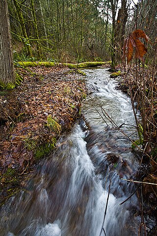
Boeing Creek is a stream in the U.S. state of Washington, located in the city of Shoreline, just north of Seattle. It is about 1.6 miles (2.6 km) long and empties into Puget Sound. The creek is heavily modified along its course, and in many places has been diverted into culverts. The watershed of Boeing Creek is about 11.2 square miles (29 km2) in size, with two main tributaries aside from the mainstem. The creek takes its name from William Boeing, who built a mansion along the creek in 1913. Despite the river modifications and stormwater pollution, the creek supports a variety of riparian habitats, native animals and fishes.
The Clowhom River is a short, 19.8-kilometre (12.3 mi) river in British Columbia. It flows into the head of the Salmon Inlet about 26.2 km west of Squamish.
Sequalitchew Creek, located in DuPont, Washington emanates from Sequalitchew Lake, Fort Lewis, Washington, was the location of the original Fort Nisqually trading post established in 1833 by the Hudson's Bay Company. The historic, natural flow of Sequalitchew Creek runs from Sequalitchew Lake, through Edmonds Marsh, down the canyon and out to the Puget Sound.

Monte Bello Open Space Preserve is a 3,133-acre (12.68 km2) open space preserve, located near Palo Alto in the Santa Cruz Mountains, in San Mateo and Santa Clara Counties, California, United States. The preserve encompasses the upper Stevens Creek watershed in the valley between Monte Bello Ridge and Skyline Ridge. "Monte Bello" means "beautiful mountain" in Italian, and refers to Black Mountain which is the highest part of Montebello Ridge. The straight valley of upper Stevens Creek is also the rift valley of the San Andreas Fault.

The Satsop Hills are foothills of the Olympic Mountains in Mason County, Washington north of Matlock, Washington, between Wynoochee Lake to the west and Lake Cushman to the east.
Moxlie Creek is a stream in Thurston County in the U.S. state of Washington. It is an Olympian creek originating from artesian springs in Watershed Park. It flows north into the East Bay of Budd Inlet. The creek is piped underground between East Bay and the headwaters, more than one third of its 1.8 mile length. For over 50 years the park groundwater was used to supply the city's drinking water, and waterworks remnants can be seen in the area.

Indian Creek is a stream in Thurston County in the U.S. state of Washington. It is a 3-mile Olympian creek. Its source is a wetland along the northern end of South Bay Road. It enters Budd Inlet at East Bay, having first joined with Moxlie Creek. It can most easily be accessed between Boulevard Road and Frederick Road along the Karen Fraser Woodland Trail. American Indian settlements near the creek's course may account for the name.

Schumacher Creek, formerly Shumocher Creek, is a creek in Mason County in the U.S. state of Washington. It flows into Mason Lake on the traditional territory of the Squaxin Island Tribe. Schumacher Creek is part of the Sherwood Creek watershed, and contains Trask Lake and Carson Lake.
