
Halifax Chebucto is a provincial electoral district in Nova Scotia, Canada, that elects one member of the Nova Scotia House of Assembly.

Halifax Citadel-Sable Island is a provincial electoral district in Halifax, Nova Scotia, Canada, that elects one member of the Nova Scotia House of Assembly.

St. Mary's Cathedral Basilica is a Gothic Revival Catholic cathedral located in downtown Halifax, Nova Scotia, Canada. It is the cathedral church of the Archdiocese of Halifax and is the largest Catholic church in the Archdiocese. Consecrated on October 19, 1899, it was made a basilica in 1950 by Pope Pius XII. The St. Mary's Cathedral Basilica boasts the tallest granite spire in North America.
Richmond was a Canadian urban neighbourhood comprising part of the North End of the Halifax Peninsula in Nova Scotia's Halifax Regional Municipality.

The Art Gallery of Nova Scotia is the provincial art gallery of Nova Scotia. It is located in downtown Halifax, Nova Scotia, Canada with a branch gallery in Yarmouth, Nova Scotia. The Art Gallery of Nova Scotia is the largest art museum in Atlantic Canada.
Route 318 is a collector road in the Canadian province of Nova Scotia.
Dollar Lake Provincial Park is a seasonal Provincial Park located in the Musquodoboit Valley area of the Halifax Regional Municipality in Nova Scotia, Canada in the community of Wyses Corner, Nova Scotia, 22 kilometres from the Halifax International Airport, on the Old Guysborough Road.

The Halifax Court House is a historic building in downtown Halifax, Nova Scotia. Its main section was completed in 1863, with the east wing, built in 1930, being the newest portion. The Italian renaissance style building was designed by William Thomas, a Toronto architect who built prominent structures across Canada.
Westphal is an unincorporated urban community located in Dartmouth, Nova Scotia and an unincorporated suburban community located outside of Dartmouth, Nova Scotia. Some of Westphal is considered part of Dartmouth, Nova Scotia and some of it is considered separate from Dartmouth, Nova Scotia. The area is bound by Port Wallace in the north, Waverley Road in the west, Lake Major Road in the east and Main Street in the south. The area also includes the watershed and water filtration plant for the Halifax Regional Water Commission that supplies drinking water for the residents of Dartmouth and surrounding communities east of Halifax Harbour. It is named after two Westphal brothers who became admirals in the British navy and who hailed from this part of Nova Scotia - George Augustus Westphal and his younger brother Philip. Their surname is of German origin.
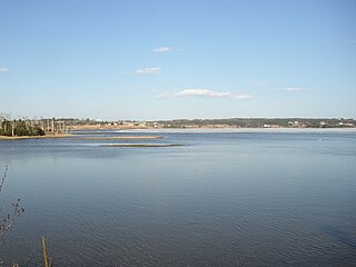
East Lawrencetown is a rural community within Halifax Regional Municipality in Nova Scotia, Canada on the Eastern Shore on Route 207 along the scenic route Marine Drive. The community is 22.4 kilometers from Halifax. Lawrencetown Beach Provincial Park is located in the community, at the southern end of Lawrencetown Lake, a natural ocean inlet. The beach is a year-round destination for surfing, attracting both locals and those from abroad. There are also places to park your vehicle, stroll along boardwalks, hike, mountain bike and swim. Available to the public in the summer is a canteen, showers, flush toilets and a section of beach that is supervised by the Nova Scotia Lifeguard Service.
The Halifax Regional Municipality (HRM) in the Canadian province of Nova Scotia is composed of more than 200 communities and neighbourhoods.
Boulderwood is a Residential subdivision in Armdale on Mainland Halifax within the Halifax Regional Municipality Nova Scotia on the shore of the Northwest Arm in Halifax Harbour.
Halifax Northwest was a provincial electoral district in Nova Scotia, Canada, that elected one member of the Nova Scotia House of Assembly. It existed from 1956 to 1967.
Halifax was a provincial electoral district in Nova Scotia, Canada, that elected one member of the Nova Scotia House of Assembly. It existed from 1867 to 1933.

Lawrencetown is a Canadian rural community in Halifax, Nova Scotia on Route 207. The settlement was established during the eve of Father Le Loutre's War and at the beginning of the French and Indian War.

The Nova Scotia Sport Hall of Fame was established in 1964, to honor outstanding athletes, teams and sport builders in the Canadian province of Nova Scotia. The facilities are located at the World Trade and Convention Centre in the provincial capital city of Halifax.
Fairmount, Nova Scotia is a residential neighbourhood in Halifax, Nova Scotia. It encompasses Mount Olivet Cemetery (Halifax) which contains the graves of some victims Titanic disaster and the Halifax Explosion and Sir Charles Tupper.
The Northwest Arm Drive is a 4-lane divided highway that runs entirely in Halifax in the Halifax Regional Municipality connecting Nova Scotia Highway 102 in Clayton Park to Nova Scotia Route 306 in Spryfield. The highway is a stub of the incomplete "Harbour Drive" project which would have connected Nova Scotia Highway 102 with the Halifax waterfront, via a bridge over the Northwest Arm and a 6-lane highway through the south end along Water Street and along Barrington past Cogswell. The project was cancelled in the 1970s in the wake of public opposition, but not before Northwest Arm Drive and the Cogswell Street Interchange were completed.

Cambridge Military Library is a public library building in Royal Artillery Park (Halifax) in Halifax, Nova Scotia, Canada which was created in 1886. The building was created to house the garrison library collection, which had been moved from various locations in the city since its creation in 1817. It is the oldest library collection in Atlantic Canada. This building was the social and literary centre of military Halifax. In 1902, the officers of the garrison requested the library be named after the Prince George, Duke of Cambridge.

The Black-Binney House was a former residence built in 1819 in Halifax, Nova Scotia which is now a National Historic Site of Canada. The house was built by John Black (merchant) and is reflective of the Palladian-inspired residences common during the late 18th and early 19th centuries in Eastern Canada. In 1857, Hibbert Binney subdivided the property to build the St. Matthew's United Church (Halifax). In 1965 Sidney Culverwell Oland purchased and renovated the building to house the Nova Scotia Division of the Canadian Corps of Commissionaires.


