Humphrey is a town in Cattaraugus County, New York, United States. The population was 701 at the 2020 census. The town is named after Charles Humphrey, who at the time of the town's founding was Speaker of the New York State Assembly.

Aneth is a census-designated place (CDP) in San Juan County, Utah, United States. The population was 598 at the 2000 census. The origin of the name Aneth is obscure.
Angelo is a town in Monroe County, Wisconsin, United States. The population was 1,268 at the 2000 census. The unincorporated community of Angelo is located in the town. The unincorporated community of Farmers Valley is also located partially in the town.
Sodo or Wolaita Sodo or is a city in south-central Ethiopia. The administrative center of the Wolaita Zone. It has a latitude and longitude of 6°54′N37°45′E with an elevation between 1,600 and 2,100 metres above sea level. It was part of the former Sodo woreda which included Sodo Zuria which completely surrounds it.

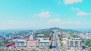
Mizan Tefere is the largest town in South West Ethiopia Peoples' Region and one of four Capital cities of the region. Mizan is also the administrative centre, of the Bench Sheko Zone in the South West Ethiopia Peoples' Region of Ethiopia. Located about 160 kilometers southwest of Jimma, Mizan Tefere has a latitude and longitude of 7°0′N35°35′E and an elevation of 1451 meters. Mizan Teferi, together with the neighbouring town of Aman, forms a separate woreda called Mizan Aman. This is surrounded by Debub Bench woreda.

Jimma is a zone in Oromia Region of Ethiopia. Jimma is named after former Kingdom of Jimma, which was absorbed into the former province of Kaffa in 1932. Jimma is bordered on the south by the Southern Nations, Nationalities and Peoples Region, the northwest by Illubabor Zone, on the north by East Welega Zone and on the northeast by West Shewa Zone; part of the boundary with West Shewa Zone is defined by the Gibe River. The highest point in this zone is Mount Maigudo. Towns and cities in Jimma include Agaro, Limmu Inariya and Saqqa. The town of Jimma was separated from Jimma Zone and is a special zone now.
Kembata Tembaro is a zone in the Southern Nations, Nationalities, and Peoples' Region of Ethiopia. It was formerly known as Kembata, Alaba and Tembaro, until Alaba became a special woreda in 2002. This zone is named after the Kambaata people and one of its subgroups, the Tembaro people, which gained ethnic recognition in 2012.
Damot Gale is a woreda in Southern Nations, Nationalities, and Peoples' Region, Ethiopia. Part of the Wolayita Zone, Damot Gale is bordered on the southwest by Sodo Zuria, on the northwest by Boloso Sore and Damot Pulasa, on the north by the Hadiya Zone, on the east by Diguna Fango, and on the southeast by Damot Weyde. The administrative center of Damot Gale is Boditi. Damot Pulasa woreda was separated from Damot Gale.
Kacha Bira is a woreda in the Southern Nations, Nationalities, and Peoples' Region of Ethiopia. Part of the Kembata Tembaro Zone, Kacha Bira is bordered on the south by an exclave of the Hadiya Zone, on the southwest by the Wolayita Zone, on the west by Hadero Tunto, on the northwest by the Hadiya Zone, on the north by Doyogena and Angacha, and on the east by Kedida Gamela. Towns in Kacha Bira include Shinshicho and Hadero.
Sodo Zuria is one of the woredas in the Southern Nations, Nationalities, and Peoples' Region of Ethiopia. Part of the Wolayita Zone, Sodo Zuria is bordered on the southwest by Offa, on the west by Kindo Koysha, on the northwest by Damot Sore, on the north by Boloso Sore, on the northeast by Damot Gale, on the east by Damot Weyde, and on the southeast by Humbo. Town of Sodo was separated from Sodo woreda.
Metu Zuria is a woreda in Oromia Region, Ethiopia. Part of the Illubabor Zone, Metu Zuria is bordered on the south by Ale, on the southwest by Bure, on the west by the Kelem Welega Zone, on the north by Darimu, on the northeast by Supena Sodo, on the east by Yayu and on the southeast by Southern Nations, Nationalities and Peoples Region. The former Metu worida was separated for Bicho, Bilo Nopha and Metu Zuria woredas and Metu Town.
Gindabarat is one of the woredas in the Oromia Region of Ethiopia. The district is marginal within the central-highlands of Ethiopia, being isolated geographically by lowland gorges and rivers which separate it from all but one neighboring district, and physically, due to a poor road network. Part of the West Shewa Zone, Gindabarat is bordered on the south by Jeldu, on the southwest by Ambo, on the west by the Guder River which separates it from the Horo Guduru Welega Zone, on the north by the Abay River which separates it from the Amhara Region, on the east by the Muger River which separates it from the North Shewa Zone, and on the southeast by Meta Robi. The major town in Gindabarat is Kachise. Abuna Gindabarat woreda was separated from Gindabarat.
Jeldu is one of the districts in the Oromia of Ethiopia. Part of the West Shewa Zone, Jeldu is bordered on the south by Dendi, on the southwest by Ilfeta, on the north by Ginde Beret, on the northeast by Meta Robi, and on the southeast by Ejerie. Towns in Jeldu include, Gojo, Osole, and Shekute, Boni.
Gera is one of the woredas in the Oromia Region of Ethiopia. It is named after the former Kingdom of Gera, whose territory was approximately the same as the modern woreda. Part of the Jimma Zone, Gera is bordered on the south by the Gojeb River which separates it from the Southern Nations, Nationalities and Peoples Region, on the northwest by Sigmo, on the north by Setema, on the northeast by Gomma, and on the east by Seka Chekorsa. The administrative center of this woreda is Chira; other towns in Gera include Cheriko and Dusta.
Dedo is one of the woredas in the Oromia Region of Ethiopia. Part of the Jimma Zone, Dedo is bordered on the south by the Gojeb River which separates it from the Southern Nations, Nationalities and Peoples Region, on the west by Gera, on the north by Kersa, and on the east by Omo Nada. The major town in Dedo is Sheki.
Adami Tullu and Jido Kombolcha is one of the districts in the Oromia Region of Ethiopia. Part of the East Shewa Zone located in the Great Rift Valley, Adami Tullu and Jido Kombolcha is bordered on the south by West Arsi Zone with which it shares the shores of Lakes Abijatta and Langano, on the west by the Silte Zone of Southern Nations, Nationalities and Peoples Region, on the north by Dugda Bora, on the northeast by Hora-Dambal, and on the east by the Arsi Zone. The main town of district is Adami Tullu; other towns include Abosa, Bulbulla, and Jido.
Hosaena is a town and separate woreda in southern Ethiopia, and the administrative center of the Hadiya Zone. Located in the Southern Nations, Nationalities, and People's Region (SNNPR), Hosaena has a latitude and longitude of 7°33′N37°51′E with an elevation of 2177 meters above sea level. It was part of Limo woreda and is surrounded by it.
Rayitu is one of the Districts in the Oromia Region of Ethiopia. Located in East Bale zone or Eastern part of the Bale Zone, Rayitu is bordered on the south by the Somali Region, on the west by Ginir, and on the north and east by Seweyna; the Gestro River defines the southwest boundary. Towns in Raytu include Dhedecha Bela Town.
Sendafa is a town and separate woreda in Oromia Region, Ethiopia. Its name is taken from the Oromo name for a kind of thick, jointed grass or reed which grows in swampy areas. Located in the Oromia Special Zone Surrounding Finfinne of the Oromia Region, Sendafa has a latitude and longitude of 9°09′N39°02′E with an elevation of 2514 meters above sea level. The town lies on the paved Addis Ababa - Adigrat highway, some 38 kilometers north of the capital.
Kelafo is a town in eastern Ethiopia. Located in the Gode Zone of the Somali Region, this town has a latitude and longitude of 05°35′20″N44°12′20″E and an elevation of 233 meters above sea level.