
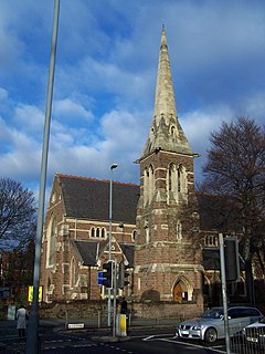
Shobnall is a settlement and civil parish located in Staffordshire, England. It covers an area located in the west of Burton upon Trent. The population of Shobnall taken at the 2011 census was 5,071. [1]
Shobnall is a settlement and civil parish located in Staffordshire, England. It covers an area located in the west of Burton upon Trent. The population of Shobnall taken at the 2011 census was 5,071. [1]

Girard is a city in Trumbull County, Ohio, United States. The population was 9,958 at the 2010 census. It is part of the Mahoning Valley region.

East Northamptonshire is a local government district in Northamptonshire, England. Its council is based in Thrapston and Rushden. Other towns include Oundle, Raunds, Irthlingborough and Higham Ferrers. The town of Rushden is by far the largest settlement in the district. The population of the District Council at the 2011 Census was 86,765.
Birchfield is located in and between Perry Barr, Aston, Handsworth Wood. Birchfield shares the B6 and B20 postcode with surrounding areas Handsworth Wood, Aston and Perry Barr. The main roads within the area include Birchfield road, This leads on to towards Birmingham city centre. The area is home to many schools, including Birchfield Community Primary School.
The Federal University of Rio Grande is a public Brazilian university funded by the Brazilian federal government, located in the city of Rio Grande, Rio Grande do Sul, Brazil.
New England is a residential area of Peterborough in Cambridgeshire, England, For electoral purposes it forms part of Peterborough North ward. The area is bounded by Millfield to the south, Dogsthorpe to the east, by the A47 to the north and the A15 to the west. The Faidhan-e-Madina Mosque opened here in 2003.

Daysland is a town in central Alberta located on Highway 13, 43 kilometres (27 mi) east of Camrose.
McDonald Creek Provincial Park is a provincial park in British Columbia, Canada, located 10 km south of Nakusp along Highway 6 in the Arrow Lakes region. The 468-hectare park is bisected by Upper Arrow Lake, and it provides beaches, a boat launch and 46 camping spaces on the eastern shore of the reservoir. Formerly a homesteading site, the area was set aside for recreation in 1982. In 2014, the campground underwent an upgrade, including the installation of a new services including showers and additional camping spaces.
Burton and South Derbyshire College is a college located in Burton upon Trent in England. Early in 2011 the college was renamed from "Burton College".
V343 Carinae is a blue-white star or star system in the southern constellation of Carina. It has the Bayer designation d Carinae, while V343 Carinae is a variable star designation. The star is visible to the naked eye with an apparent visual magnitude of 4.31. The distance to this object is approximately 1,440 light years based on parallax. It is drifting further away with a radial velocity of +13 km/s.

The County of Paintearth No. 18 is a municipal district in east central Alberta, Canada. Located in Census Division No. 7, its municipal office is located southeast of the Town of Castor near the intersection of Highway 12 and Highway 36.
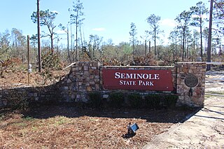
Seminole State Park is a 604 acre (2.44 km2) state park located on the shores of Lake Seminole in the extreme southwest corner of Georgia. The park offers excellent fishing opportunities on the lake, as well as a tranquil getaway in one of the park's cottages or campsites. The park also offers a scenic nature trail to experience the forest in the park. The park also offers treehouse camping that sleeps up to fifteen people. The park recently opened a new group shelter that seats up to two hundred people. The park has a new Facebook page where people can go and see what events or specials are going on at the park.
KBQB is a commercial radio station located in Chico, California. KBQB airs an adult hits music format.

μ Orionis is a quadruple star system in the constellation Orion, similar to Mizar and Epsilon Lyrae with combined visual magnitude of 4.13. The four stars are known as Mu Orionis Aa, Mu Orionis Ab, Mu Orionis Ba, and Mu Orionis Bb. All four components are spectroscopic, with A and B systems only several tenths of an arcsec apart. The entire system is located approximately 155 Light Years from the Sun.
HD 120987 is a star system located in the constellation Centaurus. HD 120987 is a quintuple star system located 50 pc from the Sun. The system has an apparent magnitude of 5.565. Based on the system's parallax, it is located some 172 light-years away.

Sigma Geminorum is a binary star system in the constellation Gemini, just to the northeast of Pollux. It is visible to the naked eye with an apparent visual magnitude of 4.20. Based upon an annual parallax shift of 26.08 mas, it is located 125 light years from the Sun.
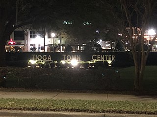
Tioga is a real estate development located about three miles west of Gainesville in unincorporated Alachua County, Florida, United States. "Town of Tioga" is a marketing expression.

Glantwymyn is a community in the northwest (Montgomeryshire) of Powys, Wales.

The Waltham Iron Ore Tramway was a 1,000 mm gauge industrial tramway serving the ironstone pits of the Waltham Iron Ore Company, a subsidiary of the Staveley Coal and Iron Company. It was located to the north of the village of Branston in Leicestershire on the edge of the Belvoir Estate. The tramway operated from 1884 until 1958.
Coordinates: 52°48′25″N1°39′11″W / 52.807°N 1.653°W
| | This Staffordshire location article is a stub. You can help Wikipedia by expanding it. |