Related Research Articles

Barnegat Light is a borough in Ocean County, in the U.S. state of New Jersey. As of the 2020 United States census, the borough's population was 640, an increase of 66 (+11.5%) from the 2010 census count of 574, which in turn reflected a decline of 190 (−24.9%) from the 764 counted in the 2000 census. The borough borders the Atlantic Ocean on Long Beach Island and is home to Barnegat Lighthouse.
Lower New York Bay is a section of New York Bay south of the Narrows. The eastern end of the Bay is marked by two spits of land, Sandy Hook, New Jersey, and Rockaway, Queens. The waterway between the spits connects the Bay to the Atlantic Ocean at the New York Bight. Traversing the floor of the Bay southeasterly from the Narrows to the Bight and beyond is Hudson Canyon.
The Jersey Shore, commonly referred to locally as simply the Shore, is the coastal region of the U.S. state of New Jersey. Geographically, the term encompasses about 141 miles (227 km) of oceanfront bordering the Atlantic Ocean, from Perth Amboy in the north to Cape May Point in the south. The region includes Middlesex, Monmouth, Ocean, Atlantic, and Cape May counties, which are in the central and southern parts of the state. Located in the center of the Northeast Megalopolis, the northern half of the shore region is part of the New York metro area, while the southern half of the shore region is part of the Philadelphia metro area. The Jersey Shore hosts the highest concentration of oceanside boardwalks in the United States.

The New York–New Jersey Harbor Estuary, also known as the Hudson-Raritan Estuary, is in the northeastern states of New Jersey and New York on the East Coast of the United States. The system of waterways of the Port of New York and New Jersey forms one of the most intricate natural harbors in the world and one of the busiest ports of the United States. The harbor opens onto the New York Bight in the Atlantic Ocean to the southeast and Long Island Sound to the northeast.

Cape Hatteras Light is a lighthouse located on Hatteras Island in the Outer Banks in the town of Buxton, North Carolina and is part of the Cape Hatteras National Seashore. It is the tallest lighthouse in the U.S. from base to tip at 210 feet. The lighthouse's semi-unique pattern makes it easy to recognize and famous. It is often ranked high on lists of most beautiful, and famous lighthouses in the US.

Barnegat Bay is a small brackish arm of the Atlantic Ocean, approximately 42 miles (68 km) long, along the coast of Ocean County, New Jersey in the United States. It is separated from the Atlantic by the long Island Beach State Park, as well as by the north end of Long Beach Island, popular segments of the Jersey Shore. The bay is fed by several small rivers, including the Toms River, the Forked River, the Metedeconk River, Cedar Creek, Oyster Creek, Mill Creek, Westecunk Creek, and Tuckerton Creek, all of which empty into the bay through small estuaries along its inner shore. The communities of Toms River, Silverton, and Forked River sit along the river estuaries on the bay.

The Hereford Inlet Lighthouse is a historic lighthouse located in North Wildwood, New Jersey, situated on the southern shore of Hereford Inlet at the north end of Five Mile Beach. Its construction was completed and it became operational in 1874.

The Edwin B. Forsythe National Wildlife Refuge is a U.S. National Wildlife Refuge located in southern and south-central New Jersey, along the Atlantic coast, north of Atlantic City, in Atlantic and Ocean counties. The refuge was created in 1984 out of two existing refuge parcels created to protect tidal wetland and shallow bay habitat for migratory water birds. The Barnegat Division is located in Ocean County on the inland side of Barnegat Bay. The Brigantine Division is located approximately 10 miles (16 km) north of Atlantic City along the south bank of the mouth of the Mullica River. The two divisions are separated by approximately 20 miles (32 km). The refuge is located along most active flight paths of the Atlantic Flyway, making it an important link in the network of national wildlife refuges administered nationwide by the U.S. Fish and Wildlife Service. Forsythe Refuge is a part of the Hudson River/New York Bight Ecosystem and The New Jersey Coastal Heritage Trail Route. The refuge is named for Edwin B. Forsythe, conservationist Congressman from New Jersey. The refuge was named as a Ramsar Site of international importance in 1986.
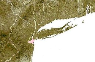
Barnegat Lighthouse is a historic lighthouse located in Barnegat Lighthouse State Park on the northern tip of Long Beach Island, in the borough of Barnegat Light, Ocean County, New Jersey, United States, on the south side of Barnegat Inlet.

Absecon Island is a barrier island located on the South Jersey Shore of the Atlantic Ocean in Atlantic County, New Jersey, United States. On the island from north to south are the resort communities of Atlantic City, Ventnor City, Margate City, and Longport, with a total population among the four communities of 53,917 as of the 2020 United States census. The island ends at Absecon Inlet to the north and Great Egg Harbor Inlet to the south.
Brigantine Island is an island off the Atlantic Ocean coast of New Jersey, located northeast of Atlantic City. It is 6 miles (9.7 km) long. The resort community of Brigantine is located on the island.
Little Beach is a barrier island along the coast of New Jersey. It is believed to be the last uninhabited barrier island left on the U.S. Atlantic coast. It is part of Galloway Township, in Atlantic County, New Jersey.

Absecon Inlet is a narrow strait on the southeastern coast of New Jersey, United States.
Little Egg Inlet is an inlet connecting the Atlantic Ocean and the Great Bay along the southeastern coast of New Jersey, United States. Little Egg Inlet forms a maritime border separating Little Egg Harbor Township in southern Ocean County and Galloway Township in northeastern Atlantic County.
Peters Beach or Peter Beach is a former barrier island located on the Jersey Shore of the Atlantic Ocean in Atlantic County, New Jersey, United States. It is now a part of Brigantine Island.
Squan Beach is the historic name of a barrier spit located on the Jersey Shore of the Atlantic Ocean in Ocean County, New Jersey, United States. Since the closing of Cranberry Inlet around 1812, it has been joined physically to Island Beach, and is a major component of the Barnegat Peninsula.
Brigantine Inlet is an inlet connecting Little Bay with the Atlantic Ocean in Atlantic County, New Jersey.

Brazos Santiago Pass is a natural coastal landform located in the Lower Laguna Madre and Lower Rio Grande Valley on the furthest southern beach terrain of the Texas Gulf Coast. The seacoast passage is interpolated by barrier islands encompassing the southern Brazos Island and the northern South Padre Island.

The Jupiter Inlet is a natural opening through the barrier islands of Martin and Palm Beach counties in Jupiter, Florida, that connects the south end of the Indian River Lagoon and the Loxahatchee River to the Atlantic Ocean. It is one of the six inlets into the Indian River Lagoon System. Its approximate location is 26.9440°N 80.0716°W.
Horseshoe Island is a 100 acres (40 ha) remote island located off the coast of Little Egg Inlet in New Jersey. The island is critical for coastal avian species, as the area is both free of human and mammal predator activity.
References
- ↑ Faden, William (1777). The Province of New Jersey, Divided into East and West, commonly called The Jerseys (Map). London.
- ↑ Historical and Biographical Atlas of the New Jersey Coast, Woolman and Rose, Philadelphia, 1878
- ↑ State of New Jersey "Annual report of the State Geologist For the Year 1905" Part 1. Changes Along the New Jersey Coast, by Lewis M. Haupt, C. E.; pp. 61 & 62