Balaltar is a village development committee in Udayapur District in the Sagarmatha Zone of south-eastern Nepal. At the time of the 1991 Nepal census it had a population of 2551 people living in 460 individual households.

Baraha, Sagarmatha is a village development committee in Udayapur District in the Sagarmatha Zone of south-eastern Nepal. At the time of the 1991 Nepal census it had a population of 2738 people living in 471 individual households.
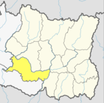
Bărăi is a village development committee in Udayapur District in the Sagarmatha Zone of south-eastern Nepal. At the time of the 1991 Nepal census it had a population of 4613.
Bhumarashuwa is a village development committee in Udayapur District in the Sagarmatha Zone of south-eastern Nepal. At the time of the 1991 Nepal census it had a population of 13,631 people living in 2531 individual households.
Chaudandi is a village development committee in Udayapur District in the Sagarmatha Zone of south-eastern Nepal. At the time of the 1991 Nepal census it had a population of 2715 people living in 469 individual households.
Dumre is a village development committee in Udayapur District in the Sagarmatha Zone of south-eastern Nepal. At the time of the 1991 Nepal census it had a population of 11,749 people living in 2510 individual households.
Hardeni is a village development committee in Udayapur District in the Sagarmatha Zone of south-eastern Nepal. At the time of the 1991 Nepal census it had a population of 2906 people living in 523 individual households.

Jalpachilaune is a populated place located in Triyuga municipality of Udayapur District in Province No. 1 of Nepal. At the time of 2011 Nepal census it had a population of 3,864 people living in 807 individual households.
Janti is a village development committee in Udayapur District in the Sagarmatha Zone of south-eastern Nepal. At the time of the 1991 Nepal census it had a population of 2142 people living in 385 individual households.
Jogidaha is a populated place located in Triyuga municipality of Udayapur District in Province No. 1 of Nepal. At the time of 2011 Nepal census it had a population of 6,665 people living in 1,451 individual households.
Katari is a Municipality in Udayapur District in the Province No. 1 of south-eastern Nepal.It lies by the Tawa river having the bridge of length 123.5m. This was established by merging two existing village development committees i.e. Triveni and Katari on 18 May 2014. At the time of the 1991 Nepal census it had a population of 7230 people living in 1410 individual households.
Khanbu is a populated place located in Triyuga municipality of Udayapur District in Province No. 1 of Nepal. At the time of 2011 Nepal census it had a population of 4,350 people living in 782 individual households.
Lekhani, Sagarmatha is a village development committee in Udayapur District in the Sagarmatha Zone of south-eastern Nepal. At the time of the 1991 Nepal census it had a population of 2141 people living in 373 individual households.
Panchawati is a village in, and headquarter of, Udayapurgadhi rural municipality in Udayapur District in Province No. 1 of south-eastern Nepal. At the time of the 1991 Nepal census it had a population of 6,580 people living in 1223 individual households.
Pokhari was a village development committee in Udayapur District in the Sagarmatha Zone of Eastern Development Region of Nepal. It became part of Rautamai Rural Municipality after reconstruction of administration in Nepal.
Yayankhu is a village development committee in Udayapur District in the Sagarmatha Zone of south-eastern Nepal. At the time of the 1991 Nepal census it had a population of 2575.
Risku is a village development committee in Udayapur District in the Sagarmatha Zone of south-eastern Nepal. At the time of the 1991 Nepal census it had a population of 11,546 people living in 2083 individual households.
Saune is a populated place located in Triyuga municipality of Udayapur District in Province No. 1 of Nepal. At the time of 2011 Nepal census it had a population of 2,678 people living in 518 individual households.
Tawasri is a village development committee in Udayapur District in the Sagarmatha Zone of south-eastern Nepal. At the time of the 1991 Nepal census it had a population of 4612 people living in 843 individual households.
Triveni is a town in Katari Municipality, Udayapur District, in the Sagarmatha Zone of south-eastern Nepal. The formerly Triveni village development committee was merged to form a new municipality from 18 May 2014. At the time of the 1991 Nepal census, Triveni had a population of 6015 people, living in 1105 individual households.