
Jung Bahadur Rana,, was born Bir Narsingh Kunwar (1817-1877). His mother, Ganesh Kumari, was the daughter of Kaji Nain Singh Thapa, the brother of Mukhtiyar Bhimsen Thapa from the prominent Thapa dynasty. During his lifetime, Jung Bahadur eliminated factional fighting at court, removed his family's rivals such as the Pandes and Basnyats, introduced innovations in the bureaucracy and judiciary, and made efforts to modernize Nepal. He is considered a significant figure in Nepalese history. Some modern historians blame Jung Bahadur for initiating a dark period in Nepalese history marked by an oppressive dictatorship that lasted 104 years, while others attribute this period to his nephews, the Shumsher Ranas. Rana's rule is often associated with tyranny, debauchery, economic exploitation, and religious persecution.

Kavrepalanchok District is one of the 77 districts of Nepal. The district, with Dhulikhel as its district headquarters, covers an area of 1,396 km2 (539 sq mi). It is a part of Bagmati Province and has a population of 364,039.

Sindhuli District, a part of the Bagmati Province, is one of the seventy-seven districts of Nepal, a landlocked country located in South Asia. The district, with Sindhulimadhi Kamalamai as its headquarters, covers an area of 2,491 km2 (962 sq mi). As per the 2011 census, Sindhuli District has a population of 296,192.
Surkhet District is a district in Karnali Province of mid-western Nepal. Surkhet is one of the ten districts of Karnali located about 600 kilometres (373 mi) west of the national capital Kathmandu. The district's area is 2,489 square kilometres (961 sq mi). It had 288,527 population in 2001 and 350,804 in 2011 which male comprised 169,461 and female 181,381. Its district headquarters, Birendranagar, is the capital of Karnali Province. It is serving as a business hub and document center for Karnali province. According to population, development, road links, landforms, climate, many peoples are migrating here. After becoming province capital developmental activities are boosted and are in peak level. All the governmental works are carried here. Birendranagar is beautiful valley surrounded by hills having moderate climate.

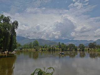
Kamalamai is a municipality in Sindhuli District, in the Bagmati Province of central south Nepal. At the time of the 2011 Nepal census it had a population of 39,413 people in 9,304 households. The city is located in the Sindhuli Valley of central south Nepal. The historic symbol of the valley, Sindhuli Gadhi fort, is at the peak of a hill of the Mahabharata range. The city is in the plain valley made by the Kamla River. Kamalamai Municipality is the largest municipality of Nepal according to area.
Danchhi is a village and former Village Development Committee that is now part of Kageshwari-Manohara Municipality in Kathmandu District in Province No. 3 of central Nepal. At the time of the 2011 Nepal census, it had a population of 11,246 and had 2,593 households in it. Danchhi is now included in Kageswori Manohara Municipality. Danchhi/Thali is bounded by Bagmati and Manohara river. The major places include Thali/थली, Nayapati, Bhadrawas, Hariyalinagar, Dumakhal, and Gajarkot. The major government schools are Shree Sahid Aadarsha Uchha MaVi, Shree Kanti Bhairab MaVi, and Shree Chaulanarayan PraVi. Private schools include Miniland English High School, Mount Everest Secondary School, Pragya Sadan School, Alpine Academy, and Hindu Vidhya Peeth.
Borlang is a village development committee in northern-central Nepal. As of the 1991 Nepal census it had a population of 4,737 and had 837 houses.
Kavre Nitya Chandeswori popularly known as "Kavre" is a village development committee in Kavrepalanchok District in the Bagmati Zone of central Nepal. Two of its V.D.C's are included in Dhulikhel Municipality in the year 2015 A.D. At the time of the 2011 Nepal census it had a population of 4,927 in 1,042 individual households.

Panchkhal is a Municipality in Kavrepalanchok District in the Bagmati Province of central Nepal. Panchkhal has an area of 103 km2 and population density of 386.6/km2, according to the 2011 census. Glacial strand retreat and fluvial incision led to develop landscapes and evolve the area having a relief of about 122 to 750 m. At the time of the 2011 Nepal census it had a population of 35340 in 8948 households combining of the previous VDCs that were merged. Previous Aniakot, HokseBazar, Kharelthok, Koshidekha, Baluwa & Panchkhal VDCs was merged to form the agriculturally rich Panchkhal Municipality with the motto of "पाँचखाल नगर, कृषि शहर ".
Lunkhu Deurali was a Village Development Committee in Parbat District in the Gandaki Province Nepal. At the time of the 2011 Nepal census it had a population of 2546 people living in 503 individual households.
Kshetrapa (Nepali:क्षेत्रपा) is a village development committee in north-eastern Nepal. As per the 2011 National Population and Housing Census, Kshetrapa had 2,447 people living in 580 individual households. Kshetrapa has one high school, Shree Kshetrawati Higher Secondary School, which is located at Peepal Daada, Majhgaun. Namdu Jugu Road, which runs through the village, is under construction as of 2020.

Hariwan or Harion is a town and municipality in Nepal, located in Sarlahi District. The municipality is surrounded by Lalbandi municipality in the East and Bagmati municipality in the West, Hariharpurgadhi municipality of Sindhuli District, Bagmati Province falls in the North and Haripur in the South.It has been divided into 11 wards with an administration center in Harion Bazar.
Beldandi is a rural municipality in Kanchanpur District in Sudurpashchim Province of southwestern Nepal named after the former Village Development Committee. At the time of the 1991 Nepal census the VDC had a population of 9301 people living in 1483 individual households. According to the Nepal census 2011 the municipality had 3022 individual households and a population of 21,959. In the north and west, Beldandi is surrounded by Suklaphatha national park. To the east lies Belauri Municipality. On the south, it borders India.
Amarapuri is a town in Gaidakot Municipality in Nawalpur District in the Lumbini Zone of southern Nepal. It became a municipality in May 2014 by merging the existing Mukundapur, Amarapuri, Gaidakot, Nawalparasi, VDCs. At the time of the 2011 Nepal census it had a population of 8,762 living in 1,979 households. Amarapuri has three high schools, the Shree Laxmi Higher Secondary School, Amar Jyoti Higher Secondary School and Amar English Higher Secondary Boarding School.

Dapcha Chatrebangh, or Dapcha, is a village near Mount Gaurishankar in Namobuddha Municipality in Kavrepalanchok District in Bagmati Province of central Nepal, about 15 kilometres southeast of the district headquarters of Dhulikhel. It is a ridgetop settlement, and was previously on the trade route that led to Kathmandu.
Kshitij English Boarding School (KEBS) is a private boarding school situated in the heart of Bhakteshwor Marga, Banepa-10, Kavrepalanchowk district. It was founded in 2006.
Gaindakot is a municipality in Nawalpur District in the Gandaki Zone of southern Nepal. It became a municipality in May 2014 by merging the existing Mukundapur, Amarapuri, and Gaindakot VDCs. It was again expanded by merging Ratanpur VDC. It is situated on the shore of Narayani River in the lap of Maula Kalika temple. So this place has a great possibility of tourism development. At the time of the 2011 Nepal census, it had a population of 58,841 and 13,623 individual households according to 2011 Nepal census.
Kathauna Bazar is a city in Shambhunath Municipality Ward No. 6, in the Saptari district of Nepal. It is 20 km east of Lahan Municipality, and is the central city of Shambhunath Municipality. Shambhunath municipality's head office is located at Kathauna Bazar. At the time of the 1991 Nepal census it had a population of 5167 people, living in 933 individual households.
Buddhabhumi is a Municipality in Kapilvastu District in the Lumbini Province of southern Nepal. It is located 308 km west of Kathmandu, 47 km west of Butwal and 206 km east of Nepalgung.
