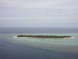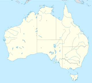
The Coral Sea Islands Territory is an external territory of Australia which comprises a group of small and mostly uninhabited tropical islands and reefs in the Coral Sea, northeast of Queensland, Australia. The only inhabited island is Willis Island. The territory covers 780,000 km2 (301,160 sq mi), most of which is ocean, extending east and south from the outer edge of the Great Barrier Reef and includes Heralds Beacon Island, Osprey Reef, the Willis Group and fifteen other reef/island groups. Cato Island is the highest point in the Territory.

The Coral Sea is a marginal sea of the South Pacific off the northeast coast of Australia, and classified as an interim Australian bioregion. The Coral Sea extends 2,000 kilometres (1,200 mi) down the Australian northeast coast. The sea was the location for the Battle of the Coral Sea, a major confrontation during World War II between the navies of the Empire of Japan, and the United States and Australia.

A cay, also spelled caye or key, is a small, low-elevation, sandy island on the surface of a coral reef. Cays occur in tropical environments throughout the Pacific, Atlantic and Indian Oceans.

Panulirus cygnus is a species of spiny lobster, found off the west coast of Australia. Panulirus cygnus is the basis of Australia's most valuable fishery, making up 20% of value of Australia's total fishing industry, and is identified as the western rock lobster.

Shoalwater Bay is a large bay on the Capricorn Coast of Central Queensland, Australia 100 km north of the coastal town of Yeppoon and 628 km north-north-west of the state capital, Brisbane. Since 1966, the land surrounding Shoalwater Bay has been under the ownership of the Australian Defence Force, for the purpose of military training exercises. Shoalwater Bay is also a noted dugong habitat and is part of the Great Barrier Reef Marine Park. The bay is bounded by the Torilla Peninsula to the west and the Warginburra Peninsula and Leicester and Townshend islands to the east.

The Northumberland Islands are a scattered island chain off the eastern coast of Queensland, Australia.
The Lytton First Nation, a First Nations band government, has its headquarters at Lytton in the Fraser Canyon region of the Canadian province of British Columbia. While it is the largest of all Nlaka'pamux bands, unlike all other governments of the Nlaka'pamux (Thompson) people, it is not a member of any of the three Nlaka'pamux tribal councils, which are the Nicola Tribal Association, the Fraser Canyon Indian Administration and the Nlaka'pamux Nation Tribal Council.
The Big Breaker is the most northerly geographic feature in the Houtman Abrolhos islands in the Indian Ocean off the west coast of Australia. It is located at the extreme tip of a reef that extends about three kilometres north of North Island. Its gazetted location is 28°15′56″S113°35′13″E, but in fact it is located about 270 metres south-east of there, at 28°16′00″S113°35′21″E. It is so named because it is a breaker, a portion of submerged reef over which waves break.
Kardiva Channel is a broad channel running from southwest to northeast and cutting across the Maldive atoll chain. This channel divides the Northern from the Central atolls of the Maldives.

Frederick Reef is in the Coral Sea Islands, over 220 nautical miles (410 km) northeast of Gladstone, Queensland. The reef gets its name from Frederick, which first reported sighting the reef.
Allison Harbour, also formerly known as False Bay and False Schooner Passage, is a natural harbour on the Central Coast of British Columbia, Canada, extending north from Queen Charlotte Strait to the southeast of Bramham Island. It is the site of the former post office and steamer landing of Allison Harbour, British Columbia. The Allison Reefs lie in the entrance to the sound; Allison Cone (185m), which is nearby between Shelter Bay and Cape Caution, was named in association with Allison Harbour. It is now protected as part of Allison Harbour Marine Provincial Park.

Fimbulheimen is a mountain range in Queen Maud Land, Antarctica. It stretches from Jutulstraumen by 1° west of Carsten Borchgrevink Ice at 18° east, about 200 km from the ice edge. Fimbulheimen is thus between Maudheim Plateau and Sør-Rondane.
The Tlowitsis Nation, formerly the Klowitsis Tribe, the Turnour Island Band and the Tlowitsis-Mumtagila First Nation, is the Indian Act band government of the Ławit'sis (Tlowitsis) tribe of the Kwakwaka'wakw peoples, located in the Queen Charlotte Strait-Johnstone Strait area in the Discovery Islands between Vancouver Island and the British Columbia mainland in Canada. Ławit'sis territory covers parts of northern Vancouver Island, Johnstone Strait, and adjoining inlets of the mainland. Kalugwis, on Turnour Island, was their principal community in times past, but the band's offices are in the city of Campbell River to the southeast. Hanatsa IR No. 6 on Port Neville is the most populated of the band's Indian reserves.
Arganza is a town and one of 44 civil parishes in Tineo, a municipality within the province and autonomous community of Asturias in northern Spain. Located between the As-217 and the As-15, its elevation is 1,509 ft (460 m) above sea level.

Kleptuza Glacier is a 6 km long and 6 km wide glacier draining the east slopes of Mount Hector in the Trojan Range and the north slopes of Osterrieth Range on Anvers Island in the Palmer Archipelago, Antarctica. Situated southeast of Thamyris Glacier and west of Altimir Glacier. Flowing northwards to enter Fournier Bay east of Madzharovo Point and west of Studena Point.

Margaret Brock Reef is a reef in the Australian state of South Australia located in the state's coastal waters on its south-east coast about 7 kilometres (4.3 mi) west of the headland of Cape Jaffa and about 27.2 kilometres (16.9 mi) south-west of the town of Kingston SE. It is the site of both a navigation aid which operated as a manned lighthouse from 1872 to 1973 and as an automatic beacon onward to the present day, and a rock lobster sanctuary declared under state law in 1973. It is named after the barque Margaret Brock which was wrecked there in 1852.


