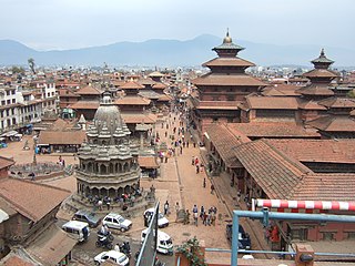
Kathmandu is the capital and largest city of Nepal, with a population of around 1 million. Also known as the city of temples, the city stands at an elevation of approximately 1,400 metres above sea level in the bowl-shaped Kathmandu valley in central Nepal. The valley was historically called the "Nepal Mandala" and has been the home of the Newar people, a cosmopolitan urban civilization in the Himalayan foothills. The city was the royal capital of the Kingdom of Nepal and hosts palaces, mansions and gardens of the Nepalese aristocracy. It has been home to the headquarters of the South Asian Association for Regional Cooperation (SAARC) since 1985. Today, it is the seat of government of the Nepalese republic, established in 2008, and is part of the Bagmati Province.

In the 2011 census, Nepal's population was approximately 26 million people with a population growth rate of 1.35% and a median age of 21.6 years. In 2016, the female median age was approximately 25 years old and the male median age was approximately 22 years old. Only 4.4% of the population is estimated to be more than 65 years old, comprising 681,252 females and 597,628 males. 61% of the population is between 15 and 64 years old, and 34.6% is younger than 14 years. In 2011, the Birth rate is estimated to be 22.17 births per 1,000 people with an infant mortality rate of 46 deaths per 1,000 live births. Compared to the infant mortality rate in 2006 of 48 deaths per 1000 live births, the 2011 IMR is a slight decrease within that 5-year period. Infant mortality rate in Nepal is higher in rural regions at 44 deaths per 1000 live births, whereas in urban regions the IMR is lower at 40 deaths per 1000 live births. This difference is due to a lack of delivery assistance services in rural communities compared to their urban counterparts who have better access to hospitals and neonatal clinics. Life expectancy at birth is estimated to be 67.44 years for females and 64.94 years for males. The mortality rate is estimated to be 681 deaths per 100,000 people. Net migration rate is estimated to be 61 migrants per 100,000 people. According to the 2011 census, 65.9% of the total population is literate.

The Nepalese Armed Forces are the military forces of Nepal. The current Nepal Army traces its direct historic roots from the Royal Nepal Army, renamed in recognition of Nepal's transition from a monarchy to a popularly elected republic in 2006. Composed primarily of the ground-based Nepalese Army, organized into six active combat divisions, the Nepalese Armed Forces also operates the smaller Nepalese Army Air Service designed to support army operations and provide close light combat support. The Nepalese Army also operates smaller formations responsible for the organization of air defense, logistics, military communications, artillery, and airborne forces within Nepalese territory. In addition, the Armed Police Force acts as a paramilitary force tasked with maintaining internal security within Nepal.

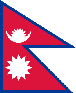
Nepal, officially the Federal Democratic Republic of Nepal, is a sovereign country in South Asia. It is mainly in the Himalayas, but also includes parts of the Indo-Gangetic Plain. It is the 49th largest country by population and 93rd largest country by area. It is landlocked and borders Tibet in the north and India in the south, east and west, while Bangladesh is located only 27 km (17 mi) from its southeastern tip and Bhutan is separated from it by the Indian state of Sikkim. Nepal has a diverse geography, including fertile plains, subalpine forested hills, and eight of the world's ten tallest mountains, including Mount Everest, the highest point on Earth. Kathmandu is the capital and the largest city. Nepal is a multiethnic country, with Nepali as the official language.

Lalitpur Metropolitan City, historically Patan, is the third largest city of Nepal after Kathmandu and Pokhara, and it is located in the south-central part of Kathmandu Valley, a new metropolitan city of Nepal. Lalitpur is also known as Manigal. It is best known for its rich cultural heritage, particularly its tradition of arts and crafts. It is city renowned for its festival and feast, fine ancient art, and the making of metallic and stone carved statues. At the time of the 2011 Nepal census it had a population of 226,728 in 54,748 individual households. The city received extensive damage from an earthquake on 25 April 2015.
Buddhism in Nepal started spreading since the reign of Ashoka through Indian and Tibetan missionaries. The Kiratas were the first people in Nepal who embraced Gautama Buddha’s teachings, followed by the Licchavis and Newar people. Buddha was born in Lumbini in the Shakya Kingdom. Lumbini is considered to lie in present-day Rupandehi District, Lumbini zone of Nepal. Buddhism is the second-largest religion in Nepal. According to 2001 census, 10.74% of Nepal's population practiced Buddhism, consisting mainly of Tibeto-Burman-speaking ethnicities, the Newar. However, in the 2011 census, Buddhists made up just 9% of the country's population.

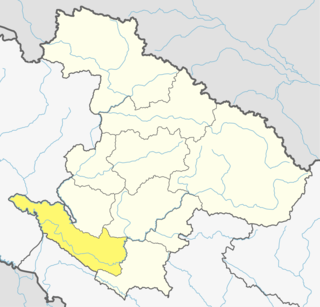
Chitwan District is one of 77 districts of Nepal, and takes up the southwestern corner of Bagmati Province. Bharatpur, largest city of Nepal after Kathmandu, is its administrative centre. It covers 2,238.39 km2 (864.25 sq mi), and in 2011 had a population of 579,984 people. Bharatpur is the commercial and service centre of South Central Nepal and a major destination for higher education, health care and transportation in the region. Chitwan lies in the Terai region of Nepal. It is in the drainage basin of the Gandaki River and is roughly triangular, taking that river as its meandering northwestern border, and a modest watershed border, with India, as the basis of its southern limit.

Jhapa is a district of Province No. 1 in eastern Nepal named after a Rajbanshi word "Jhapa" meaning "cover" (verb). The latest official data, the 2011 Nepal Census, puts the total population of the district at 812,650. Jhapa is one of the most ethnically diverse districts of the country, and is home to 110 ethnic groups. The total area of the district is 1606 square kilometres.

Lalitpur District (Nepali: ललितपुर जिल्लाListen , a part of Bagmati Province, is one of the seventy-seven districts of Nepal. The district, with Lalitpur as its district headquarters, covers an area of 385 km2 and has a population of 337,785. It is one of the three districts in the Kathmandu Valley, along with Kathmandu and Bhaktapur. Its population was 466,784 in the initial 2011 census tabulation. It is surrounded by Makwanpur, Bhaktapur, Kathmandu and Kavre.

Surkhet District is the province capital of Karnali province.Surkhet is the one of the ten districts of Karnali located about 600 kilometres (373 mi) west of the national capital Kathmandu. The district's area is 2,488.64 square kilometres (960.87 sq mi)which is longest in Nepal. It had 288,527 population in 2001 and 350,804 in 2011 which male comprised 169,461 and female 181,381. It is the district headquarters of surkhet and commercial hub of the Karnali state of the new federal republic.
Dhut magar is the language of Magars, an ethnic group, indigenous native from Nepal. The Magar Language is mainly spoken in Nepal, but a small number of Nepali Magar people include from Southern Bhutan, Darjeeling, and Sikkim, India. It is divided into two groups and further dialect divisions give a distinct tribal identity. In Nepal, 788,530 people speak the language.

Education in Nepal was long based on home-schooling and gurukulas. The first formal school, Durbar High School, established by Jung Bahadur Rana in 1853, was intended for the elite. The birth of Nepalese democracy in 1951 opened its classrooms to a more diverse population. Education in Nepal from the primary school to the university level has been modeled from the very inception on the Indian system, which is in turn the legacy of the old British Raj.

A clash between the Nepalese government forces and the Communist Party of Nepal occurred between 1996 and 2006, resulting in an increase in human rights abuses throughout the country. Both sides have been accused of torture, unlawful killings, arbitrary arrests, and abductions. Nepal was home to the most disappearances in the world during the conflict. The conflict is also considered one of major reasons for lack of development in Nepal.

The Catholic Church in Nepal is part of the worldwide Catholic Church, under the spiritual leadership of the Pope in Rome. As of 2011 there are over 10,000 Catholics in Nepal, organized into one Catholic jurisdiction known as an apostolic vicariate.

Birgunj is a metropolitan city in Parsa District in Province No. 2 of southern Nepal. It lies 135 km (84 mi) south of the capital Kathmandu, attached in the north to Raxaul in the border of the Indian state of Bihar. As an entry point to Nepal from Patna and Kolkata, Birgunj is known as the "Gateway to Nepal". It is also called "Commercial capital of Nepal". The town has significant economic importance for Nepal as most of the trade with India is via Birgunj and the Indian town of Raxaul. Tribhuvan Highway links Birgunj to Nepal's capital, Kathmandu. Birgunj was one of the first three municipalities formed during the rule of Prime Minister Mohan Shumsher Jang Bahadur Rana. It was declared a Metropolitan City on 22 May 2017 along with Biratnagar and Pokhara. Birgunj is one of the largest city in Nepal and largest in Province no. 2. Birgunj is the sixth most populated metropolis of the nation.

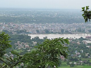
Butwal officially Butwal Sub-Metropolitan is one of the twin cities of rapidly growing Butwal-Bhairahawa urban agglomeration in Nepal. It lies in Lumbini Province, Rupandehi District, and also was the interim capital of Lumbini province until Deukhuri was formally voted as the state capital. It was given the title "Green City of Nepal 2019". It is also home to the administrative headquarters of Lumbini Zone. This city stands beside the bank of Tinau River, and at the northern edge of the Terai plain below the Siwalik Hills. Its name, Butwal was derived from Batauli Bazaar, the town's oldest residential area which is located on the western bank of the Tinau river. Butwal is a lively city comprising the Panoramic views of the combination of hills and plains.

Triyuga is one of eight municipalities of Udayapur district of the Province No. 1 of Nepal. Gaighat is the headquarter of the municipality. According to the 1991 Nepal census, it had a population of 55,291. According to the 2011 Nepal census, Triyuga had 87,557 inhabitants. It is divided into 16 wards. Triyuga Municipality was established on B.S. Chaitra 13, 2053. It was named after Triyuga River. A river which flows through the town. Triyuga is the 3rd largest municipality in Nepal and 1st largest in Province No. 1 in term of size (area). The total area of the municipality is 547.43 square kilometres (211.36 sq mi)

The Nepalese Army, formerly known as the Gurkha Army, is the land service branch of the Nepalese Armed Forces. The terms "Gurkha" and "Gorkhali" are synonymous with "Nepali". During the period of the Nepalese unification campaign, it was known as the Gurkha Army and later as the Royal Nepalese Army following the establishment of a Hindu monarchy in Nepal. It was officially renamed to the Nepalese Army on 28 May 2008, following the abolition of the 240-year-old Shah dynasty shortly after the Nepalese Civil War.

Janakpurdham or Janakpur is a sub-metropolitan city in Dhanusa District, Province No. 2, Nepal. The city is a hub for religious and cultural tourism. It has been declared as the temporary capital for Province No. 2 until the Province Assembly votes for a permanent capital.

Bhadrapur is a town and municipality in Jhapa District in the Mechi Zone of southeastern Nepal. It lies on the banks of the Mechi River, and shares borders with Bihar state, India on south and West Bengal state on north. There is a border crossing with customs office for goods. Galgalia village in Kishanganj District borders with Bhadrapur


