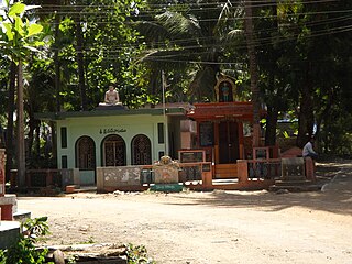
Chintalapudi is a town municipality and mandal headquarters in Eluru District of the Indian state of Andhra Pradesh.
Agadallanka is a village in Eluru district in the state of Andhra Pradesh in India. The nearest train station is Gundlakamma located at a distance of 12.38 km.
Sreeparru is a village in Eluru district in the state of Andhra Pradesh in India. It is 22 km from the city of Eluru, the headquarters of Eluru district.
Pinakadimi is a village in Eluru district of the Indian state of Andhra Pradesh. It is located in Pedavegi mandal of Eluru revenue division. It is located at a distance of 7 km from district headquarters Eluru city.

Biccavolu mandal is one of the 19 mandals in East Godavari district of the Indian state of Andhra Pradesh. It is under the administration of Rajahmundry revenue division and the headquarters are located at Biccavolu village. Biccavolu Mandal is bounded by Rayavaram Mandal towards South, Pedapudi Mandal towards East, Anaparthy Mandal towards west, Ramachandrapuram Mandal towards north. It is located ata distance of 41 kilometres from Rajahhmundry.
Amberpeta is a village in Eluru district in the state of Andhra Pradesh in India. The nearest railway station is Kacheguda(KCG) located at a distance of 0.81 Km.
Amudalachalaka is a village in West Godavari district of the Indian state of Andhra Pradesh. It is administered under Eluru revenue division. Eluru is the nearest train station located more than 10 Km from Amudalachalaka.
Karugorumilli is a village in West Godavari district in the state of Andhra Pradesh in India. The nearest railway station is located in town of Palacole.

Koderu is a village in West Godavari district in the state of Andhra Pradesh in India. The nearest railway station is Palakollu (PKO) located at a distance of 3.87 Km.
Pedamallam is a village in West Godavari district in the state of Andhra Pradesh in India.

Penumanchili is a village in West Godavari district in the state of Andhra Pradesh in India.
Ajjamuru is a village in West Godavari district in the state of Andhra Pradesh in India. akiveedu railway station is the nearest Railway Station.
Chinakapavaram is a village in West Godavari district in the state of Andhra Pradesh in India.
Gummuluru is a village in West Godavari district in the state of Andhra Pradesh in India. The nearest railway station is Godavari(GVN) located at a distance of 12.41 Km.
Kolleru is a village in West Godavari district in the state of Andhra Pradesh in India.
Madivada is a village in West Godavari district in the state of Andhra Pradesh in India.
Taratava is a village in West Godavari district in the state of Andhra Pradesh in India.
Aravalli is a village in West Godavari district in the state of Andhra Pradesh in India.
Eduru is a village in West Godavari district in the state of Andhra Pradesh in India. The nearest railway station is at Krishnapatnam (KAPT) located at a distance of 15.83 Km
Gummampadu is a village in West Godavari district in the state of Andhra Pradesh in India. Relangi and Velpuru Rail Way Station are the nearest railway stations.


