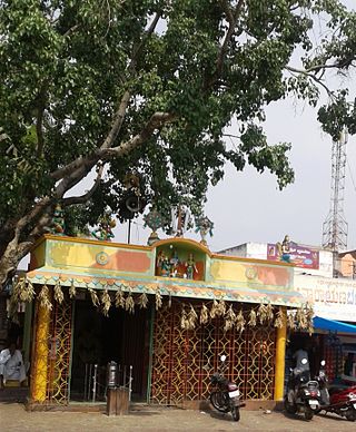
Porur is a neighbourhood of Chennai, India. It is situated in the Maduravoyal taluk of Chennai district in the southern part of the city. Since 2011, it has been a part of the Chennai Corporation and included in zone number 11.

Hungund or Hunagunda is a taluk in the northern district of Bagalkot in Karnataka, India. Major towns in the taluk are Amingad, Hunagunda. Kudalasangama, where the social reformist Basavanna died, is located in the taluk. Hunagunda Taluk also contains Aihole and Pattadkal which were once under the rule of Chalukyas of Badami. Amingad is known for Amingad karadantu, a sweet dish.

Kanakapura is a city in the Ramanagara district of Karnataka on the banks of the Arkavathi river and the administrative center of the taluk of the same name. Its founder is Shrihan Kanaka Sigmanath, hence its name. Kanakapura is largest cocoon silk producer in India. River Cauvery flows around 21 km in Kanakapura Taluk. Previously belonged to Bangalore Rural District. It was formerly the largest constituency in the country. (1,553 km2 [600 sq mi]). It is located among the lush green forests of the state of Karnataka. The town is infamous with the traffic of Kanakpura Road in Benglaluru, one of the most narrow and traffic-prone roads of the state. The town is a tourism hotspot and an often visited tourist favorite in the entire state of Karnataka, as it has something for everyone ranging from avid trekkers to history buffs and wildlife enthusiasts. The forest area in this taluk is very wide and about half of the Bannerghatta National Park is located in our Kanakapura area. Kodihalli wildlife range and harohalli wildlife range its division. The Kaveri Wildlife Sanctuary consists of two main zones namely the Sangam Wildlife range, the Mugguru Wildlife range.

Boothapandi is a panchayat town in Kanyakumari district in the state of Tamil Nadu, India.
Chikkanayakanahalli is a town in Tiptur sub-division of Tumakuru district, in the state of Karnataka, India. It is 30 km away from Tiptur and 132 km from Bangalore.
Choornikkara is a census town and in Aluva in Ernakulam District in Kerala, India. It is also the headquarters of the Choornikkara gram panchayat

Devarshola is a panchayat town in The Nilgiris district in the state of Tamil Nadu, India.Devarshola comes under the administration of Gudalur revenue division and the taluk of Gudalur. It is one of the major tourist attractions in gudalur forest division and nearby to Mudumalai, Bandipur and Wayanad National parks. The state highway SH-98 Passing through the town which connects Gudalur and Sulthan Bathery.
Ethapur (Yethapur) is a panchayat town in Pethanaickenpalayam Taluk in Salem District in the state of Tamil Nadu, India. Ethapur is also referred to as "Vasishtronum" named by Vashista one of the Saptarishis.

Guledgudda is a town in the Indian state of Karnataka. It was earlier a part of the Badami taluk, but is now the headquarters of the Guledgudda taluk in Bagalkot district.
Haliyala is a town in Uttara Kannada in the Indian state of Karnataka. It is the headquarters town for Haliyal Taluk. It can be classified as a main-road town.
Keeripatti is a Town Panchayat in Attur taluk of Salem district in the Indian state of Tamil Nadu. It is famous for jallikattu, a culture there. Keeripatti is surrounded by mountains on all sides.
Kilpennathur is a Panchayat Town in Tiruvanamalai district in the Indian state of Tamil Nadu. Kilpennathur is one of the taluks of Tiruvannamalai district and an assembly constituency of Tamil Nadu. The MLA of Kilpennathur assembly constituency is DMK party Mr. K. Pichandi. Vettavalam is the most populous town panchayat in this taluk. Kilpennathur is located a 12.25 degrees latitude and 79.224 degrees longitude. Nearest towns are Avalurpet, Vettavalam, Gingee and Tiruvannamalai, and Chennai is about 177 km away.
Natrampalli is a selection grade panchayat town and Taluk in Tirupattur district in the Indian state of Tamil Nadu. The Natrampalli block is a revenue block in the Tirupattur district of Tamil Nadu, India.
Nemili is a Taluk in Ranipet district of Tamil Nadu state, announced on 31 August 2015 by Tamil Nadu Chief Minister Selvi J.Jayalalitha. Before becoming a separate taluk, it was a town panchyat under Arakkonam Taluk. It is located in the Ranipet district about 72 kilometres from the state capital of Chennai. The major businesses are farming, hand loom and power looms. Nemili itself is a panchayat town in Ranipet District in the Indian state of Tamil Nadu.

New Mahe is a census town in Thalassery taluk of Kannur district in the Indian state of Kerala. It is part of Greater Mahé Region.

Panniyannur is a census town in Thalassery taluk of Kannur district in the Indian state of Kerala. It is part of Greater Mahé Region.

Ramanattukara is a municipality census town in Kozhikode district in the Indian state of Kerala. The town was formerly called Kadungan Chira village. Ramanattukara is located 15 km away from Kozhikode city.
Venkatapur is a census town in Bhatkal Taluk in Uttara Kannada district of Karnataka.

Channarāyapatna or Channarāyapattana is a town and Taluk headquarters in Hassan district of Karnataka, India. It lies on the Bangalore-Mangalore National Highway-75 in Karnataka, India. Jain pilgrimage Shravanabelagola is a famous site in the taluk. Channarayapatna has major railway connection from Bangalore to Mangalore, Karwar, and Mysore.
Kuruburu is a village in Chintamani Taluk in the Chikballapur district in the state of Karnataka, India.


