
Interstate 10 (I-10) is the southernmost cross-country highway in the American Interstate Highway System. I-10 is the fourth-longest Interstate in the United States at 2,460.34 miles (3,959.53 km), following I-90, I-80, and I-40. This freeway is part of the originally planned network that was laid out in 1956, and its last section was completed in 1990.

Interstate 610 (I-610) is a freeway that forms a 38-mile-long (61 km) loop around the inner city sector of the city of Houston, Texas. I-610, colloquially known as The Loop, Loop 610, The Inner Loop, or just 610, traditionally marks the border between the inner city of Houston and its surrounding areas. It is the innermost of the three Houston beltways, the other two being Beltway 8 and State Highway 99, of which various segments are under construction or planning. In Houston, the area inside the 610 Loop is the urban core. Jeff Balke of the Houston Press wrote that the freeway "is as much a social and philosophical divide as a physical one". Mike Snyder in the Houston Chronicle wrote that as someone from the 610 Loop he historically felt "kind of special" due to being close to "the city’s historical core and its major business, educational and cultural institutions".

Buffalo Bayou is a slow-moving body of water which flows through Houston in Harris County, Texas. Formed 18,000 years ago, it has its source in the prairie surrounding Katy, Fort Bend County, and flows approximately 53 miles (85 km) east through the Houston Ship Channel into Galveston Bay and the Gulf of Mexico. In addition to drainage water impounded and released by the Addicks and Barker reservoirs, the bayou is fed by natural springs, surface runoff, and several significant tributary bayous, including White Oak Bayou, Greens Bayou, and Brays Bayou. Additionally, Buffalo Bayou is considered a tidal river downstream of a point 440 yards (400 m) west of the Shepherd Drive bridge in west-central Houston.
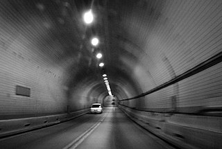
The Washburn Tunnel is a two-lane underwater motor-vehicle tunnel connecting Galena Park and Pasadena, two suburbs of Houston, Texas. Completed in 1950, it travels north-south underneath the Houston Ship Channel. It was named after Harris County, Texas Auditor Harry L. Washburn. It is the largest and first toll-free vehicular tunnel in the Southern United States.

Beltway 8 (BW8), the Sam Houston Parkway, along with the Sam Houston Tollway, is an 88-mile (142 km) beltway around the city of Houston, Texas, United States, lying entirely within Harris County.

The West Seattle Bridge, officially the Jeanette Williams Memorial Bridge, is a cantilevered segmental bridge that serves as the primary connection between West Seattle and important highways such as State Route 99, the Spokane Street Viaduct, and Interstate 5. It was built between 1981 and 1984 after the previous bascule bridge was deemed inoperable as a result of being struck by the freighter Antonio Chavez in 1978.

The Houston Ship Channel, in Houston, Texas, is part of the Port of Houston, one of the busiest seaports in the world. The channel is the conduit for ocean-going vessels between Houston-area terminals and the Gulf of Mexico, and it serves an increasing volume of inland barge traffic.
The Harris County Toll Road Authority maintains and operates a 103-mile (165.8 km) toll road system in the Greater Houston area. Its headquarters are located in Houston's Fairbanks/Northwest Crossing neighborhood.

Sam Houston Tollway Ship Channel Bridge is a span in Harris County, Texas. It was acquired from the then–Texas Turnpike Authority (TTA) on May 5, 1994, and is now a part of the Harris County Toll Road Authority system. The bridge opened to traffic in May 1982 and carries four lanes of the Sam Houston Tollway over the Houston Ship Channel with a clearance of 175 feet (53 m).

The Fred Hartman Bridge is a cable-stayed bridge in the U.S. state of Texas spanning the Houston Ship Channel. The bridge carries 2.6 miles (4.2 km) of State Highway 146 (SH 146), between the cities of Baytown and La Porte. The bridge is also expected to carry State Highway 99 (SH 99) when it is completed around Houston.

U.S. Highway 90 Alternate is an alternate route to U.S. Highway 90 in the U.S. state of Texas, running from west of Seguin east via Seguin, Gonzales, Hallettsville, Eagle Lake, Rosenberg and Sugar Land to northeastern Houston. South of Downtown Houston, US 90 Alternate is built to freeway and near-freeway standards along a section of South Main Street.

The 1968 Gerald Desmond Bridge was a through arch bridge that carried five lanes of Ocean Boulevard from Interstate 710 in Long Beach, California, west across the Back Channel to Terminal Island. The bridge was named after Gerald Desmond, a prominent civic leader and a former city attorney for the City of Long Beach. In October 2020, a new cable-stayed bridge named Long Beach International Gateway replaces the old Gerald Desmond Bridge due to insufficient vertical clearance for shipping, and demolition of the 1968 arch bridge is expected to be completed in 2023.

The I-10 Twin Span Bridge, a nearly 5.5-mile (8.9 km) causeway officially known as the Frank Davis "Naturally N'Awlins" Memorial Bridge, consists of two parallel trestle bridges. These parallel bridges cross the eastern end of Lake Pontchartrain in southern Louisiana from New Orleans to Slidell. The current bridge spans were constructed in the second half of the 2000s after the original bridges were extensively damaged by Hurricane Katrina on August 29, 2005. The first span opened to eastbound traffic on July 9, 2009. On April 7, 2010, the second span was opened to traffic and the old twin spans were permanently closed to traffic.

Interstate 10 (I-10) is the major east–west Interstate Highway in the Southern United States. In the U.S. state of Texas, it runs east from Anthony, at the border with New Mexico, through El Paso, San Antonio, and Houston to the border with Louisiana in Orange, Texas. At just under 880 mi (1,420 km), the Texas segment of I-10, maintained by the Texas Department of Transportation, is the longest continuous untolled freeway in North America that is operated by a single authority. It is also the longest stretch of Interstate Highway with a single designation within a single state. Mile marker 880 and its corresponding exit number in Orange, Texas, are the highest numbered mile marker and exit on any freeway in North America. After widening was completed in 2008, a portion of the highway west of Houston is now also believed to be the widest in the world, at 26 lanes when including feeders.

State Highway 225 is an east–west freeway in the Houston area between the Interstate 610 Loop in Houston and State Highway 146/future State Highway 99 in La Porte. It is identified as the La Porte Freeway over its entire length except for Pasadena where it is called the Pasadena Freeway. The freeway passes near several refineries, chemical plants, and tank farms as it passes through Pasadena and Deer Park.

Interstate 69 (I-69) is an Interstate Highway that is in the process of being built in the US state of Texas. It is part of a longer I-69 extension known as the NAFTA superhighway, that, when completed, will connect Canada to Mexico. In Texas, it will connect Tenaha and I-69 in Louisiana at the Louisiana border through the eastern part of the state and along the Texas Gulf Coast to Victoria, where it will split into three branches: I-69E to Brownsville, I-69C to Pharr, and I-69W to Laredo. The first segment of I-69 in Texas was opened in 2011 near Corpus Christi. The American Association of State Highway and Transportation Officials (AASHTO) approved an additional 58 miles (93 km) of US 77 from Brownsville to the Willacy–Kenedy county line for designation as I-69, which was to be signed as I-69E upon concurrence from the Federal Highway Administration (FHWA). FHWA approval for this segment was announced on May 29, 2013. By March 2015, a 74.9-mile (120.5 km) section of US 59 had been completed and designated as I-69 through Greater Houston. As of 2022, short segments near the southern terminuses of the three branch routes have also all been completed. These branches are planned to be connected.
The Baytown Tunnel or Baytown – La Porte Tunnel was a two-lane underwater motor-vehicle tunnel connecting Baytown and La Porte, two suburbs of Houston, Texas. Completed in 1953, it traveled northeast-southwest underneath the Houston Ship Channel and had a length of 4,110 feet (1,250 m). It was closed to vehicular traffic in 1995 with the opening of the Fred Hartman Bridge, and subsequently demolished beginning in 1997 in order for the U.S. Army Corps of Engineers to deepen the channel in 1998.

On May 23, 2013, at approximately 7:00 pm PDT, a span of the bridge carrying Interstate 5 over the Skagit River in the U.S. state of Washington collapsed. Three people in two different vehicles fell into the river below and were rescued by boat, escaping serious injury. The cause of the catastrophic failure was determined to be an oversize load striking several of the bridge's overhead support beams, leading to an immediate collapse of the northernmost span.

The McKee Street Bridge carries McKee Street across Buffalo Bayou in Houston, Texas. Built in 1932, the three-span reinforced concrete girder bridge connects the Second and Fifth Ward areas, northeast of downtown Houston. The bridge was listed on the National Register of Historic Places on September 3, 2002.
The Harbor Bridge Project is the replacement of the existing through arch bridge that crosses the Corpus Christi Ship Channel, which serves the Port of Corpus Christi in Corpus Christi, Texas, with a modern cable-stayed bridge design. The route will connect with SH 286 at its southern terminus and US 181 on the north. Groundbreaking on construction took place on August 8, 2016 and was scheduled to be completed by the spring of 2020, but was extensively delayed due to engineering and design issues, and is tentatively planned to be completed in 2025.
