Alberschwende is a municipality and a village in the district of Bregenz in the Austrian state of Vorarlberg.

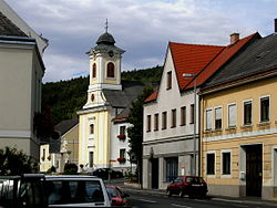
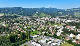
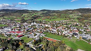
Weiz is a town in the eastern part of the Austrian state of Styria.
Deutschlandsberg is a town in Deutschlandsberg district of Styria, Austria. It is located in southern Austria, near the border with Slovenia. It is approximately 35 km from Graz. Popular tourist attractions include the Deutschlandsberg Castle.
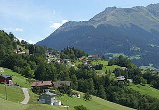
Bartholomäberg is a municipality and a village in the district of Bludenz in the Austrian state of Vorarlberg.

Artstetten-Pöbring is a town in the district of Melk in the Austrian state of Lower Austria.
Pöggstall is a town in the district of Melk in the Austrian state of Lower Austria.

Herzogenburg is a town in the district of Sankt Pölten-Land in the Austrian state of Lower Austria.

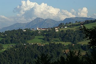
Blons is a municipality in the district of Bludenz in Austrian state of Vorarlberg.

Bludesch is a municipality in the district of Bludenz in the Austrian state of Vorarlberg.

Raggal is a municipality in the district of Bludenz in the Austrian state of Vorarlberg.

Sankt Gallenkirch is a municipality in the district of Bludenz in the Austrian state of Vorarlberg.

Silbertal is a municipality in the district of Bludenz in the Austrian state of Vorarlberg.
Sonntag is a municipality in the district of Bludenz in the Austrian state of Vorarlberg.
Buch is a municipality in the district of Bregenz in the Austrian state of Vorarlberg.

Höchst is a municipality in the district of Bregenz in the Austrian state of Vorarlberg.

Koblach is a municipality in the district of Feldkirch in the Austrian state of Vorarlberg.

Mäder is a municipality in the district of Feldkirch in the Austrian state of Vorarlberg.
Altschwendt is a municipality in the district of Schärding in the Austrian state of Upper Austria.

Bad Gleichenberg is a municipality in the district of Südoststeiermark in the Austrian state of Styria.

Bad Waltersdorf is a spa town in the district of Hartberg-Fürstenfeld in Styria, Austria.