
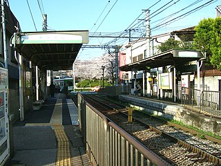
Shim-Mikawashima Station is a railway station on the Keisei Main Line in Arakawa, Tokyo, Japan, operated by the private railway operator Keisei Electric Railway.
Asukayama Station is a station in the Tokyo Sakura Tram. It is located in Kita, Tokyo. The section between here and Oji-ekimae Station is shared with other vehicles with it being on Meiji-dōri Street.

Zalesie is a village in the administrative district of Gmina Rogowo, within Żnin County, Kuyavian-Pomeranian Voivodeship, in north-central Poland. It lies approximately 6 kilometres (4 mi) south-east of Rogowo, 17 km (11 mi) south of Żnin, and 50 km (31 mi) south of Bydgoszcz.
Chrosna is a village in the administrative district of Gmina Liszki, within Kraków County, Lesser Poland Voivodeship, in southern Poland. It lies approximately 7 kilometres (4 mi) north-west of Liszki and 17 km (11 mi) west of the regional capital Kraków.
Brzoskwinia is a village in the administrative district of Gmina Zabierzów, within Kraków County, Lesser Poland Voivodeship, in southern Poland. It lies approximately 6 kilometres (4 mi) south-west of Zabierzów and 17 km (11 mi) west of the regional capital Kraków.
Czerkasy is a village in the administrative district of Gmina Łaszczów, within Tomaszów Lubelski County, Lublin Voivodeship, in eastern Poland. It lies approximately 2 kilometres (1 mi) west of Łaszczów, 24 km (15 mi) north-east of Tomaszów Lubelski, and 113 km (70 mi) south-east of the regional capital Lublin.
Zamłynie is a village in the administrative district of Gmina Tyszowce, within Tomaszów Lubelski County, Lublin Voivodeship, in eastern Poland. It lies approximately 29 km (18 mi) north-east of Tomaszów Lubelski and 107 km (66 mi) south-east of the regional capital Lublin.
Dłużec is a village in the administrative district of Gmina Wolbrom, within Olkusz County, Lesser Poland Voivodeship, in southern Poland. It lies approximately 4 kilometres (2 mi) west of Wolbrom, 17 km (11 mi) north-east of Olkusz, and 41 km (25 mi) north-west of the regional capital Kraków.
Gołaczewy is a village in the administrative district of Gmina Wolbrom, within Olkusz County, Lesser Poland Voivodeship, in southern Poland. It lies approximately 6 kilometres (4 mi) south-west of Wolbrom, 15 km (9 mi) north-east of Olkusz, and 38 km (24 mi) north-west of the regional capital Kraków.
Kąpiołki is a village in the administrative district of Gmina Wolbrom, within Olkusz County, Lesser Poland Voivodeship, in southern Poland. It lies approximately 6 kilometres (4 mi) north-west of Wolbrom, 20 km (12 mi) north-east of Olkusz, and 45 km (28 mi) north of the regional capital Kraków.
Czerwona Wola is a village in the administrative district of Gmina Sieniawa, within Przeworsk County, Subcarpathian Voivodeship, in south-eastern Poland. It lies approximately 9 kilometres (6 mi) east of Sieniawa, 19 km (12 mi) north-east of Przeworsk, and 53 km (33 mi) east of the regional capital Rzeszów.
Antoniów is a village in the administrative district of Gmina Radomyśl nad Sanem, within Stalowa Wola County, Subcarpathian Voivodeship, in south-eastern Poland. It lies approximately 6 kilometres (4 mi) north-west of Radomyśl nad Sanem, 19 km (12 mi) north-west of Stalowa Wola, and 77 km (48 mi) north of the regional capital Rzeszów.
Potworów is a village in Przysucha County, Masovian Voivodeship, in east-central Poland. It is the seat of the gmina called Gmina Potworów. It lies approximately 19 kilometres (12 mi) north-east of Przysucha and 81 km (50 mi) south of Warsaw.
Bronoszewice is a village in the administrative district of Gmina Gozdowo, within Sierpc County, Masovian Voivodeship, in east-central Poland.
Dzierżanów is a village in the administrative district of Gmina Krotoszyn, within Krotoszyn County, Greater Poland Voivodeship, in west-central Poland. It lies approximately 8 kilometres (5 mi) north-west of Krotoszyn and 81 km (50 mi) south of the regional capital Poznań.
Lutom is a village in the administrative district of Gmina Czersk, within Chojnice County, Pomeranian Voivodeship, in northern Poland. It lies approximately 13 kilometres (8 mi) south-west of Czersk, 19 km (12 mi) east of Chojnice, and 90 km (56 mi) south-west of the regional capital Gdańsk.
Kołodzieje is a village in the administrative district of Gmina Prabuty, within Kwidzyn County, Pomeranian Voivodeship, in northern Poland. It lies approximately 5 kilometres (3 mi) south of Prabuty, 17 km (11 mi) east of Kwidzyn, and 81 km (50 mi) south-east of the regional capital Gdańsk.
Gil Mały is a village in the administrative district of Gmina Miłomłyn, within Ostróda County, Warmian-Masurian Voivodeship, in northern Poland. It lies approximately 8 kilometres (5 mi) south-west of Miłomłyn, 15 km (9 mi) west of Ostróda, and 50 km (31 mi) west of the regional capital Olsztyn.
Krushevska is a village in Kardzhali Municipality, Kardzhali Province, southern Bulgaria.
Santo Domingo is a corregimiento in Bugaba District, Chiriquí Province, Panama. It has a land area of 50.9 square kilometres (19.7 sq mi) and had a population of 2,625 as of 2010, giving it a population density of 51.5 inhabitants per square kilometre (133/sq mi). Its population as of 1990 was 1,988; its population as of 2000 was 2,276.


