
Silicon Valley Monterey Bay Council (#055) is a Boy Scouts of America council headquartered in San Jose, California. It was the result of a council merger between the Santa Clara County Council and the Monterey Bay Area Council. In 2004, the previous two councils served over 11,000 youth in over 400 Boy Scout troops, Cub Scout packs, Venturing crews, and Explorer posts. In 2012, the Monterey Bay Area Council announced that after 89 years as a separate council, it had agreed to merge back into the Santa Clara County Council. As of 2013, the council served 13,000 youth in four different counties.

Mount Umunhum is a peak in the Santa Cruz Mountains, located in Santa Clara County, California. It is the fourth-highest peak in the Santa Cruz Mountains, after Loma Prieta, Crystal Peak, and Mt. Chual. Most of the mountain is located within the Sierra Azul Open Space Preserve.

Alum Rock Park, in the Alum Rock district of San Jose, California, is California's oldest municipal park, established in 1872 but serving as public land since the pueblo was established in 1777. Located in a valley in the Diablo Range foothills on the east side of San Jose, the 720 acre (2.9 km2) park offers 13 miles (21 km) of trails, varying from fairly level along Penitencia Creek to sharp switchbacks climbing to the ridges to the South Rim Trail and the North Rim Trail. The narrow floor of the valley includes a visitor center, a small museum/animal rehab facility, picnic areas, playgrounds, lawns, sand volleyball pits, mineral springs, lush plant life, woodlands, creek play opportunities, and occasional group camping.
The Bay Area Ridge Trail is a planned 550-mile (890 km) multi-use trail along the hill and mountain ridgelines surrounding the San Francisco Bay Area, in Northern California. Currently, 400 miles (640 km) have been established. When complete, the trail will connect over seventy-five parks and open spaces. The trail is being designed to provide access for hikers, runners, mountain bicyclists, and equestrians. It will be accessible through trailheads near major population centers, but the trail will extend into more remote areas. The first trail section was dedicated on May 13, 1989.

State Route 35, generally known as Skyline Boulevard for most of its length, is a mostly two-lane state highway in the U.S. state of California. It runs along the ridge of the Santa Cruz Mountains from the high point of State Route 17 near Lexington Reservoir in Santa Clara County to State Route 1 just south of Daly City in San Mateo County, where it crosses SR 1 and loops around Lake Merced to become Sloat Boulevard in San Francisco. SR 35 then continues along Sloat Boulevard until it reaches its terminus when it meets SR 1 again at 19th Avenue.

Formed in 1972 by voter initiative, the Midpeninsula Regional Open Space District (MROSD) is a non-enterprise special district in the San Francisco Bay Area. It has acquired and preserved a regional green belt of open space land and provides opportunities for ecologically-sensitive public enjoyment and education.

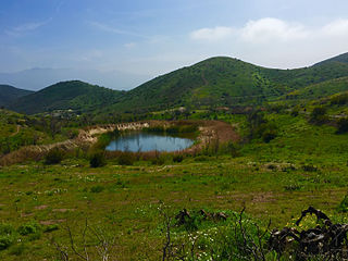
Stevens Creek Reservoir is an artificial lake located in the foothills of the Santa Cruz Mountains near Cupertino, California. A 1,063-acre (430 ha) county park surrounds the reservoir and provides limited fishing, picnicking, hiking, and horseback riding activities. Although swimming is not allowed, non-power boating is allowed for certain parts of the year. No powered boats or jet skis are allowed. All vessels must be inspected for invasive Quagga mussels prior to launch.

Black Mountain is a summit on Monte Bello Ridge in the Santa Cruz Mountains of west Santa Clara County, California, south of Los Altos and Los Altos Hills, and west of Cupertino; it is within the Palo Alto city limits though not near the developed part of the city. It is located on the border between Rancho San Antonio Open Space Preserve and Monte Bello Open Space Preserve, with the summit located in the former. Early Spanish explorers commonly named tree- or chaparral-covered summits which look black in the distance Loma Prieta, from the Spanish . The Spanish also called the middle portion of the Santa Cruz Mountains the Sierra Morena meaning, extending from Half Moon Bay Road south to a gap at Lexington Reservoir, and which includes a summit called Sierra Morena. There are over 100 "Black Mountains" in California.

Rancho San Antonio County Park and Rancho San Antonio Open Space Preserve are a conjoined public recreational area in the Santa Cruz Mountains, in the northwest quadrant of Santa Clara County, California. The County Park is bordered by Los Altos with some parts of the eastern part of the County Park in western Cupertino. The Open Space Preserve is on the west side of the County Park, also bordered by Los Altos Hills, Monte Bello Open Space Preserve, and the Permanente Quarry.
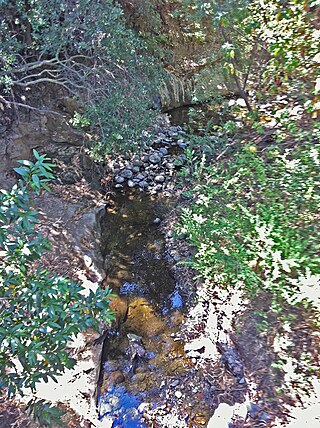
Upper Penitencia Creek is actually one of two creeks by the name Penitencia Creek in the northeastern Santa Clara Valley of Santa Clara County, California. They are both tributaries of Coyote Creek. The upper creek was diverted southwestward, connecting it directly to Coyote Creek ca. 1850 by a farmer to irrigate his fields, permanently splitting Upper Penitencia Creek from Lower Penitencia Creek. Upper Penitencia Creek drains the western slopes of Mount Hamilton of the Diablo Range, and passes through Alum Rock Park, before ending at its confluence with Coyote Creek at Berryessa Road. In December 2018, the San Francisco Estuary Institute published a report commissioned by the Santa Clara Valley Water District to establish a vision for Upper Penitencia Creek's lower four miles focusing on ways "to expand flow conveyance and flood water storage from the Coyote Creek confluence upstream to the Dorel Drive bridge in a manner that works with the existing landscape features and supports habitats for native species".
The Santa Clara Valley Open Space Authority (OSA) is an independent special district in Santa Clara County, California, U.S. A bill signed by Governor Wilson in 1992, SB2027, created the district as the Santa Clara County Open Space Preserve as of February 1, 1993. In 2015, Governor Jerry Brown signed California Senate Bill SB422 to rename the authority with "Valley" instead of "County." The OSA serves areas of the county outside the Midpeninsula Regional Open Space District with the exception of Gilroy. The OSA uses $4.2 million per year from a $12-per-parcel property-tax assessment to hire open space technicians and to open land to the public.
Monte Bello Open Space Preserve is a 3,133-acre (12.68 km2) open space preserve, located near Palo Alto in the Santa Cruz Mountains, in San Mateo and Santa Clara Counties, California, United States. The preserve encompasses the upper Stevens Creek watershed in the valley between Monte Bello Ridge and Skyline Ridge. "Monte Bello" means "beautiful mountain" in Italian, and refers to Black Mountain which is the highest part of Montebello Ridge. The straight valley of upper Stevens Creek is also the rift valley of the San Andreas Fault.

El Sereno Open Space Preserve is a park unit of the Midpeninsula Regional Open Space District located on the peak and slopes of 2580 ft. El Sereno mountain, a peak in the Santa Cruz Mountains. The preserve is located in Santa Clara County, California.

Carr Peak is the third-highest mountain in Cochise County, Arizona and is the second-highest mountain in the Huachuca Mountains. It rises about 10 miles (16 km) south of Sierra Vista, Arizona. The summit is in the Miller Peak Wilderness on the Coronado National Forest and about 4 miles (6 km) south of the Nature Conservancy's Ramsey Canyon Preserve. The area is well known among birders because of the variety of hummingbird species seen in the area as well as the dozens of southwestern specialties such as Apache pine, Chihuahua pine, ridge-nosed rattlesnake, lesser long-nosed bat and elegant trogon.
Los Trancos Creek is a creek that flows northerly from Monte Bello Ridge on the northeast slope of the Santa Cruz Mountains to its confluence with San Francisquito Creek at Stanford University in California, United States. The creek forms the boundary between northwestern Santa Clara County and southeastern San Mateo County.
Diablo Range is an unincorporated census county division (CCD) located in the Diablo Mountains Range, on the eastern side of Santa Clara County, California.

Deer Ridge Open Space is a 188-acre public-owned open-space area in the southwest portion of the town of Newbury Park, California. It contains a series of north-facing mountainous ridges and canyons, dominated by chaparral and oak trees. It shares borders with the Santa Monica Mountains National Recreation Area to the south, and the Los Robles Trail traverses the length of Deer Ridge Open Space. Its main trailhead is located on Potrero Road, while a smaller access point is located at the southern end of Felton Street. The Los Robles Trail is the Conejo Open Space Conservation Agency’s longest trail, and connects to open-space areas and parks such as the Los Padres Open Space, Conejo Ridge Open Space, Hope Nature Preserve, Old Conejo Open Space, and the Los Vientos Open Space. The trail in Newbury Park provides panoramic views of the Conejo Valley and Santa Monica Mountains, before entering the Hope Nature Preserve. The Los Robles Trail provides more than 25 miles of contiguous trails connecting Newbury Park to Westlake Village in Los Angeles County. Immediately south of the Deer Ridge Open Space in Newbury Park are the Hidden Valley and Rancho Sierra Vista Satwiwa.
Dos Vientos Open Space is a 1,216 acres (492 ha) open space area in western Newbury Park, California. It contains more than 41 miles (66 km) of trails used for cycling, hiking and equestrians. Originally a part of the Rancho Guadalasca Spanish Land Grant of 1836, the area is now an important wildlife movement corridor into the Santa Monica Mountains through the Point Mugu State Park. It provides a habitat for a variety of wildlife, including bobcats, mule deer, coyotes, eagles, hawks, barn owls, mountain lions, and more. It provides regional and internal trail connections, many trails offering panoramic views of the Conejo Valley, Oxnard Plain, Topatopa Mountains, Channel Islands, and the Pacific Ocean. Some of the endangered plant species found here include Conejo buckwheat, Verity's liveforever, and Conejo dudleya. The landscape is undeveloped, and dominated by coastal sage scrub, grassy hillsides, oak woodlands, and chaparral habitats.

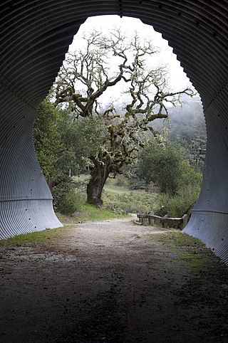
Máyyan 'Ooyákma – Coyote Ridge Open Space Preserve is an 1,859-acre (7.41 km2) publicly owned open space preserve in southern Santa Clara County. It opened to the public in August 2023 and there five miles of trails for visitors to enjoy. Visitors will need a free "Butterfly Pass" for hiking, biking, or horseback riding on the trails located inside the Habitat Protection Area. Total, there are 3.9 miles of trail designated as a portion of Bay Area Ridge Trail, a regional trail system that will someday stretch more than 550 miles along the ridge lines that encircle San Francisco Bay.

Ventu Park Open Space is a 141-acre open space area in Newbury Park, California. Its primary features are the Rosewood Trail leading to Angel Vista, a 1,603 ft peak in the Santa Monica Mountains. Parking for the Rosewood Trail is located at the Stagecoach Inn Park, across Lynn Road from the primary trailhead. The Rosewood Trail begins with oak woodland and crosses a creek at the canyon floor, before climbing up towards the steep Angel Vista Point. There are 360-degree panoramic views of the Conejo Valley, the Oxnard Plain, the California Channel Islands, Pacific Ocean, Point Mugu, Hidden Valley, as well as the Santa Monica-, Santa Susana- and Topa Topa Mountains.
