Sikhio Town

Last updated
The Great Hall of Wat Luang Phor Toh The Great Hall of Luang Poo Toh - Thailand - panoramio.jpg
The Great Hall of Wat Luang Phor Toh

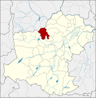
Sikhio (Thai : สีคิ้ว) is the central town of Sikhio District, Nakhon Ratchasima Province, northeastern Thailand. It covers parts of the sub-districts Sikhio and Mittraphab, a total area of 11.63 km². As of 2007 it had a population of 18,663. [1] The town is subdivided into 19 boroughs ( chumchon ).

Thai language language spoken in Thailand

Thai, Central Thai or Ayutthaya or Siamese, is the sole official and national language of Thailand and the first language of the Central Thai people and vast majority of Thai of Chinese origin. It is a member of the Tai group of the Kra–Dai language family. Over half of Thai vocabulary is derived from or borrowed from Pali, Sanskrit, Mon and Old Khmer. It is a tonal and analytic language.

Nakhon Ratchasima Province Province in Thailand

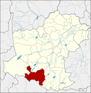
Nakhon Ratchasima, often called Khorat ) is one of the Isan provinces (changwat) of Thailand's northeast corner. It is the country's largest province by area, with a population of about 2.7 million who produce about 250 billion baht in GDP, the highest in Isan. Neighbouring provinces are Chaiyaphum, Khon Kaen, Buriram, Sa Kaeo, Prachinburi, Nakhon Nayok, Saraburi, and Lopburi.

Thailand Constitutional monarchy in Southeast Asia

Thailand, officially the Kingdom of Thailand and formerly known as Siam, is a country at the center of the Southeast Asian Indochinese peninsula composed of 76 provinces. At 513,120 km2 (198,120 sq mi) and over 68 million people, Thailand is the world's 50th largest country by total area and the 21st-most-populous country. The capital and largest city is Bangkok, a special administrative area. Thailand is bordered to the north by Myanmar and Laos, to the east by Laos and Cambodia, to the south by the Gulf of Thailand and Malaysia, and to the west by the Andaman Sea and the southern extremity of Myanmar. Its maritime boundaries include Vietnam in the Gulf of Thailand to the southeast, and Indonesia and India on the Andaman Sea to the southwest. Although nominally a constitutional monarchy and parliamentary democracy, the most recent coup in 2014 established a de facto military dictatorship.

Contents

History

Sikhio was established as a sanitary district ( sukhaphiban ) in 1956. [2] In 1966 the area of the district was enlarged. [3] Like all sanitary districts, it was upgraded to a sub-district municipality ( thesaban tambon ) in 1999. [4] Effective 31 January 2008 it was upgraded to a town ( thesaban mueang ). [5]

Sukhaphiban were administrative divisions of Thailand.

Transport

Sikhio is on the northeastern railway connecting Bangkok with Nakhon Ratchasima. Mittraphap Road passes south of town.

Mittraphap Road road in Thailand

Mittraphap Road or Thailand Route 2 is one of the four major highways in Thailand, along with Phahonyothin Road, Sukhumvit Road, and Phetkasem Road. It runs from Saraburi to Nong Khai. It was built with financial assistance from the United States of America.

Related Research Articles

Na Wa District Amphoe in Nakhon Phanom, Thailand

Na Wa is a district (amphoe) in Nakhon Phanom Province, northeast Thailand.

Talat Chaiya is the one of two sub-district municipalities in Chaiya District, Surat Thani Province, southern Thailand. It was founded as the center of Chaiya District in 1915 on the area of former Srivijaya city of Chaiya. It covers an area of 21.0 km² and has a population of 5,549.

Khanom District Amphoe in Nakhon Si Thammarat, Thailand

Khanom is the northernmost district (amphoe) of Nakhon Si Thammarat Province, southern Thailand.

Pak Chong District District in Nakhon Ratchasima, Thailand

Pak Chong is the westernmost district (amphoe) of Nakhon Ratchasima Province, northeastern Thailand.

Chai Badan District District in Lopburi, Thailand

Chai Badan is a district (amphoe) in the eastern part of Lopburi Province, central Thailand. The local people usually call it Lam Narai, as the district center is in Tambon Lam Narai.

Lam Sonthi District District in Lopburi, Thailand

Lam Sonthi is the easternmost district (amphoe) of Lopburi Province, central Thailand.

Thepharak District District in Nakhon Ratchasima, Thailand

Thepharak is a district (amphoe) in the northwestern part of Nakhon Ratchasima Province.

Soeng Sang District Amphoe in Nakhon Ratchasima, Thailand

Soeng Sang is a district (amphoe) in the southeastern part of Nakhon Ratchasima Province, northeastern Thailand.

Ban Lueam District Amphoe in Nakhon Ratchasima, Thailand

Ban Lueam is a district (amphoe) in the northern part of Nakhon Ratchasima Province, northeastern Thailand.

Wang Nam Khiao District Amphoe in Nakhon Ratchasima, Thailand

Wang Nam Khiao is a district (amphoe) in the southern part of Nakhon Ratchasima Province, northeastern Thailand.

Non Daeng District Amphoe in Nakhon Ratchasima, Thailand

Non Daeng is a district (amphoe) in the northeastern part of Nakhon Ratchasima Province, northeastern Thailand.

Kaeng Sanam Nang District Amphoe in Nakhon Ratchasima, Thailand

Kaeng Sanam Nang is the northernmost district (amphoe) of Nakhon Ratchasima Province, northeastern Thailand.

Nong Bun Mak District Amphoe in Nakhon Ratchasima, Thailand

Nong Bun Mak is a district (amphoe) of Nakhon Ratchasima Province, northeastern Thailand.

Sida District Amphoe in Nakhon Ratchasima, Thailand

Sida is a district (amphoe) in the northeastern part of Nakhon Ratchasima Province, northeastern Thailand.

Bua Lai District Amphoe in Nakhon Ratchasima, Thailand

Bua Lai is a district (amphoe) in the northeastern part of Nakhon Ratchasima Province, northeastern Thailand.

Mueang Yang District Amphoe in Nakhon Ratchasima, Thailand

Mueang Yang is a district (amphoe) in the northeastern part of Nakhon Ratchasima Province, northeastern Thailand.

Phra Thong Kham District Amphoe in Nakhon Ratchasima, Thailand

Phra Thong Kham is a district (amphoe) in the northern part of Nakhon Ratchasima Province, northeastern Thailand.

Lam Thamenchai District Amphoe in Nakhon Ratchasima, Thailand

Lam Thamenchai is a district (amphoe) of Nakhon Ratchasima Province, northeastern Thailand.

Ban Phaeng District Amphoe in Nakhon Phanom, Thailand

Ban Phaeng is a district (amphoe) in Nakhon Phanom Province, northeast Thailand.

Ko Samui (city) City Municipality in Southern Thailand

Ko Samui officially City of Ko Samui is a city in Surat Thani, Southern Thai, Thailand.

References

  1. "Population statistics 2007". Department of Provincial administration.
  2. ประกาศกระทรวงมหาดไทย เรื่อง จัดตั้งสุขาภิบาลสีคิ้ว อำเภอสีคิ้ว จังหวัดนครราชสีมา (PDF). Royal Gazette (in Thai). 73 (45 ง ฉบับพิเศษ): 27–28. 1956-05-30.
  3. ประกาศกระทรวงมหาดไทย เรื่อง เปลี่ยนแปลงเขตสุขาภิบาลสีคิ้ว อำเภอสีคิ้ว จังหวัดนครราชสีมา (PDF). Royal Gazette (in Thai). 83 (33 ง): 1599–1600. 1966-04-12.
  4. พระราชบัญญัติเปลี่ยนแปลงฐานะของสุขาภิบาลเป็นเทศบาล พ.ศ. ๒๕๔๒ (PDF). Royal Gazette (in Thai). 116 (9 ก): 1–4. 1999-02-24.
  5. รายงานการประชุม คณะกรรมการพิจารณาร่างกฎหมายของกระทรวงมหาดไทย คณะที่ 2 ครั้งที่ 56/2550 (in Thai). Legal Affairs Bureau, Office of the Permanent Secretary for Interior.

Coordinates: 14°54′N101°43′E / 14.900°N 101.717°E / 14.900; 101.717

Geographic coordinate system Coordinate system

A geographic coordinate system is a coordinate system that enables every location on Earth to be specified by a set of numbers, letters or symbols. The coordinates are often chosen such that one of the numbers represents a vertical position and two or three of the numbers represent a horizontal position; alternatively, a geographic position may be expressed in a combined three-dimensional Cartesian vector. A common choice of coordinates is latitude, longitude and elevation. To specify a location on a plane requires a map projection.