In geography and geology, a cliff is a vertical, or nearly vertical, rock exposure. Cliffs are formed as erosion landforms by the processes of weathering and erosion. Cliffs are common on coasts, in mountainous areas, escarpments and along rivers. Cliffs are usually formed by rock that is resistant to weathering and erosion. Sedimentary rocks most likely to form cliffs include sandstone, limestone, chalk, and dolomite. Igneous rocks such as granite and basalt also often form cliffs.

Reinhold Messner is an Italian mountaineer, adventurer, explorer, and author from the trilingual Italian province of South Tyrol.

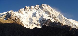
Masherbrum is located in the Ghanche District, Gilgit Baltistan of Pakistan. At 7,821 metres (25,659 ft) it is the 22nd highest mountain in the world and the 9th highest in Pakistan. It was the first mapped peak in the Karakoram mountain range, hence the designation "K1".

Haramosh Peak is a mountain located in the Karakoram range of the Gilgit-Baltistan of Pakistan. Its height is also often given as 7,409m. Haramosh lies about 65 kilometres (40 mi) east of Gilgit, in the south-central region of the Rakaposhi-Haramosh Mountains, a subrange of the Karakoram range. It rises steeply above the north bank of the Indus River, a little ways upstream of its confluence with the Gilgit River. The massif has two summits, Haramosh Peak and Haramosh Kutwal Laila Peak. The peak was first scaled in 1958 by an Austrian team consisting of Heini Roiss, Stephan Pauer, and Dr. Franz Mandl.

Disteghil Sar or Distaghil Sar is the highest mountain in the Hispar Muztagh, a subrange of the Karakoram mountain range, in Gilgit-Baltistan region of Pakistan. It is the 19th highest mountain on earth and the 7th highest peak in Pakistan. Destghil sar is a Wakhi language word, that means "above the inner ranch." The mountain has an about 3 km long top ridge above 7400m with three distinct summits: (north)west 7885m, central 7760 m, and (south)east 7696m or 7535m.

Nazir Sabir Urdu: نذیر صابر is a Pakistani mountaineer. He was born in Hunza. He has climbed Mount Everest and four of the five 8000 m peaks in Pakistan, including the world's second highest mountain K2 in 1981, Gasherbrum II 8035m, Broad Peak 8050m in 1982, and Gasherbrum I 8068m in 1992. He became the first from Pakistan to have climbed Everest on 17 May 2000 as a team member on the Mountain Madness Everest Expedition led by Christine Boskoff from the United States that also included famed Everest climber Peter Habeler of Austria and eight Canadians.
The Buni Zom group is a prominent mountain area of Chitral, in the Hindu Raj range of Pakistan. Buni Zom (main) is the highest peak of the group with an elevation of 6,542 m (21,463 ft). It is located about 50 km (30 mi) northeast of the town of Chitral, and about 50 km (30 mi) east of Tirich Mir, the highest peak in the Hindu Kush.

Batura Sar, also referred to as Batura I, is the 25th highest mountain on earth and the 10th highest in Pakistan. It is the highest peak of the Batura Muztagh, which is the westernmost subrange of the Karakoram range. It forms the apex of the Batura Wall, which is a continuously high part of the backbone of the Batura Muztagh.
Saltoro Kangri is the highest peak of the Saltoro Mountains, also known as the Saltoro Range, which is a part of the Karakoram. It is the 31st highest mountain in the world, but it is in a very remote location deep in the Karakoram. It is located on the Actual Ground Position Line between Indian controlled territory in the Siachen region and Pakistani-controlled territory west of the Saltoro Range. It is currently controlled by India.
Surveyed as K6, but also known as Baltistan Peak. This is a notable peak of the Masherbrum Mountains, a subrange of the Karakoram mountain range in Gilgit Baltistan region of Pakistan. Despite being much lower than its sister mountains, the Eight-thousanders and high 7000m peaks such as Masherbrum, it has huge, steep faces, and great relief above the nearby valleys.
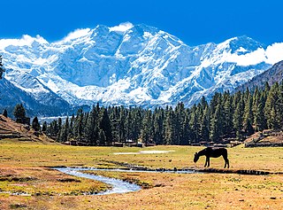
Laila Peak is a major prominence at the southwestern terminus of the Rupal Valley in Pakistan. The peak soars 5,971 metres (19,590 ft) above sea level and some 7,500 feet above the Rupal Valley floor. To its north lies the Rupal Glacier and to its east lies 5,642m Rupal Peak. To the north of the Rupal Glacier stands the Nanga Parbat massif, one of largest in the world. Nanga Parbat itself soars 8,126 m (26,660 ft) above sea level. About its flanks stand numerous notable peaks including Rakhiot Peak, Chongra Peak, Shaigiri and Mazeno Peak.
Rakhiot Peak is a peak in the Himalayas range of the Gilgit–Baltistan, Pakistan. It is one of the many subsidiary summits of the Nanga Parbat massif.

The Saltoro Mountains are a subrange of the Karakoram Range. They are located in the heart of the Karakoram, on the southwest side of the Siachen Glacier, one of the two longest glaciers outside the polar regions. The name given to this range is shared with the Saltoro Valley which is located to the west of this range, downslope on the Pakistan side of the Actual Ground Position Line.

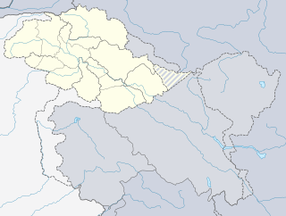
Gilgit-Baltistan has been under Pakistan administration since 1947 and was given self-governing status on August 29, 2009. Gilgit-Baltistan comprises 10 districts within three divisions. The four districts of Skardu Kharmang Shigar and Ghanche are in the Baltistan Division, four districts of Gilgit Ghizer Hunza and Nagar districts which were carved out of Gilgit District are in the Gilgit Division and the third division is Diamir, comprising Chilas and Astore. The main political centres are the towns of Gilgit and Skardu.
Rupal Peak is a mountain in Pakistan's western Himalayas. The peak is located just south of Nanga Parbat on the Rupal Valley and is sometimes climbed by mountaineers as they acclimatize for higher local peaks. Despite its unique beauty, steep north face and impressive height, Rupal is greatly overshadowed by Nanga Parbat, the Mazeno Wall, and the mighty Rupal Face. To its west lie Laila Peak and Shaigiri, and to its north flows the Rupal Glacier which later forms the Rupal River.
Chongra Peak is a peak in the Himalaya range of Asia. Located in Gilgit–Baltistan, Pakistan, it is one of the many subsidiary summits of the Nanga Parbat massif. The peak lies just south of the Indus River, in Pakistan. Not far to the north is the western end of the Karakoram range.

The Nun Kun mountain massif consists of a pair of Himalayan peaks: Nun, 7,135 m (23,409 ft) and its neighbor peak Kun Peak, 7,077 m (23,218 ft). Nun is the highest peak in the part of the Himalayan range lying on the Indian side of the Line of Control in Jammu and Kashmir. The massif is located near the Suru valley, about 250 km (160 mi) east of Srinagar, the state capital. The Nun Kun massif is bounded to the north by the Suru valley and the Zanskar range. To the east, it is flanked by the Suru valley and the Pensila(4400m), a pass which separates Suru from the Zanskar Valley. To the South lies the Kishtwar National Park and the Krash Nai river. While to the southwest and to the south lie a maze of glaciers, peaks and rivers giving access to Kashmir, Kishtwar and Doda regions of the state of Jammu and Kashmir. The rocks predominantly are stratified sedimentary rocks composed of shale and sandstone. Metamorphic rocks and granite formations are also seen at places. The area is rich in minerals especially garnets.
Günther Messner was an Italian mountaineer from South Tyrol and the younger brother of Reinhold Messner. Günther climbed some of the most difficult routes in the Alps during the 1960s, and joined the Nanga Parbat-Expedition in 1970 just before the beginning of the expedition due to an opening within the team.

Nanga Parbat is a 2010 German motion picture mountaineering movie about two brothers, Reinhold and Günther Messner, who climbed Nanga Parbat.