
Siliguri is a city which spans areas of the Darjeeling and Jalpaiguri districts in the Indian state of West Bengal. The city is located on the banks of the Mahananda River at the foothills of the Himalayas.
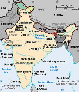
The Siliguri Corridor, or Chicken's Neck, is a narrow stretch of land of about 22 kilometres, located in the Indian state of West Bengal, that connects India's northeastern states to the rest of India, with the countries of Nepal and Bangladesh lying on either side of the corridor. The Kingdom of Bhutan lies on the northern side of the corridor. The Kingdom of Sikkim formerly lay on the northern side of the corridor, until its merger with India in 1975.

New Jalpaiguri Junction Railway Station(Station code: NJP) is a railway station which serves the twin cities of Siliguri and Jalpaiguri, the largest metropolis of North Bengal. New Jalpaiguri, as a railway station serves as the entry point to Nepal, Sikkim, Bhutan ,Bangladesh and the seven northeastern states. The railway station is the largest as well as the most busiest railway junction of North East Frontier Zone, which serves as the lifeline of the Northeastern states. NJP acts as a connecting base for the Northeastern states to the indian mainland.

The Mahananda River is a trans-boundary river that flows through the Indian states of West Bengal and Bihar, and Bangladesh.

Gorumara National Park is a National Park in northern West Bengal, India. Located in the Dooars region of the Himalayan foothills, it is a medium-sized park with grasslands and forests. It is primarily known for its population of Indian rhinoceros. The park has been declared as the best among the protected areas in India by the Ministry of Environment and Forests for the year 2009.

Mirik is a tourist spot located in the hills of Darjeeling district in West Bengal, India. It is the headquarters of Mirik subdivision. The name Mirik comes from the Lepcha words Mir-Yok meaning "place burnt by fire".
Transport in Darjeeling consists of the intra-city transport and the communication between the city and other locations in Darjeeling district. Darjeeling is a hill station in the Indian state of West Bengal and it is the headquarters of Darjeeling district situated in the Mahabharat Range at an average elevation of 2,134 m above sea level.
Dabgram is a small industrial hamlet near Siliguri in the Jalpaiguri district of West Bengal, India. It lies adjacent to Phulbari, Jalpaiguri in Jalpaiguri district. It can also be noted as a suburb/neighborhood of the city of Siliguri.

Maney Bhanjyang is a small transit-town in the Darjeeling Sadar subdivision, Darjeeling district in the state of West Bengal in India. It is located at the gateway of the Singalila National Park, 28 km away from Darjeeling town. The income of the local residents is geared towards tourism, especially foreign trekkers. Maney Bhanjyang is the start of the trailhead for the trek to Sandakphu on the Singalila Ridge, the highest point in West Bengal. Conveyance for Sandakphu is also available mainly from Maney Bhanjyang in the form of Land Rovers of 1960 model. The 4 hour ride can be quite 'jumpy' as drivers maneuver their prized possessions along snaky curves and uphill roads.
Siliguri subdivision is a subdivision of the Darjeeling district in the state of West Bengal, India. It consists of the Siliguri municipal corporation and four community development blocks: Matigara, Naxalbari, Phansidewa and Kharibari. The four blocks contain 22 gram panchayats and two census towns: Bairatisal and Uttar Bagdogra. The subdivision has its headquarters at Siliguri.
Madarihat is a small village located in the Alipurduar subdivision of Alipurduar district, West Bengal, India. This village is situated on the outskirts of Jaldapara National Park which is famous for Indian rhinoceros. This is one of the main tourist spot in North Bengal surrounded by tea gardens, forests, hill and small rivers and also having a great diversity in the population. Madarihat is also world famous for the local wooden furniture.
Khoribari is an administrative division in Siliguri subdivision of Darjeeling district in the Indian state of West Bengal. Khoribari police station serves this block. Headquarters of this block is at Khoribari.
The Katihar–Siliguri line is a railway line connecting Katihar in the Indian state of Bihar with Siliguri Junction in West Bengal, via Aluabari Road Junction (Islampur), Thakurganj and Bagdogra. It was a metre gauge track that was converted to 1,676 mm Broad Gauge in 2011.

Siliguri Police Commissionerate or Siliguri Metropolitan Police, established in 2012, is a city police force with primary responsibilities in law enforcement and investigation within the certain urban parts of Siliguri, West Bengal. The Commissionerate is part of the West Bengal Police, and is under the administrative control of Home Ministry of West Bengal. It was formed after bifurcation of the Darjeeling Police District, and has eight police stations under its jurisdiction. Niraj Kumar Singh IPS has taken over charge of the Commissioner of Police Silliguri Police Commissionerate on 29-06-2017.

Siliguri Town is one of the three railway stations that serve Siliguri in Darjeeling district in the Indian state of West Bengal. The other two stations are: Siliguri Junction and New Jalpaiguri.

Siliguri Junction is one of the three railway stations that serve Siliguri in Darjeeling district in the Indian state of West Bengal. The other two stations are: Siliguri Town and New Jalpaiguri. It has 1,676 mm broad gauge and Narrow Gauge tracks. It formerly had the distinction of having three gauges, but the metre-gauge line from Aluabari Road to Alipuarduar was converted later.

Katihar Junction railway station serves Katihar city in Katihar district in the Indian state of Bihar. The Katihar Junction railway station is connected to most of the major cities in India by the railway network.
Thakurganj railway station serves Thakurganj town in Kishanganj district in the Indian state of Bihar. The Mechi flowing nearby forms the boundary between Nepal and India in the area. On the other side of the border, Prithivinagar is a village development committee in Jhapa District of Nepal.
Adhikari railway station is a small railway station in Darjeeling district, West Bengal. Its code is ADQ. It serves Adhikari town. The station consists of two platforms. The platforms are not well sheltered. It lacks many facilities including water and sanitation.
The New Mal–Changrabandha–New Cooch Behar line are a set of 2 lines which connect Changrabandha, a border transit point near Indo-Bangladesh border in Cooch Behar district with the stations of New Mal in Jalpaiguri district and New Cooch Behar in Cooch Behar district of West Bengal. It is under the jurisdiction of Northeast Frontier Railway. The Malbazar–Changrabandha section of the line was a metre gauge line, before its gauge conversion began on 2002.The Malbazar-Changrabandha section was re-opened to public on 20 January 2016 after gauge conversion. The New Changrabandha-New Cooch Behar broad gauge line was built as an extension as a part of the New Maynaguri–Jogighopa rail line to provide an alternate link from North Bengal to Assam and was opened to public on 21 February 2016.


