
Derrygonnelly is a small village and townland in County Fermanagh, Northern Ireland. Near Lower Lough Erne, the village was home to 680 people at the 2011 Census and dates to the Plantation era. It is situated within Fermanagh and Omagh district.

Boho is a hamlet and a civil parish 11 kilometres (7 mi) covering approximately 12 km × 7 km southwest of Enniskillen in County Fermanagh, Northern Ireland. It is situated within Fermanagh and Omagh district.

The Arney River is a small river in County Fermanagh, Northern Ireland, feeding from Lower Lough MacNean and into Upper Lough Erne. It meanders through a wide, flat Glacial Trough between the uplands of Fermanagh, Belmore Mountain and the Cuilcagh Mountains. The valley is characterised by wide flat lowlands enclosed by low hills. The Cladagh River drains into the Arney River.

Saint Faber is the patron saint of the Sacred Heart Church in Boho, County Fermanagh and of Monea.

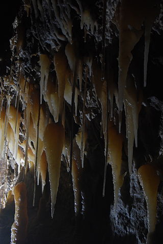
The Boho Caves are a collection of caves centred on the village of Boho, County Fermanagh on the northern slopes of Belmore Mountain. They encompass the main Boho Cave and the smaller Waterfall Cave and Upper and Lower Ravine Caves. The Boho Cave system is the sixth-longest cave system in Northern Ireland, is designated an Area of Special Scientific Interest and is the only example of joint-controlled caves in Northern Ireland.
Knockmore is an upland area and townland situated in County Fermanagh, Northern Ireland outside the village of Derrygonnelly, in the historical barony of Magheraboy. This area, together with the adjacent Barrs of Boho and most of the uplands in Boho parish, are described as the Knockmore Scarplands. The focal point of the area is Knockmore summit at 277 metres (909 ft).
Killydrum is a townland in County Fermanagh, Northern Ireland. It has previously been referred to as Kildrome (1659) and Killdrum (1695). This townland belongs to the land division of Old Barr in the area of Boho.

Reyfad is a townland in County Fermanagh, Northern Ireland. It lies in the land division of Old Barr, in the civil parish of Boho. The townland has previously been called Rayfadd - 1659, Raffada (Magheryboy) - 1672 and Ráith Fada "long fort" - 1833.

Aghanaglack or Aghnaglack, is a townland in County Fermanagh, Northern Ireland. It is situated in the civil parish of Boho, as well as Fermanagh and Omagh district.
Shannon Cave is an active stream passage cave which straddles the border of County Fermanagh, Northern Ireland and County Cavan in the Republic of Ireland.
The Caves of the Tullybrack and Belmore hills are a collection of caves in southwest County Fermanagh, Northern Ireland. The region is also described as the West Fermanagh Scarplands by environmental agencies and shares many similar karst features with the nearby Marble Arch Caves Global Geopark.
Carr or Corr is a townland in County Fermanagh, Northern Ireland. The area is situated in the civil parish of Boho and contains Carron Lough which is reputed to be quite deep and also the Sillees River. It is situated within Fermanagh and Omagh district.
Clogherbog is a townland in County Fermanagh, Northern Ireland. It is part of the civil parish of Boho, and contains the sub-townlands of Carrickrory, Lough Nacloyduff, Loughanquin, Loughnamanfin and Tullylaur. It is situated within Fermanagh and Omagh district.

Glenkeel is a townland in County Fermanagh, Northern Ireland. It is situated in the south-west corner of the civil parish of Boho, in the land division of Old Barr, in the former barony of Magheraboy. It is situated within Fermanagh and Omagh district.
Kilnamadoo or Kilnamaddoo is a townland in County Fermanagh, Northern Ireland. It is situated within the civil parish of the area of Boho, as well as Fermanagh and Omagh district.
Knocknahunshin, is a townland in County Fermanagh, Northern Ireland. It is in the civil parish of Boho, in between the townlands of Glenkeel and Reyfad. Within this area are the sub-townlands of Arduagh, Carricknamulloge, Carricknine, Horse Rock, Legloughra, Owneyglas, Silkins and Sterrickinard.

The Cuilcagh Lakelands Geopark formerly known as the Marble Arch Caves Global Geopark straddles the border between Northern Ireland and the Republic of Ireland. It is centred on the Marble Arch Caves and in 2001 it became one of the first geoparks to be designated in Europe.

The Cliffs of Magho are a 9-kilometre-long (5.6 mi) limestone escarpment located in the townland of Magho, County Fermanagh, Northern Ireland. The NNW-facing cliffs overlook the western reaches of Lower Lough Erne and define the northern edge of Lough Navar Forest, a major plantation managed by the Forest Service of Northern Ireland. A popular viewpoint atop the cliffs is accessed by a forest drive.

Drumbegger is a townland situated in County Fermanagh, Fermanagh and Omagh district, Northern Ireland. It is part of the civil parish of Boho in the old barony of Magheraboy and contains the sub-townland known as Oubarraghan.
