
The Cedar River is a river in the U.S. state of Washington. About 45 miles (72 km) long, it originates in the Cascade Range and flows generally west and northwest, emptying into the southern end of Lake Washington. Its upper watershed is a protected area called the Cedar River Watershed, which provides drinking water for the greater Seattle area.

The Owyhee River is a tributary of the Snake River located in northern Nevada, southwestern Idaho and southeastern Oregon in the United States. It is 280 miles (450 km) long. The river's drainage basin is 11,049 square miles (28,620 km2) in area, one of the largest subbasins of the Columbia Basin. The mean annual discharge is 995 cubic feet per second (28.2 m3/s), with a maximum of 50,000 cu ft/s (1,400 m3/s) recorded in 1993 and a minimum of 42 cu ft/s (1.2 m3/s) in 1954.

The Clark Fork, or the Clark Fork of the Columbia River, is a river in the U.S. states of Montana and Idaho, approximately 310 miles (500 km) long. The largest river by volume in Montana, it drains an extensive region of the Rocky Mountains in western Montana and northern Idaho in the watershed of the Columbia River. The river flows northwest through a long valley at the base of the Cabinet Mountains and empties into Lake Pend Oreille in the Idaho Panhandle. The Pend Oreille River in Idaho, Washington, and British Columbia, Canada which drains the lake to the Columbia in Washington, is sometimes included as part of the Clark Fork, giving it a total length of 479 miles (771 km), with a drainage area of 25,820 square miles (66,900 km2). In its upper 20 miles (32 km) in Montana near Butte, it is known as Silver Bow Creek. Interstate 90 follows much of the upper course of the river from Butte to Saint Regis. The highest point within the river's watershed is Mount Evans at 10,641 feet (3,243 m) in Deer Lodge County, Montana along the Continental Divide.

The Pit River is a major river draining from northeastern California into the state's Central Valley. The Pit, the Klamath and the Columbia are the only three rivers in the U.S. that cross the Cascade Range.

The Feather River is the principal tributary of the Sacramento River, in the Sacramento Valley of Northern California. The river's main stem is about 73 miles (117 km) long. Its length to its most distant headwater tributary is just over 210 miles (340 km). The main stem Feather River begins in Lake Oroville, where its four long tributary forks join—the South Fork, Middle Fork, North Fork, and West Branch Feather Rivers. These and other tributaries drain part of the northern Sierra Nevada, and the extreme southern Cascades, as well as a small portion of the Sacramento Valley. The total drainage basin is about 6,200 square miles (16,000 km2), with approximately 3,604 square miles (9,330 km2) above Lake Oroville.

The Payette River is an 82.7-mile-long (133.1 km) river in southwestern Idaho and is a major tributary of the Snake River.

The Mokelumne River is a 95-mile (153 km)-long river in northern California in the United States. The river flows west from a rugged portion of the central Sierra Nevada into the Central Valley and ultimately the Sacramento–San Joaquin River Delta, where it empties into the San Joaquin River-Stockton Deepwater Shipping Channel. Together with its main tributary, the Cosumnes River, the Mokelumne drains 2,143 square miles (5,550 km2) in parts of five California counties. Measured to its farthest source at the head of the North Fork, the river stretches for 157 miles (253 km).

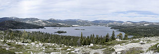
Union Valley Reservoir is a reservoir in eastern El Dorado County, California, about 20 miles (32 km) northeast of Placerville. The 277,000 acre-feet (342,000,000 m3) lake is in Eldorado National Forest in the Sierra Nevada at an elevation of 4,870 feet (1,480 m).
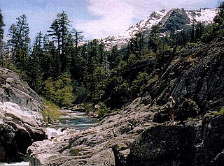
The Rubicon River is a major tributary of the Middle Fork American River in the Sierra Nevada of Northern California, west of Lake Tahoe. Its length is 60 miles (97 km) with a watershed of about 184 square miles (477 km2). The river's headwaters are in the Crystal Range of the Sierra Nevada, within the Eldorado National Forest's Desolation Wilderness. Historically, the Rubicon River was known as the South Fork of the Middle Fork of the American River.

Cherry Creek is a large, swift-flowing stream in the Sierra Nevada mountain range, and is the largest tributary of the Tuolumne River. The creek is 40 miles (64 km) long measured to its farthest headwaters; the main stem itself is 26 miles (42 km) long, draining a watershed of 234 square miles (610 km2) in the Stanislaus National Forest. Part of the drainage also extends into the northwest corner of Yosemite National Park.

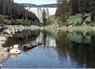
Loon Lake is a reservoir in the Eldorado National Forest of El Dorado County, California, United States. The 76,200 acre⋅ft (94,000,000 m3) lake is formed by Loon Lake Dam, completed in 1963 as part of the Upper American River Project by Sacramento Municipal Utility District to conserve spring snow melt runoff for use during the summer and autumn for hydroelectric power production. Loon Lake Dam impounds water at the headwaters of Gerle Creek which, prior to the dam, flowed intermittently through (natural) Loon and Pleasant Lakes. But most of the water now stored in Loon Lake arrives from Buck Island Reservoir in the adjacent Rubicon River watershed by way of the Buck-Loon Tunnel. Nearby is Loon Lake Chalet, a popular winter recreation destination. In summer, a boat ramp for water sports and camping are available, but the area is less popular than nearby Union Valley Reservoir and Rubicon Trail.
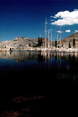
Lake Aloha is a large shallow backcountry reservoir located at an elevation of 8,116 feet in the Sierra Nevada Range, west of Lake Tahoe in El Dorado County, in eastern California.
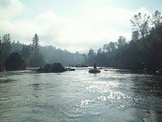
The South Fork American River is a major tributary of the American River in El Dorado County, California, draining a watershed on the western slope of the Sierra Nevada east of Sacramento. The river begins in pristine Desolation Wilderness and flows through the Sierra Nevada foothills. The river at Coloma was the site of James Marshall's discovery of gold at Sutter's Mill on January 24, 1848, which started the California Gold Rush. The South Fork of the American is "the most popular recreation stream in the West" for whitewater rafting in North America, e.g., 80,000 visitors in 2011. Professional whitewater rafting companies have been offering commercial rafting trips on the South Fork American River since 1978.

The South Fork Eel River is the largest tributary of the Eel River in north-central California in the United States. The river flows 105 miles (169 km) north from Laytonville to Dyerville/Founders' Grove where it joins the Eel River. The South Fork drains a long and narrow portion of the Coast Range of California in parts of Mendocino and Humboldt counties. U.S. Route 101 follows the river for much of its length.
The North Fork Clearwater River is a major tributary of the Clearwater River in the U.S. state of Idaho. From its headwaters in the Bitterroot Mountains of eastern Idaho, it flows 135 miles (217 km) westward and is dammed by the Dworshak Dam just above its mouth in north-central Idaho. Draining a rugged watershed of 2,462 square miles (6,380 km2), the river has an average flow of over 5,600 cubic feet per second (160 m3/s), accounting for a third of the discharge from the Clearwater basin. The river drains parts of Clearwater, Shoshone, Latah, and Idaho counties. Most of the watershed is managed by the U.S. Forest Service. Some of the fish of the river include westslope cutthroat trout, rainbow trout, mountain whitefish, and the threatened bull trout. It also has smallmouth bass and a kokanee salmon run, both from Dworshak Reservoir. The North Fork drainage is home to grizzly bears, cougars, deer, moose, black bear, elk, grey wolves, and osprey. The river used to have a large steelhead run before the implementation of Dworshak Dam. The North Fork of the Clearwater is located within the Clearwater National Forest

The North Fork American River is the longest branch of the American River in Northern California. It is 88 miles (142 km) long from its source at the crest of the Sierra Nevada, near Lake Tahoe, to its mouth at Folsom Lake northeast of Sacramento. Prior to the construction of Folsom Dam the river was about 9 miles (14 km) longer making for a total length of 97 miles (156 km).

The North Fork Kings River is a 40.3-mile (64.9 km) tributary of the Kings River, in the U.S. state of California. The river's main stem is entirely within Fresno County, and its watershed drains about 387 square miles (1,000 km2) of the southern Sierra Nevada mountain range.

The Middle Fork American River is one of three forks that form the American River in Northern California. It drains a large watershed in the high Sierra Nevada west of Lake Tahoe and northeast of Sacramento in Placer and El Dorado Counties, between the watersheds of the North Fork American River and South Fork American River. The Middle Fork joins with the North Fork near Auburn and they continue downstream to Folsom Lake as the North Fork, even though the Middle Fork carries a larger volume of water.
The Upper American River Project (UARP) is a hydroelectric system operated by the Sacramento Municipal Utility District (SMUD) of Sacramento, California in the United States.

Cottonwood Creek is a major stream and tributary of the Sacramento River in Northern California. About 68 miles (109 km) long measured to its uppermost tributaries, the creek drains a large rural area bounded by the crest of the Coast Ranges, traversing the northwestern Sacramento Valley before emptying into the Sacramento River near the town of Cottonwood. It defines the boundary of Shasta and Tehama counties for its entire length. Because Cottonwood Creek is the largest undammed tributary of the Sacramento River, it is known for its Chinook salmon and steelhead runs.