Silver Creek (Oregon)

Last updated
Map all coordinates using: OpenStreetMap  ·  Google Maps
Download coordinates as: KML  ·  GPX

Silver Creek is the name of several different streams, locales, and other features in the U.S. state of Oregon, [1] including:

U.S. state constituent political entity sharing sovereignty as the United States of America

In the United States, a state is a constituent political entity, of which there are currently 50. Bound together in a political union, each state holds governmental jurisdiction over a separate and defined geographic territory and shares its sovereignty with the federal government. Due to this shared sovereignty, Americans are citizens both of the federal republic and of the state in which they reside. State citizenship and residency are flexible, and no government approval is required to move between states, except for persons restricted by certain types of court orders. Four states use the term commonwealth rather than state in their full official names.

Oregon State of the United States of America

Oregon is a state in the Pacific Northwest region on the West Coast of the United States. The Columbia River delineates much of Oregon's northern boundary with Washington, while the Snake River delineates much of its eastern boundary with Idaho. The parallel 42° north delineates the southern boundary with California and Nevada. Oregon is one of only three states of the contiguous United States to have a coastline on the Pacific Ocean.

name type elevation coordinate USGS map GNIS ID description
Little North Fork Silver Creek (Marion County, Oregon) Stream 1,617 ft (493 m) 44°53′02″N122°35′53″W / 44.8839°N 122.5981°W / 44.8839; -122.5981 (Little North Fork Silver Creek (Little North Fork Silver Creek County, Marion)) Elk Prairie 1123243
Little Silver Creek (Josephine County, Oregon) Stream 1,325 ft (404 m) 42°27′06″N123°51′11″W / 42.4517°N 123.8531°W / 42.4517; -123.8531 (Little Silver Creek (Little Silver Creek County, Josephine)) York Butte 1145255
Little Silver Creek (Curry County, Oregon) Stream 62 ft (19 m) 42°29′34″N124°12′46″W / 42.4928°N 124.2128°W / 42.4928; -124.2128 (Little Silver Creek (Little Silver Creek County, Curry)) Quosatana Butte 1145256
Little Silver Creek Lake (Josephine County, Oregon) Lake 2,228 ft (679 m) 42°28′49″N123°48′59″W / 42.4803°N 123.8164°W / 42.4803; -123.8164 (Little Silver Creek Lake (Little Silver Creek Lake County, Josephine)) York Butte 1155689
North Fork Silver Creek (Josephine County, Oregon) Stream 899 ft (274 m) 42°27′23″N123°53′12″W / 42.4564°N 123.8867°W / 42.4564; -123.8867 (North Fork Silver Creek (North Fork Silver Creek County, Josephine)) Silver Peak 1146997
North Fork Silver Creek (Lake County, Oregon) Stream 5,095 ft (1,553 m) 42°59′10″N121°09′29″W / 42.9861°N 121.1581°W / 42.9861; -121.1581 (North Fork Silver Creek (North Fork Silver Creek County, Lake)) Partin Butte 1156729
North Fork Silver Creek (Marion County, Oregon) Stream 1,378 ft (420 m) 44°52′35″N122°38′56″W / 44.8764°N 122.6489°W / 44.8764; -122.6489 (North Fork Silver Creek (North Fork Silver Creek County, Marion)) Drake Crossing 1163178 meets South Fork Silver Creek to form Silver Creek (Marion County, Oregon)
North Silver Creek Youth Camp (Marion County, Oregon) Locale 1,539 ft (469 m) 44°53′19″N122°37′39″W / 44.8886°N 122.6275°W / 44.8886; -122.6275 (North Silver Creek Youth Camp (North Silver Creek Youth Camp County, Marion)) Drake Crossing 1162315
Silver Butte Creek (Curry County, Oregon) Stream 82 ft (25 m) 42°46′24″N124°29′54″W / 42.7733°N 124.4983°W / 42.7733; -124.4983 (Silver Butte Creek (Silver Butte Creek County, Curry)) Sixes 1154678
Silver Creek (Yamhill County, Oregon) Stream 331 ft (101 m) 45°17′46″N123°19′28″W / 45.2961°N 123.3244°W / 45.2961; -123.3244 (Silver Creek (Silver Creek County, Yamhill)) Fairdale 1126960
Silver Creek (Coos County, Oregon) Stream 331 ft (101 m) 43°28′53″N123°55′51″W / 43.4814°N 123.9308°W / 43.4814; -123.9308 (Silver Creek (Silver Creek County, Coos)) Golden Falls 1126961
Silver Creek (Lane County, Oregon) Stream 928 ft (283 m) 44°06′59″N122°26′37″W / 44.1164°N 122.4436°W / 44.1164; -122.4436 (Silver Creek (Silver Creek County, Lane)) Nimrod 1126962
Silver Creek (Baker County, Oregon) Stream 4,987 ft (1,520 m) 44°48′31″N118°12′28″W / 44.8086°N 118.2078°W / 44.8086; -118.2078 (Silver Creek (Silver Creek County, Baker)) Bourne 1126963
Silver Creek (Marion County, Oregon) Stream 157 ft (48 m) 45°00′01″N122°50′27″W / 45.0003°N 122.8408°W / 45.0003; -122.8408 (Silver Creek (Silver Creek County, Marion)) Silverton 1126964 formed out of the South and North forks from the Cascade foothills; forms in Silver Falls State Park
Silver Creek (Curry County, Oregon) Stream 69 ft (21 m) 42°30′04″N124°14′10″W / 42.5011°N 124.2361°W / 42.5011; -124.2361 (Silver Creek (Silver Creek County, Curry)) Soldier Camp Mountain 1149483
Silver Creek (Douglas County, Oregon) Stream 23 ft (7.0 m) 43°40′23″N124°09′39″W / 43.6731°N 124.1608°W / 43.6731; -124.1608 (Silver Creek (Silver Creek County, Douglas)) Winchester Bay 1149484
Silver Creek (Grant County, Oregon) Stream 3,793 ft (1,156 m) 44°52′43″N118°35′17″W / 44.8786°N 118.5881°W / 44.8786; -118.5881 (Silver Creek (Silver Creek County, Grant)) Silver Butte 1149485
Silver Creek (Lake County, Oregon) Stream 4,311 ft (1,314 m) 43°07′36″N120°55′55″W / 43.1267°N 120.9319°W / 43.1267; -120.9319 (Silver Creek (Silver Creek County, Lake)) Tuff Butte 1149486
Silver Creek (Harney County, Oregon) Stream 4,101 ft (1,250 m) 43°15′47″N119°11′21″W / 43.2631°N 119.1892°W / 43.2631; -119.1892 (Silver Creek (Silver Creek County, Harney)) Northwest Harney Lake 1149487 flows into Harney Lake
Silver Creek (Josephine County, Oregon) Stream 276 ft (84 m) 42°27′16″N124°00′01″W / 42.4544°N 124.0003°W / 42.4544; -124.0003 (Silver Creek (Silver Creek County, Josephine)) Silver Peak 1149488
Silver Creek (Lane County, Oregon) Stream 2,185 ft (666 m) 43°53′04″N122°15′50″W / 43.8844°N 122.2639°W / 43.8844; -122.2639 (Silver Creek (Silver Creek County, Lane)) Sardine Butte 1149489
Silver Creek (Umatilla County, Oregon) Stream 4,252 ft (1,296 m) 45°06′03″N119°06′17″W / 45.1008°N 119.1047°W / 45.1008; -119.1047 (Silver Creek (Silver Creek County, Umatilla)) Deerhorn Creek 1149490
Silver Creek (Wallowa County, Oregon) Stream 3,983 ft (1,214 m) 45°23′44″N117°25′38″W / 45.3956°N 117.4272°W / 45.3956; -117.4272 (Silver Creek (Silver Creek County, Wallowa)) Lostine 1149491
Silver Creek (Linn County, Oregon) Stream 3,271 ft (997 m) 44°35′19″N122°18′04″W / 44.5886°N 122.3011°W / 44.5886; -122.3011 (Silver Creek (Silver Creek County, Linn)) Quartzville 1153818
Silver Creek (Douglas County, Oregon) Stream 2,008 ft (612 m) 43°06′19″N122°35′44″W / 43.1053°N 122.5956°W / 43.1053; -122.5956 (Silver Creek (Silver Creek County, Douglas)) Buckeye Lake 1155281
Silver Creek (Douglas County, Oregon) Stream 16 ft (4.9 m) 43°51′18″N124°03′43″W / 43.8550°N 124.0619°W / 43.8550; -124.0619 (Silver Creek (Silver Creek County, Douglas)) Fivemile Creek 1639262
Silver Creek Camp (Baker County, Oregon) Locale 5,108 ft (1,557 m) 44°48′39″N118°13′00″W / 44.8108°N 118.2167°W / 44.8108; -118.2167 (Silver Creek Camp (Silver Creek Camp County, Baker)) Bourne 1126965
Silver Creek Cemetery (Harney County, Oregon) Cemetery 4,324 ft (1,318 m) 43°36′02″N119°37′16″W / 43.6006°N 119.6211°W / 43.6006; -119.6211 (Silver Creek Cemetery (Silver Creek Cemetery County, Harney)) Riley 2696682
Silver Creek Dam (Marion County, Oregon) Dam 440 ft (130 m) 44°58′59″N122°44′46″W / 44.9831°N 122.7461°W / 44.9831; -122.7461 (Silver Creek Dam (Silver Creek Dam County, Marion)) Drake Crossing 1133677
Silver Creek Dam (Harney County, Oregon) Dam 4,163 ft (1,269 m) 43°24′24″N119°23′58″W / 43.4067°N 119.3994°W / 43.4067; -119.3994 (Silver Creek Dam (Silver Creek Dam County, Harney)) Moon Reservoir 1133679
Silver Creek Landing (Lane County, Oregon) Locale 928 ft (283 m) 44°06′59″N122°26′34″W / 44.1164°N 122.4428°W / 44.1164; -122.4428 (Silver Creek Landing (Silver Creek Landing County, Lane)) Nimrod 1162259
Silver Creek Landing Boat Ramp (Lane County, Oregon) Locale 906 ft (276 m) 44°06′58″N122°26′34″W / 44.1161°N 122.4428°W / 44.1161; -122.4428 (Silver Creek Landing Boat Ramp (Silver Creek Landing Boat Ramp County, Lane)) Nimrod 2668140
Silver Creek Marsh (Lake County, Oregon) Swamp 4,829 ft (1,472 m) 43°00′12″N121°08′10″W / 43.0033°N 121.1361°W / 43.0033; -121.1361 (Silver Creek Marsh (Silver Creek Marsh County, Lake)) Bridge Creek Draw 1149492
Silver Creek Marsh Recreation Site (Lake County, Oregon) Locale 4,819 ft (1,469 m) 43°00′21″N121°08′01″W / 43.0058°N 121.1336°W / 43.0058; -121.1336 (Silver Creek Marsh Recreation Site (Silver Creek Marsh Recreation Site County, Lake)) Bridge Creek Draw 1155829
Silver Creek Post Office (historical) (Marion County, Oregon) Post Office 312 ft (95 m) 44°59′19″N122°45′57″W / 44.9886°N 122.7658°W / 44.9886; -122.7658 (Silver Creek Post Office (historical) (Silver Creek Post Office (historical) County, Marion)) Stayton NE 1164681
Silver Creek Reservoir (Marion County, Oregon) Reservoir 417 ft (127 m) 44°58′56″N122°44′28″W / 44.9822°N 122.7411°W / 44.9822; -122.7411 (Silver Creek Reservoir (Silver Creek Reservoir County, Marion)) Drake Crossing 1133678
Silver Creek Reservoir (Lake County, Oregon) Reservoir 4,439 ft (1,353 m) 43°05′04″N121°04′42″W / 43.0844°N 121.0783°W / 43.0844; -121.0783 (Silver Creek Reservoir (Silver Creek Reservoir County, Lake)) Hager Mountain 1161731
Silver Creek Riffle (Curry County, Oregon) Rapids 89 ft (27 m) 42°30′02″N124°14′14″W / 42.5006°N 124.2372°W / 42.5006; -124.2372 (Silver Creek Riffle (Silver Creek Riffle County, Curry)) Soldier Camp Mountain 1159195
Silver Creek Valley (Harney County, Oregon) Valley 4,163 ft (1,269 m) 43°27′19″N119°25′44″W / 43.4553°N 119.4289°W / 43.4553; -119.4289 (Silver Creek Valley (Silver Creek Valley County, Harney)) Moon Reservoir 1126966
Silver Falls State Park (Marion County, Oregon) Park 1,384 ft (422 m) 44°51′04″N122°38′46″W / 44.8511°N 122.6461°W / 44.8511; -122.6461 (Silver Falls State Park (Silver Falls State Park County, Marion)) Stout Mountain 1158484
Silver Fork (Siskiyou County, California) Stream 3,842 ft (1,171 m) 41°59′57″N122°57′15″W / 41.9992°N 122.9542°W / 41.9992; -122.9542 (Silver Fork (Silver Fork County, Siskiyou)) Condrey Mountain 266186
South Fork Silver Creek (Marion County, Oregon) Stream 958 ft (292 m) 44°53′21″N122°39′48″W / 44.8892°N 122.6633°W / 44.8892; -122.6633 (South Fork Silver Creek (South Fork Silver Creek County, Marion)) Drake Crossing 1127320 meets North Fork Silver Creek to form Silver Creek (Marion County, Oregon)
South Fork Silver Creek (Josephine County, Oregon) Stream 1,148 ft (350 m) 42°27′08″N123°52′44″W / 42.4522°N 123.8789°W / 42.4522; -123.8789 (South Fork Silver Creek (South Fork Silver Creek County, Josephine)) Silver Peak 1150013
South Silver Creek Youth Camp (Marion County, Oregon) Locale 1,542 ft (470 m) 44°51′17″N122°36′35″W / 44.8547°N 122.6097°W / 44.8547; -122.6097 (South Silver Creek Youth Camp (South Silver Creek Youth Camp County, Marion)) Lyons 1127348
Thompson Valley Diversion Dam (Lake County, Oregon) Dam 4,439 ft (1,353 m) 43°05′30″N121°04′46″W / 43.0917°N 121.0794°W / 43.0917; -121.0794 (Thompson Valley Diversion Dam (Thompson Valley Diversion Dam County, Lake)) Hager Mountain 1153943
Upper Silver Creek Ranch (Harney County, Oregon) Locale 4,295 ft (1,309 m) 43°35′00″N119°35′49″W / 43.5833°N 119.5969°W / 43.5833; -119.5969 (Upper Silver Creek Ranch (Upper Silver Creek Ranch County, Harney)) Riley 1161895
West Fork Silver Creek (Coos County, Oregon) Stream 486 ft (148 m) 43°29′07″N123°56′02″W / 43.4853°N 123.9339°W / 43.4853; -123.9339 (West Fork Silver Creek (West Fork Silver Creek County, Coos)) Golden Falls 1128867
West Fork Silver Creek (Lake County, Oregon) Stream 4,439 ft (1,353 m) 43°05′09″N121°04′53″W / 43.0858°N 121.0814°W / 43.0858; -121.0814 (West Fork Silver Creek (West Fork Silver Creek County, Lake)) Hager Mountain 1152113

Related Research Articles

Country distinct region in geography; a broad term that can include political divisions or regions associated with distinct political characteristics

A country is a region that is identified as a distinct entity in political geography. A country may be an independent sovereign state or part of a larger state, as a non-sovereign or formerly sovereign political division, or a geographic region associated with sets of previously independent or differently associated people with distinct political characteristics. Regardless of the physical geography, in the modern internationally accepted legal definition as defined by the League of Nations in 1937 and reaffirmed by the United Nations in 1945, a resident of a country is subject to the independent exercise of legal jurisdiction. There is no hard and fast definition of what regions are countries and which are not.

February is the second and shortest month of the year in the Julian and Gregorian calendar with 28 days in common years and 29 days in leap years, with the quadrennial 29th day being called the leap day. It is the first of five months to have a length of less than 31 days, and the only month to have a length of less than 30 days, with the other seven months having 31 days. This year February has 28 days.

ISO 3166 is a standard published by the International Organization for Standardization (ISO) that defines codes for the names of countries, dependent territories, special areas of geographical interest, and their principal subdivisions. The official name of the standard is Codes for the representation of names of countries and their subdivisions.

March is the third month of the year in both the Julian and Gregorian calendars. It is the second of seven months to have a length of 31 days. In the Northern Hemisphere, the meteorological beginning of spring occurs on the first day of March. The March equinox on the 20th or 21st marks the astronomical beginning of spring in the Northern Hemisphere and the beginning of autumn in the Southern Hemisphere, where September is the seasonal equivalent of the Northern Hemisphere's March.

Member states of the United Nations Sovereign states that are members of the United Nations (UN) and have equal representation in the UN General Assembly

The United Nations member states are the 193 sovereign states that are members of the United Nations (UN) and have equal representation in the UN General Assembly. The UN is the world's largest intergovernmental organization.

The United States Armed Forces are the military forces of the United States of America. It consists of the Army, Marine Corps, Navy, Air Force, and Coast Guard. The President of the United States is the Commander-in-Chief of the Armed Forces and forms military policy with the Department of Defense (DoD) and Department of Homeland Security (DHS), both federal executive departments, acting as the principal organs by which military policy is carried out. All five armed services are among the seven uniformed services of the United States.
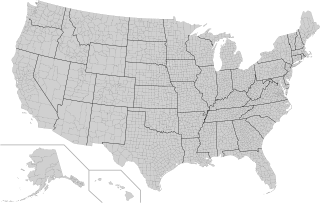
County (United States) Subdivision used by most states in the United States of America

In the United States, an administrative or political subdivision of a state is a county, which is a region having specific boundaries and usually some level of governmental authority. The term "county" is used in 48 U.S. states, while Louisiana and Alaska have functionally equivalent subdivisions called parishes and boroughs respectively.

Federal government of the United States national government of the United States

The Federal Government of the United States is the national government of the United States, a federal republic in North America, composed of 50 states, a federal district, five major self-governing territories, and several island possessions. The federal government is composed of three distinct branches: legislative, executive, and judicial, whose powers are vested by the U.S. Constitution in the Congress, the President, and the federal courts, respectively. The powers and duties of these branches are further defined by acts of congress, including the creation of executive departments and courts inferior to the Supreme Court.

A census-designated place (CDP) is a concentration of population defined by the United States Census Bureau for statistical purposes only. CDPs have been used in each decennial census since 1980 as the counterparts of incorporated places, such as self-governing cities, towns, and villages, for the purposes of gathering and correlating statistical data. CDPs are populated areas that generally include one officially designated but currently unincorporated small community, for which the CDP is named, plus surrounding inhabited countryside of varying dimensions and, occasionally, other, smaller unincorporated communities as well. CDPs include small rural communities, colonias located along the U.S. border with Mexico, and unincorporated resort and retirement communities and their environs.

Geographic Names Information System geographical database

The Geographic Names Information System (GNIS) is a database that contains name and locative information about more than two million physical and cultural features located throughout the United States of America and its territories. It is a type of gazetteer. GNIS was developed by the United States Geological Survey in cooperation with the United States Board on Geographic Names (BGN) to promote the standardization of feature names.

Combined statistical area (CSA) is a United States Office of Management and Budget (OMB) term for a combination of adjacent metropolitan (MSA) and micropolitan statistical areas (µSA) in the United States and Puerto Rico that can demonstrate economic or social linkage. The OMB defines a CSA as consisting of various combinations of adjacent metropolitan and micropolitan areas with economic ties measured by commuting patterns. These areas that combine retain their own designations as metropolitan or micropolitan statistical areas within the larger combined statistical area.

United States Navy Naval warfare branch of the United States Armed Forces

The United States Navy (USN) is the naval warfare service branch of the United States Armed Forces and one of the seven uniformed services of the United States. It is the largest and most capable navy in the world, with the highest combined battle fleet tonnage and the world's largest aircraft carrier fleet, with eleven in service, and two new carriers under construction. With 319,421 personnel on active duty and 99,616 in the Ready Reserve, the Navy is the third largest of the service branches. It has 282 deployable combat vessels and more than 3,700 operational aircraft as of March 2018, making it the second largest and second most powerful air force in the world.

References