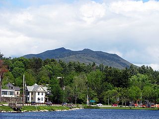
Long Lake is a town in Hamilton County, New York, United States. The population was 791 at the 2020 census.
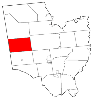
Providence is a town in Saratoga County, New York, United States. The Town of Providence is on the county's western border and is northwest of Saratoga Springs. More than half the town is located within the Adirondack Park, the town also borders the Great Sacandaga Lake.

Clifton is a town in St. Lawrence County, New York, United States. The population was 675 at the 2020 census. The town takes its name from a mining company.

The Adirondack Park is a park in northeastern New York protecting the Adirondack Mountains. The park was established in 1892 for "the free use of all the people for their health and pleasure", and for watershed protection. At 6.1 million acres, it is the largest park in the contiguous United States.

The Champlain Valley is a region of the United States around Lake Champlain in Vermont and New York extending north slightly into Quebec, Canada. It is part of the St. Lawrence River drainage basin, drained northward by the Richelieu River into the St. Lawrence at Sorel-Tracy, Quebec. The Richelieu valley is not generally referred to as part of the Champlain Valley.

The Great Sacandaga Lake is a large lake situated in the Adirondack Park in northern New York in the United States. The lake has a surface area of about 41.7 square miles (108 km2) at capacity, and the length is about 29 miles (47 km). The word Sacandaga means "Land of the Waving Grass" in the native Mohawk language. The lake is located in the northern parts of Fulton County and Saratoga County near the southern border of the Adirondack Park. A small portion also extends northward into southern Hamilton County. The broader, south end of the lake is northeast of the City of Johnstown and the City of Gloversville. Great Sacandaga Lake is a reservoir created by damming the Sacandaga River. The primary purpose for the creation of the reservoir was to control flooding on the Hudson River and the Sacandaga River, floods which had a historically significant impact on the surrounding communities.
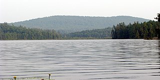
Cranberry Lake is on the east branch of the Oswegatchie River in the Adirondack Park in New York in the United States. It is the third largest lake in the Adirondack Park. About 75 percent of the shoreline is owned by the State of New York. The 118,000-acre (480 km2) Five Ponds Wilderness Area abuts its south shore, and the Cranberry Lake Wild Forest covers much of its remaining shoreline.

Big Moose Lake, at the head of the Moose River, is a large lake about five miles (8 km) north of Fourth Lake in the Adirondacks in upstate New York. The lake is within both Herkimer and Hamilton counties, and covers portions of the towns of Webb and Long Lake. Located southwest of the lake is the hamlet of Big Moose.
Lake Pleasant is located in the Adirondack Park in New York in the United States. The lake is in the town of Lake Pleasant in Hamilton County.
The North Country is the northernmost region of the U.S. state of New York, bordered by Lake Champlain to the east, the Adirondack Mountains and the Upper Capital District to the south, the Mohawk Valley region to the southwest, the Canadian border to the north, and Lake Ontario and the Saint Lawrence Seaway to the west. A mostly rural area, the North Country includes seven counties. Fort Drum, a U.S. Army base, is also located in the North Country, as is the Adirondack Park. As of 2024, the population of the region was 420,311.

Massawepie Lake is located in the town of Piercefield, in southern St. Lawrence County, New York, approximately 12 miles (19 km) southwest of the village of Tupper Lake, New York. The lake is also surrounded by the Massawepie Scout Camps. The name of the lake is of Iroquois origin, meaning "the beaver's lake". The outlet flows west into the South Branch Grass River.

The geography of New York (state) varies widely. Most of New York is dominated by farms, forests, rivers, mountains, and lakes. New York's Adirondack Park is larger than any U.S. National Park in the contiguous United States. Niagara Falls, on the Niagara River as it flows from Lake Erie to Lake Ontario, is a popular attraction. The Hudson River begins near Lake Tear of the Clouds and flows south through the eastern part of the state without draining lakes George or Champlain. Lake George empties at its north end into Lake Champlain, whose northern end extends into Canada, where it drains into the Richelieu River and then the St. Lawrence. Four of New York City's five boroughs are on the three islands at the mouth of the Hudson River: Manhattan Island, Staten Island, and Brooklyn and Queens on Long Island.
Lake Colby is a 272-acre (1.10 km2) lake, located on NY-86 just outside the village of Saranac Lake, in Franklin County, New York in the Adirondacks; its outlet feeds into Lower Saranac Lake. Lake Colby is also the name of a hamlet located just north of the lake on NY-86.
McKenzie Mountain is a 3,861-foot (1,177 m) mountain in western Essex County in the towns of St. Armand and North Elba in the Adirondack Park, a unit of the Forest Preserve.

Indian Lake is a 12-mile (19 km) long, 4,255-acre (1,722 ha) reservoir with a southwest to northeast orientation in the towns of Indian Lake and Lake Pleasant in Hamilton County, in the Adirondack Park of New York State, in the United States. The hamlet of Indian Lake is located 2 miles (3.2 km) north of the north end of Indian Lake. New York State Route 30 runs along the west shore of the lake. Most of the shore is part of the Forest Preserve. Indian Lake is fed by the Jessup River, and drains through the Indian River into Lake Abanakee, and from there through the Indian River to the Hudson River.

Greenwich is a town in the southwestern part of Washington County, New York, United States. The town is located on the western border of the county. The population was 4,868 at the 2020 census. It is part of the Glens Falls Metropolitan Statistical Area. Greenwich features several homes that were a part of the Underground Railroad.
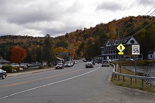
Owls Head Mountain is a 2,786-foot-tall (849 m) mountain in the Adirondack Mountains region of New York. It is located west-southwest of the hamlet of Long Lake in Hamilton County.

Silver Lake Mountain is a 2,372 ft mountain in the North-Eastern Adirondacks located near Au Sable Forks, New York. A trail starting from Silver Lake Road leads 0.9 miles up the mountain to the summit offering views of the surrounding lakes and mountains, including Whiteface Mountain.
Lizard Pond is located in the Adirondack Mountains southwest of Garnet Lake, New York. Fish species present in the lake are brook trout, and black bullhead. There is carry down trail access off Garnet Lake on the southeast shore.
Silver Lake is located near Perry, New York.


