Uvinza is one of the eight administrative districts of Kigoma Region in Tanzania. Uvinza is bordered to the northwest by Kigoma District and Kigoma-Ujiji District. North of the district is bordered by Kasulu District. Lake Tanganyika borders the district on the west. Mpanda District in Katavi Region boders the district to the south and Kaliua District in Tabora Region borders the district to the east. The district is named in honor of the Vinza people whom the western part of district was their historic kingdom. Southern Uvinza District is home to the Mahale Mountains National Park. A unique park that is home to both Chimpanzees and lions in the same habitat.

Kaliua District is one of the seven districts of the Tabora Region of Tanzania. It is bordered to the north by Kahama and Ushetu Districts, to the east by Uyui District and Urambo District, to the south by Katavi Region and to the west by Uvinza District and Geita Region. Its administrative seat is the town of Kaliua.
Kigoma District is one of the eight administrative districts of Kigoma Region in Tanzania. The district lies north of the city of Kigoma-Ujiji. Uvinza District, to the west and south of Ujiji, was split off from the Kigoma District in 1 July, 2013.

Bangwe is an administrative ward in Kigoma-Ujiji District of Kigoma Region in Tanzania. The ward covers an area of 10.2 km2 (3.9 sq mi), and has an average elevation of 770 m (2,530 ft). In 2016 the Tanzania National Bureau of Statistics report there were 17,009 people in the ward, from 15,453 in 2012.

Kibirizi is an administrative ward in Kigoma-Ujiji District of Kigoma Region in Tanzania. The ward covers an area of 12.5 km2 (4.8 sq mi), and has an average elevation of 826 m (2,710 ft). In 2016 the Tanzania National Bureau of Statistics report there were 27,675 people in the ward, from 25,143 in 2012.
Mganza is an administrative ward in Uvinza District of Kigoma Region in Tanzania. The ward covers an area of 1,090 km2 (420 sq mi), and has an average elevation of 1,103 m (3,619 ft). In 2016 the Tanzania National Bureau of Statistics report there were 27,323 people in the ward, from 24,823 in 2012.

Mtego wa Noti is an administrative ward in Uvinza District of Kigoma Region in Tanzania. The ward covers an area of 293 km2 (113 sq mi), and has an average elevation of 1,061 m (3,481 ft). In 2016 the Tanzania National Bureau of Statistics report there were 16,850 people in the ward, from 15,308 in 2012.
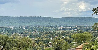
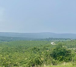
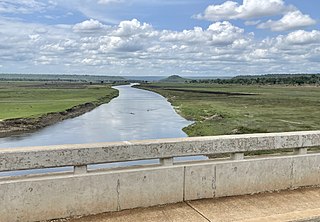
Uvinza is an administrative ward and town in Uvinza District of Kigoma Region in Tanzania. The town is the district capital of Uvinza District. The ward covers an area of 1,502 km2 (580 sq mi), and has an average elevation of 1,073 m (3,520 ft). The town is home to salt mining industry in Kigoma region. Uvinza town is situated between where the Ruchugi River and Malagarasi Rivers merge. In 2016 the Tanzania National Bureau of Statistics report there were 24,122 people in the ward, from 35,231 in 2012. Prior to 2014 the Basanza was a village in the Uvinza Ward before splitting off to form its own ward.
Buhingu is an administrative ward in Uvinza District of Kigoma Region in Tanzania. The ward covers an area of 1,673 km2 (646 sq mi), and has an average elevation of 901 m (2,956 ft). In 2016 the Tanzania National Bureau of Statistics report there were 18,682 people in the ward, from 16,973 in 2012.
Igalula is an administrative ward in Uvinza District of Kigoma Region in Tanzania. The ward covers an area of 1,228 km2 (474 sq mi), and has an average elevation of 1,089 m (3,573 ft). In 2016 the Tanzania National Bureau of Statistics report there were 26,272 people in the ward, from 23,868 in 2012.
Ilagala is an administrative ward in Uvinza District of Kigoma Region in Tanzania. The ward covers an area of 570 km2 (220 sq mi), and has an average elevation of 975 m (3,199 ft). In 2016 the Tanzania National Bureau of Statistics report there were 29,333 people in the ward, from 47,026 in 2012. Prior to 2014 the village of Mwakizega was in the Igalula Ward before splitting off to become the Mwakizega Ward.
Itebula is an administrative ward in Uvinza District of Kigoma Region in Tanzania. The ward covers an area of 459 km2 (177 sq mi), and has an average elevation of 1,083 m (3,553 ft). In 2016 the Tanzania National Bureau of Statistics report there were 27,305 people in the ward, from 24,807 in 2012.
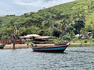
Kalya is an administrative ward in Uvinza District of Kigoma Region in Tanzania. The ward covers an area of 534.5 km2 (206.4 sq mi), and has an average elevation of 822 m (2,697 ft). In 2016 the Tanzania National Bureau of Statistics report there were 24,751 people in the ward, from 22,486 in 2012.
Kandaga is an administrative ward in Uvinza District of Kigoma Region in Tanzania. The ward covers an area of 168.7 km2 (65.1 sq mi), and has an average elevation of 954 m (3,130 ft). In 2016 the Tanzania National Bureau of Statistics report there were 26,083 people in the ward, from 23,696 in 2012.
Kazuramimba is an administrative ward in Uvinza District of Kigoma Region in Tanzania. The ward covers an area of 670.6 km2 (258.9 sq mi), and has an average elevation of 1,030 m (3,380 ft). In 2016 the Tanzania National Bureau of Statistics report there were 37,551 people in the ward, from 34,115 in 2012.
Nguruka is an administrative ward in Uvinza District of Kigoma Region in Tanzania. The ward covers an area of 138 km2 (53 sq mi), and has an average elevation of 1,062 m (3,484 ft). In 2016 the Tanzania National Bureau of Statistics report there were 29,916 people in the ward, from 27,179 in 2012.
Sigunga is an administrative ward in Uvinza District of Kigoma Region in Tanzania. The ward covers an area of 770.7 km2 (297.6 sq mi), and has an average elevation of 1,156 m (3,793 ft). In 2016 the Tanzania National Bureau of Statistics report there were 12,335 people in the ward, from 20,455 in 2012. Prior to 2014 the Herembe village was a part of Siguna Ward before it split off to form the Herembe Ward.
Sunuka is an administrative ward in Uvinza District of Kigoma Region in Tanzania. The ward covers an area of 799 km2 (308 sq mi), and has an average elevation of 930 m (3,050 ft). In 2016 the Tanzania National Bureau of Statistics report there were 39,651 people in the ward, from 36,023 in 2012.
Bitale is an administrative ward in Kigoma District of Kigoma Region in Tanzania. The ward covers an area of 48.2 km2 (18.6 sq mi), and has an average elevation of 1,035 m (3,396 ft). In 2016 the Tanzania National Bureau of Statistics report there were 22,482 people in the ward, from 20,425 in 2012.
Mwandiga is an administrative ward in Kigoma District of Kigoma Region in Tanzania. The ward covers an area of 40.5 km2 (15.6 sq mi), and has an average elevation of 860 m (2,820 ft). In 2016 the Tanzania National Bureau of Statistics report there were 20,810 people in the ward, from 18,906 in 2012.