The Iranian Plateau or Persian Plateau is a geological feature spanning parts of the Caucasus, Central Asia, South Asia, and West Asia. It makes up part of the Eurasian Plate, and is wedged between the Arabian Plate and the Indian Plate. The plateau is situated between the Zagros Mountains to the west, the Caspian Sea and the Köpet Dag to the north, the Armenian Highlands and the Caucasus Mountains to the northwest, the Strait of Hormuz and the Persian Gulf to the south, and the Indian subcontinent to the east.

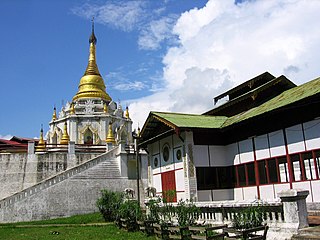
Bhamo is a city in Kachin State in northern Myanmar, 186 km (116 mi) south of the state capital, (Myitkyina). It is on the Ayeyarwady River. It lies within 65 km (40 mi) of the border with Yunnan Province, China. The population consists of Chinese and Shan, with Kachin peoples in the hills around the town. It is the administrative center of Bhamo District and Bhamo Township.

Afon Seiont is a river in Gwynedd, Wales which runs into the Menai Strait.
Gucha District was a former district in Nyanza Province, western Kenya. It was also known as South Kisii District or Ogembo District. In 1999, its population was approximately 461,000 people. Its district headquarters were at Ogembo which houses more than a thousand residents,, with more than one thousand people more that visit it each day.
Bishop River Provincial Park is a provincial park in the Pacific Ranges of the Coast Mountains on the Mainland of British Columbia, Canada, located southwest of and adjoining Ts'yl-os Provincial Park."Bishop River Park". BC Geographical Names. It lies along the upper course of the Bishop River, the main tributary of the Southgate River, from the Bishop's source at the western side of the Lillooet Icecap to midway along its course above its confluence with the Southgate. The park is 19,947 ha. in size. There are no roads or trails in the park although a forest service road from Waddington Harbour at the head of Bute Inlet leads up the Southgate to within a few miles of the park boundary.
Stuart River Provincial Park is a provincial park in British Columbia, Canada. It is located in two sections north and northwest of Vanderhoof along the Stuart River southeast of Stuart Lake and the city of Fort St. James. The upper section is located at 54°13′20″N124°00′00″W and comprises c.7391 ha. while the lower, eastern section is centred at 54°03′00″N123°37′00″W and comprises c.3390 ha. and is within the Greater Prince George area. The upper site, which is located around the confluence of the Stuart and Nechako Rivers, includes the site of Chinlac, a Dakelh village whose inhabitants were massacred and enslaved by the Tsilhqot'in of Anahim Lake c. 1745.

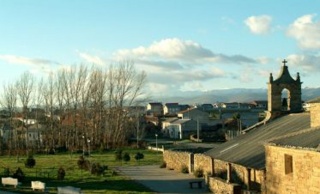
Peque is a village and municipality in the province of Zamora, part of the autonomous community of Castile and León, Spain. It has a population of approximately 124 inhabitants as of the 2023 Continuous Register.

Petrovany is a village and municipality in Prešov District in the Prešov Region of eastern Slovakia.

Mäetaguse Parish was an Estonian municipality located in Ida-Viru County. It had a population of 1,556 (2005) and an area of 285 km2 (110 mi2).

Chenderiang is a mukim and a Chinese village in Batang Padang District, Perak, Malaysia. The “Chenderiang” name was origin from Cantik and 靓 (liang) which both mean beautiful in Malay and Chinese.
Dĩnh Trì is a commune (xã) and village of Bắc Giang city, Bắc Giang Province in the Northeast region of Vietnam.
Karunga is a village in Rakvere Parish, Lääne-Viru County, in northeastern Estonia.
Assamalla is a village in Tapa Parish, Lääne-Viru County, in northeastern Estonia.
Koplitaguse is a village in Tapa Parish, Lääne-Viru County, in northeastern Estonia.
Mäetaguse is a village in Vinni Parish, Lääne-Viru County, in northeastern Estonia.

Latković is a village situated in Ljig municipality in Serbia.
Pú Hồng is a commune (xã) and village of the Điện Biên Đông District of Điện Biên Province, northwestern Vietnam. The commune covers an area of 126.5 km2 (48.8 sq mi) and has a reported population of 3442.
Bıçakçı Bridge is a historic deck arch bridge in Karaman Province, southwestern Turkey. It is on the road Bucakkışla - Ermenek, and spans over the Göksu River at 36°56′52″N39°22′23″E.
The Anglican Diocese of Oji River is one of 12 within the Anglican Province of Enugu, itself one of 14 provinces within the Church of Nigeria.
This page is based on this
Wikipedia article Text is available under the
CC BY-SA 4.0 license; additional terms may apply.
Images, videos and audio are available under their respective licenses.


