Related Research Articles

Jessamine County is a county located in the U.S. state of Kentucky. As of the 2020 census, the population was 52,991. Its county seat is Nicholasville. The county was founded in December 1798. Jessamine County is part of the Lexington-Fayette, KY Metropolitan Statistical Area. It is within the Inner Blue Grass region, long a center of farming and blooded stock raising, including thoroughbred horses. The legislature established a commercial wine industry here in the late 18th century.
The Dix River is a 79.3-mile-long (127.6 km) tributary of the Kentucky River in central Kentucky in the United States. It begins in western Rockcastle County, about 5 miles (8 km) west of Mount Vernon. It flows generally northwest, in a tight meandering course, passing north of Stanford and east of Danville. Northeast of Danville it is impounded by the Dix Dam to form the Herrington Lake reservoir. The river flows about 2 miles (3 km) before joining the Kentucky River near High Bridge, about 20 miles (32 km) southwest of Lexington, in the region of the Kentucky River Palisades.
Cedar Creek, located in Lincoln County in south-central Kentucky, USA, is an 8-mile-long (13 km) tributary to the Dix River. Via the Dix, Kentucky and Ohio rivers, it is part of the Mississippi River watershed. In 2002, a section of Cedar Creek was impounded to form Cedar Creek Lake.
Silver Creek is a large creek that flows for approximately 40 miles (64 km) through Madison County, Kentucky, in the United States.
WLTO is a commercial radio station licensed to Nicholasville, Kentucky and serving the Lexington radio market. It is owned by Cumulus Media and broadcasts a top 40 radio format. The radio studios and offices are inside Kincaid Towers in downtown Lexington, and its transmitter is just south of the Fayette/Jessamine county line on Brannon Road.
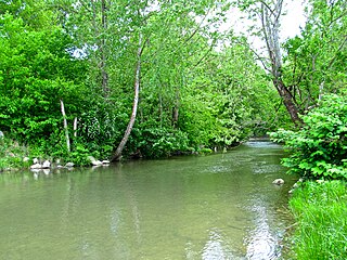
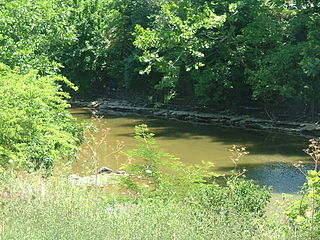
Sinking Creek may refer to:
East Jessamine High School is a public high school in Nicholasville, Kentucky, United States. It was opened in 1997 by Jessamine County. Prior to this, the school was divided into two separate institutions: East Jessamine High School and West Jessamine High School. It is the fastest growing high school in Jessamine County.
Hickman Creek is approximately 22 square mile tributary of the Kentucky River. Before flowing into the Kentucky River, Hickman Creek is formed from two separate creeks, East Hickman and West Hickman. West Hickman Creek flows through Fayette County, Kentucky and Jessamine County, Kentucky. Via the Kentucky and Ohio rivers, it is part of the Mississippi River watershed. Hickman Creek flows through 3 parks in Kentucky, Jacobson Park, Veterans Park and Belleau Woods Park.

The Valley View Ferry provides passage over the Kentucky River in rural central Kentucky. Located on Kentucky Route 169, this ferry service connects auto traffic between the county seats of Richmond in Madison County, Nicholasville in Jessamine County and Lexington Kentucky. The route leads you directly to downtown Richmond, Lexington and Nicholasville.
McDaniels is an unincorporated community in Breckinridge County, Kentucky, United States. McDaniels is located along Kentucky Route 259, 15.5 miles (24.9 km) due south of Hardinsburg. McDaniels is situated on Rough River Lake, which collects the 29.5-mile-long (47.5 km) North Fork Rough River, which flows for its entire length in Breckinridge County. McDaniels has a post office with ZIP code 40152.

Tom Dorman State Nature Preserve is located in both Garrard and Jessamine county Kentucky and protects a section of the Kentucky River Palisades. The preserve is owned by the Office of Kentucky Nature Preserves, and encompasses 880 acres (3.6 km2) of cliffs, bluffs, and bottomland. In 2007, the Kentucky State Parks announced the purchase of 90 acres adjacent to Tom Dorman State Nature Preserve for the creation of the new Palisades State Park, but that property was subsequently incorporated into the State Nature Preserve.
Brannon Woods is an unincorporated community in Jessamine County, Kentucky, United States.
Firebrook is a neighborhood in southwestern Lexington, Kentucky, United States. Its boundaries are Harrodsburg Road to the east, Military Pike to the north, Keene Road to the west, and the Jessamine County line to the south.
Dogwood Trace is a neighborhood in southwestern Lexington, Kentucky, United States. Its boundaries are South Elkhorn Creek to the north and east, Harrodsburg Road to the west, and the Jessamine County line to the south.
Drowning Creek is a stream located in Estill County, Kentucky, United States. It is a tributary of the Kentucky River.
Horse Creek is a creek a tributary of Goose Creek river in Clay County, Kentucky. It is 1.5 miles (2.4 km) upstream of Manchester on Goose at an altitude of 800 feet (240 m).
Dreaming Creek is a stream in Madison County, Kentucky, in the United States.
Sinking Creek is a stream in Breckinridge County, Kentucky, in the United States. It is a tributary of the Ohio River.
Roundstone Creek is a stream located entirely within Rockcastle County, Kentucky.
References
- ↑ U.S. Geological Survey Geographic Names Information System: Sinking Creek (Jessamine County, Kentucky)
- ↑ Collins, Lewis (1877). History of Kentucky. p. 396.
37°59′14″N84°38′49″W / 37.9872996°N 84.6468877°W
| Authority control databases: National |
|---|
| | This Jessamine County, Kentucky state location article is a stub. You can help Wikipedia by expanding it. |