Related Research Articles

The Ganges is a trans-boundary river of Asia which flows through India and Bangladesh. The 2,525 km (1,569 mi) river rises in the western Himalayas in the Indian state of Uttarakhand. It flows south and east through the Gangetic plain of North India, receiving the right-bank tributary, the Yamuna, which also rises in the western Indian Himalayas, and several left-bank tributaries from Nepal that account for the bulk of its flow. In West Bengal state, India, a feeder canal taking off from its right bank diverts 50% of its flow southwards, artificially connecting it to the Hooghly River. The Ganges continues into Bangladesh, its name changing to the Padma. It is then joined by the Jamuna, the lower stream of the Brahmaputra, and eventually the Meghna, forming the major estuary of the Ganges Delta, and emptying into the Bay of Bengal. The Ganges–Brahmaputra–Meghna system is the second-largest river on earth by discharge.

Laguna de Bay, also known as Laguna Lake, is the largest lake in the Philippines. It is located southeast of Metro Manila, between the provinces of Laguna to the south and Rizal to the north. A freshwater lake, it has a surface area of 911–949 km², with an average depth of about 2.8 meters and an elevation of about one meter above sea level. The lake is shaped like a crow's foot, with two peninsulas jutting out from the northern shore and filling the large volcanic Laguna Caldera. In the middle of the lake is the large island of Talim.

Water pollution is the contamination of water bodies, usually as a result of human activities, so that it negatively affects its uses. Water bodies include lakes, rivers, oceans, aquifers, reservoirs and groundwater. Water pollution results when contaminants mix with these water bodies. Contaminants can come from one of four main sources: sewage discharges, industrial activities, agricultural activities, and urban runoff including stormwater. Water pollution is either surface water pollution or groundwater pollution. This form of pollution can lead to many problems, such as the degradation of aquatic ecosystems or spreading water-borne diseases when people use polluted water for drinking or irrigation. Another problem is that water pollution reduces the ecosystem services that the water resource would otherwise provide.

The Bagmati River flows through the Kathmandu valley of Nepal, separating the cities of Kathmandu from Patan, before flowing through Madesh Province of southern Nepal and joining the Kamla River in the Indian state of Bihar. It is considered holy by both Hindus and Buddhists. A number of Hindu temples are located on its banks.

Narayani was one of the fourteen zones of Nepal until the restructuring of zones to Provinces, located in the central south of the country. The headquarter of Narayani zone was Hetauda. Narayani Zone is named after the Narayani River which is on the western border of the zone, separating it from the Gandaki and Lumbini zones. Narayani means beloved of Narayan which is Parvati his sister, and Narayan refers to Lord Vishnu in the Hindu religion.

The Amaravati River is the longest tributary of the Kaveri River in the fertile districts of Udumalpet, Dharapuram and Karur Tamil Nadu state, South India.

The water resources of China are affected by both severe water shortages and severe growing population and rapid economic development as well as lax environmental oversight have increased in a large scale the water demand and pollution. China has responded by measures such as rapidly building out the water infrastructure and increasing regulation as well as exploring a number of further technological solutions.

The Still River is a 25.4-mile-long (40.9 km) tributary to the Housatonic River in western Connecticut.

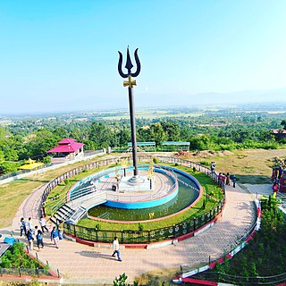
Birganj is a metropolitan city in Parsa District in Madhes Pradesh in southern Nepal. It lies 135 km (84 mi) south of the capital Kathmandu, attached in the north to Raxaul on the border of the Indian state of Bihar. As an entry point to Nepal from Patna, Birganj is known as the "Gateway of Nepal". It is also called the "Commercial Capital of Nepal". The town has significant economic importance for Nepal as most of the trade with India is via Birganj and the Indian town of Raxaul. The Tribhuvan Highway links Birgunj to Nepal's capital, Kathmandu.
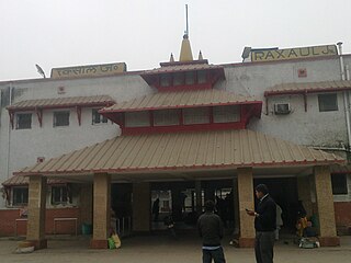
Raxaul is a sub-divisional town in the East Champaran district of the Indian state of Bihar. It is situated at the India-Nepal border with Birgunj city (Nepal). Raxaul is a major railway junction.

Pollution of the Ganges, the largest river in the Indian subcontinent, poses significant threats to human health and the larger environment. The river, which is severely polluted with human waste and industrial contaminants, provides water to about 40% of India's population across 11 states, serving an estimated population of 500 million people, which is more than any other river in the world.
The Citarum River is the longest and largest river in West Java, Indonesia. It is the third longest river in Java, after Bengawan Solo and Brantas. It plays an important role in the life of the people of West Java. It has been noted for being considered one of the most polluted rivers in the world.

The Bega or Begej, is a 244 km long river in Romania and Serbia. It rises in the Poiana Ruscă Mountains in Romania, part of the Carpathian Mountains, and it flows into the Tisa river near Titel, Vojvodina, Serbia. Its drainage basin covers an area of 4,458 km2 (1,721 sq mi), of which 2,362 km2 (912 sq mi) in Romania.

Sundarijal is a village and former Village Development Committee that is now part of Gokarneshwar Municipality in Kathmandu District in Province No. 3 of central Nepal.

Water pollution is a major environmental issue in India. The largest source of water pollution in India is untreated sewage. Other sources of pollution include agricultural runoff and unregulated small-scale industry. Most rivers, lakes and surface water in India are polluted due to industries, untreated sewage and solid wastes. Although the average annual precipitation in India is about 4000 billion cubic metres, only about 1122 billion cubic metres of water resources are available for utilization due to lack of infrastructure. Much of this water is unsafe, because pollution degrades water quality. Water pollution severely limits the amount of water available to Indian consumers, its industry and its agriculture.
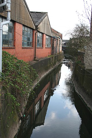
Fowlea Brook rises in Staffordshire and flows through the northern parts of Stoke-on-Trent, England. It is a tributary stream of the River Trent, and is 6 miles (9.7 km) long.
Gaindakot is a municipality in Nawalpur District in the Lumbini Zone of southern Nepal. It became a municipality in May 2014 by merging the existing Mukundapur, Amarapuri, and Gaindakot VDCs. It was again expanded by merging Ratanpur VDC. It is situated on the shore of Narayani River in the lap of Maula Kalika temple. So this place has a great possibility of tourism development. At the time of the 2011 Nepal census, it had a population of 58,841 and 13,623 individual households according to 2011 Nepal census. Contributed in the article by Prashant Subedi

Between 1947 and 1977, General Electric polluted the Hudson River by discharging polychlorinated biphenyls (PCBs) causing a range of harmful effects to wildlife and people who eat fish from the river. Other kinds of pollution, including mercury contamination and cities discharging untreated sewage, have also caused problems in the river.
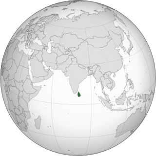
Environmental issues in Sri Lanka include large-scale logging of forests and degradation of mangroves, coral reefs and soil. Air pollution and water pollution are challenges for Sri Lanka since both cause negative health impacts. Overfishing and insufficient waste management, especially in rural areas, leads to environmental pollution. Sri Lanka is also vulnerable to climate change impacts such as extreme weather events and sea level rise.
References
- 1 2 diwakar (2021-03-19). "Sirsia, once the revered river of southern Nepal, is an exemplar of water pollution today - OnlineKhabar English News" . Retrieved 2022-07-31.
- ↑ Shah BP, Pant BR. Water quality assessment of sirsiya river. Nepal Journal of Science and Technology. 2012;13(2):141-6.
- ↑ Lal Kalu, Indra; Nidhi Paudyal, Guna; Das Gupta, Ashim (1995-12-01). "Equity and efficiency issues in irrigation water distribution". Agricultural Water Management. 28 (4): 335–348. doi:10.1016/0378-3774(95)01161-7. ISSN 0378-3774 . Retrieved 2022-07-31.