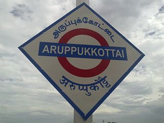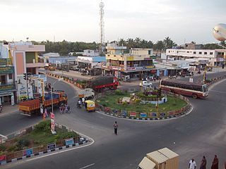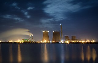
Aruppukottai is a town and a municipality in Virudhunagar district in the state of Tamil Nadu, India. Aruppukottai's classical name is "sengattu Aravakotai". Aruppukottai is about 50 km from Madurai. It is in the middle of Madurai-Tuticorin National Highways NH-45B.The small villages and towns surrounding Aruppukottai are famous for production of jasmine.Aruppukottai is always famous for producing Yarn, aruppukottai sri ramalinga mills, it was the second biggest spinning mill in Asia. Sri Ramana Maharishi was born in Tiruchuli near Aruppukottai town. Aruppukottai was part of king Sethupathi of Ramnad.King Sethupathi has Zamin Palace in Palyampatti. Aruppukottai is well known for its high quality educational institutions. As of 2011, the town had a population of 87,722. After Madurai it is the only near by city to have well built and maintained theaters. The town also hosts two famous temples - Arulmigu Amuthalingeshwarar Temple and Arulmigu Meenakshi Chokkanatha Swamy Temple on Thiruchuzhi Road.

Thoothukudi District, also known as Tuticorin District is a district in Tamil Nadu state in southern India. The district was formed by dividing Tirunelveli district in 1986 and Thoothukudi is the district headquarters. The district is known for pearl cultivation, with an abundance of pearls being found in the seas offshore. It was formerly ruled by one of the oldest kingdoms in India, the Pandyan Dynasty with the port of Korkai through which trade with Rome happened. The archaeological site at Adichanallur holds the remains of the ancient Tamil civilisation. As of 2011, the district had a population of 1,750,176 with a sex-ratio of 1,023 females for every 1,000 males.

Dharapuram is a town in Tirupur district in the Indian state of Tamil Nadu. Dharapuram is one of the oldest towns in Tamil Nadu and was the capital of Kongu Nadu under the Cheras, Western Ganga Dynasty and later Kongu Cholas, at which time it was known as Vanchipuri. Amaravathi River flows through the town. As of 2011, the town had a population of 67,007.Dharapuram Municipality is promoted 1st grade municipality on May 6, 1983. Dharapuram Town is situated along the bank of River Amaravathi, located in between 10 degree 45 minutes northern latitude and 77 degree 31 minutes eastern latitude with an extent of 7.02 km2. It is a small agricultural marketing centre for a large rural hinterland in the Tirupur District. The town is at a distance of 47 km towards of the District Headquarters Tirupur,75 km towards the Erode and at a distance of 75 km towards the industrial town Coimbatore.

Ettimadai is a suburb of Coimbatore in the state of Tamilnadu, India. Ettimadai is located between Palakkad city and Coimbatore on the NH47 near Tamil Nadu - Kerala border area. Ettimadai is one of the fast-growing south-western suburbs. It comes under the Coimbatore Corporation. The Amrita Vishwa Vidyapeetham University, along with its schools are situated here. There are other colleges such as Venkateshwara College of Business and Computer Applications, Nehru group of institution

V. Pudur is a panchayat town in Thoothukudi district in the Indian state of Tamil Nadu.

Eriyodu is a panchayat town is Located in Madurai Region in the state of Tamil Nadu, India. Eriyodu is in the administrative district of Dindigul. Eriyodu is located in Dindigul next to Karur State Highway road.

Ayyam Pudhur village, Nagadevam Palayam post, is a small village of less than 150 inhabitants, situated in the Gobi taluk, Erode district in Tamil Nadu.
It is located approximately 10 km (6 mi) from Gobichettipalayam. The nearest big village is Vellan Kovil.

Kuravan Palayam village, Nagadevam Palayam post, also known as Velliankattu Pudur, is a small village of less than 150 inhabitants, situated in the Gobi taluk, Erode district in Tamil Nadu, India. It has one Government Library. The nearest village is Ayyam Pudhur. It is situated near to Gobichettipalayam at about 10 km. Agriculture is the primary occupation, with coconuts, rice, Turmeric and sugarcane being the main crops grown.
Sivapuripatti is a small village located in Sivagangai District of Tamil Nadu, India. This place is blessed with a bright natural scenery. The nearest town to this village is Singampunari. It is located at a distance of 60 km from the city of Madurai in South India. Coconut rope production is one of main occupation here. STD code of this location is 4577.

Anna University Chennai - Regional Office, Tirunelveli Erstwhile Anna University of Technology Tirunelveli was established on 17 September 2007 from the splitting of Anna University into six universities, namely, Anna University, Chennai, Anna University, Chennai - Taramani Campus, Anna University Chennai - Regional Office, Tiruchirappalli, Anna University Chennai - Regional Office, Coimbatore, Anna University Chennai - Regional Office, Tirunelveli and Anna University Chennai - Regional Office, Madurai. Anna University Tirunelveli is bestowed with powers to grant affiliations to colleges and universities conducting graduate and post graduate courses related to engineering, technology and management.
Tirunelveli City being the district headquarters of Tirunelveli District in the Indian state of Tamil Nadu. It has a very extensive transport network. Tirunelveli is a vital tourist destination with lot of religious places, monuments and hill stations. Tirunelveli is also a major junction for transportation around Tirunelveli, Thoothukudi and Kanyakumari Districts.

Theriruveli is a village in the Ramanathapuram district of Tamil Nadu state in southern India. It is located near Pudukottai and belongs to the Mudukulathur Legislative Constituency. The economy is largely based on agriculture and sheep raising, and remittances from residents who have travelled abroad.
Thirukkattuthurai is a small village located in Karur District in the Indian state of Tamil Nadu. It is the first of the three wards of the Thirukkattuthurai village Panchayat. The village is situated on the bank of the river Cauvery. The village Co-operative water pumping station is the first of its kind in Tamil Nadu planned by O.K.Ramaswamy Gounder and inaugurated by K.Kamarajar, Chief Minister of Tamil Nadu in that period. It is about 4.5 km from TNPL Pugalur. The adjacent towns and villages are Aalamarathumeydu, Karapalayam, Nadayanur, Velayuthampalayam, Kattipalayam and Thavittupalayam. The adjacent town Velayuthampalayam have the hill named Pugali Malai/Arunattan Malai, which houses Lord Murugan.
Pugalur is an area in Tamil Nadu in southern India divided into two parts, Nanjai and Punjai. Nanjai refers to land with plenty of water usually with water bodies like rivers, canals, ponds etc. and Punjai refers to land with fewer water bodies and with facilities such as bore wells. Pugalur in the nanjai area is known as Nanjai Pugalur and Pugalur in the punjai area is known as Punjai Pugalur.

Alampattu is a village in the state of Tamil Nadu, Sivaganga District, India. It is 20 km from the town Karaikudi.

Madurai has well-developed transport facilities. Modes of transport in Madurai include road, rail and air. Madurai faces increasing daily traffic problems, so master plans have been prepared to reduce the city traffic and traffic problems in suburbs.

Vembar is a village panchayat in Thoothukudi district in the Indian state of Tamil Nadu.
Vembar is a village situated along the East Coast road at the north end of Tuticorin district. It has two Panchayets - Vembar and Vembar South.

Melaseithalai is a village in Ottapidaram taluk of Thoothukudi District, Tamil Nadu, India. The village comes under Vilathikulam and Thoothukudi.


