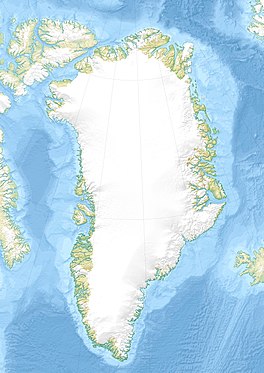
Greenland is located between the Arctic Ocean and the North Atlantic Ocean, northeast of Canada and northwest of Iceland. The territory comprises the island of Greenland—the largest island in the world—and more than a hundred other smaller islands. Greenland has a 1.2-kilometer-long (0.75 mi) border with Canada on Hans Island. A sparse population is confined to small settlements along certain sectors of the coast. Greenland possesses the world's second-largest ice sheet.

Jakobshavn Glacier, also known as Ilulissat Glacier, is a large outlet glacier in West Greenland. It is located near the Greenlandic town of Ilulissat and ends at the sea in the Ilulissat Icefjord.

King Frederik VIII Land is a major geographic division of northeastern Greenland. It extends above the Arctic Circle from 76°N to 81°N in a North-South direction along the coast of the Greenland Sea.

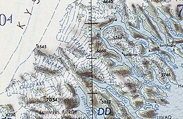
Garm is a glacier of the King Frederick VI Coast in the Sermersooq municipality, southeastern Greenland.
Kattertooq, meaning 'where there is much blue ice' in the Greenlandic language,) is a fjord of the King Frederick VI Coast in the Sermersooq municipality, southeastern Greenland.

Romer Lake is a land-locked freshwater fjord at the northern end of King Frederick VIII Land, near Greenland's northeastern coast. The Danish military base/weather station Nord —the only inhabited place in the area— lies 50 km (31 mi) to the northeast. The lake and its surroundings are part of the Northeast Greenland National Park zone.
Petermann Peak,, also known as Petermann Fjeld, Petermanns Topp and Petermann Point is a mountain in King Christian X Land, Northeast Greenland. Administratively it is part of the Northeast Greenland National Park zone.

The Princess Caroline-Mathilde Alps are a mountain range system in the Holm Land Peninsula, King Frederick VIII Land, northeastern Greenland. Administratively this range is part of the Northeast Greenland National Park zone.

Queen Louise Land is a vast mountainous region located west of Dove Bay, King Frederik VIII Land, northeastern Greenland. Administratively it is part of the Northeast Greenland National Park zone.
Henson Glacier, is one of the major glaciers in northern Greenland.

Steensby Glacier is a major glacier in northern Greenland.
C. H. Ostenfeld Glacier, is one of the major glaciers in northern Greenland.
Nordkrone is a mountainous area in Peary Land, Northern Greenland. Administratively it is part of the Northeast Greenland National Park.

The Roosevelt Range or Roosevelt Mountains is a mountain range in Northern Greenland. Administratively this range is part of the Northeast Greenland National Park. Its highest peak is the highest point in Peary Land.
Steenstrup Glacier, is a glacier in NW Greenland. Administratively it belongs to the Avannaata municipality.
Rink Glacier, is a glacier in NW Greenland. Administratively it belongs to the Avannaata municipality.
Adolf Hoel Glacier, also known as Hoel Glacier(Hoels Gletscher), is one of the major glaciers in King Christian X Land, Northeast Greenland. Administratively it lies in the Northeast Greenland National Park zone.

Rimfaxe is a glacier of the King Frederick VI Coast in the Sermersooq municipality, southeastern Greenland.
Guldfaxe is a glacier of the King Frederick VI Coast area in the Sermersooq municipality, southeastern Greenland.