Skorba, Hajdina

Last updated
Skorba
Slovenia location map.svg
Red pog.svg
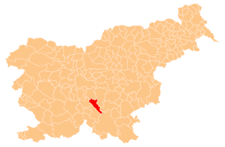
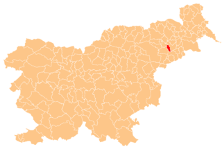
Skorba
Location in Slovenia
Coordinates: 46°25′10.73″N15°49′59.29″E / 46.4196472°N 15.8331361°E / 46.4196472; 15.8331361 Coordinates: 46°25′10.73″N15°49′59.29″E / 46.4196472°N 15.8331361°E / 46.4196472; 15.8331361
Country Flag of Slovenia.svg Slovenia
Traditional region Styria
Statistical region Drava
Municipality Hajdina
Area
  Total 2.46 km2 (0.95 sq mi)
Elevation 229.3 m (752.3 ft)
Population (2002)
  Total 372
[1]

Skorba (pronounced  [ˈskɔːɾba] ) is a village in the Municipality of Hajdina in northeastern Slovenia. The area is part of the traditional region of Styria. It is now included with the rest of the municipality in the Drava Statistical Region. [2]

Village Small clustered human settlement smaller than a town

A village is a clustered human settlement or community, larger than a hamlet but smaller than a town, with a population ranging from a few hundred to a few thousand. Though villages are often located in rural areas, the term urban village is also applied to certain urban neighborhoods. Villages are normally permanent, with fixed dwellings; however, transient villages can occur. Further, the dwellings of a village are fairly close to one another, not scattered broadly over the landscape, as a dispersed settlement.

Municipality of Hajdina Municipality in Slovenia

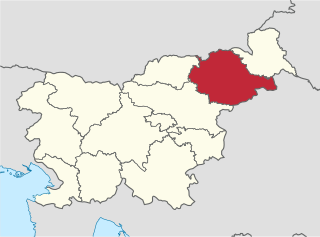
The Municipality of Hajdina is a small municipality on the right bank of the Drava River near Ptuj in northeastern Slovenia. Its administrative centre is the village of Zgornja Hajdina. Traditionally the area was part of the Styria region. The municipality is now included in the Drava Statistical Region. Sights include relics of the Roman settlement of Poetovio and the parish church of Saint Martin in Zgornja Hajdina.

Slovenia republic in Central Europe

Slovenia, officially the Republic of Slovenia, is a sovereign state located in southern Central Europe at a crossroads of important European cultural and trade routes. It is bordered by Italy to the west, Austria to the north, Hungary to the northeast, Croatia to the southeast, and the Adriatic Sea to the southwest. It covers 20,273 square kilometers (7,827 sq mi) and has a population of 2.07 million. One of the successor states of the former Yugoslavia, Slovenia is a parliamentary republic and a member of the United Nations, of the European Union, and of NATO. The capital and largest city is Ljubljana.

A number of archaeological finds close to the settlement, including a villa rustica , are associated with the nearby Roman town of Poetovio. [3]

Archaeological site Place in which evidence of past activity is preserved

An archaeological site is a place in which evidence of past activity is preserved, and which has been, or may be, investigated using the discipline of archaeology and represents a part of the archaeological record. Sites may range from those with few or no remains visible above ground, to buildings and other structures still in use.

Villa rustica Roman villa set in the open countryside, often as the hub of a large agricultural estate

Villa rustica was the term used by the ancient Romans to denote a villa set in the open countryside, often as the hub of a large agricultural estate (latifundium). The adjective rusticum was used to distinguish it from an urban or resort villa. The villa rustica would thus serve both as a residence of the landowner and his family and also as a farm management centre. It would often comprise separate buildings to accommodate farm labourers and sheds and barns for animals and crops. In modern British archaeology, a villa rustica is commonly referred to simply as a "Roman villa".

Ancient Rome History of Rome from the 8th-century BC to the 5th-century

In historiography, ancient Rome is Roman civilization from the founding of the city of Rome in the 8th century BC to the collapse of the Western Roman Empire in the 5th century AD, encompassing the Roman Kingdom, Roman Republic and Roman Empire until the fall of the western empire. The civilization began as an Italic settlement in the Italian peninsula, dating from the 8th century BC, that grew into the city of Rome and which subsequently gave its name to the empire over which it ruled and to the widespread civilisation the empire developed. The Roman empire expanded to become one of the largest empires in the ancient world, though still ruled from the city, with an estimated 50 to 90 million inhabitants and covering 5.0 million square kilometres at its height in AD 117.

Related Research Articles

Municipality of Dobrepolje Municipality in Slovenia

The Municipality of Dobrepolje is a municipality in Slovenia. It lies in a karst valley approximately 35 km (21.75 mi) south of the Slovenian capital Ljubljana. The administrative centre of the municipality is in Videm. The area was part of the traditional region of Lower Carniola. The municipality is now included in the Central Slovenia Statistical Region.

Drava Statistical Region Statistical region in 41

The Drava Statistical Region is a statistical region in Slovenia. The largest town in the region is Maribor. Its name comes from the Drava River and includes land on both banks along its course through Slovenia as well as the Pohorje mountains in the northeast of the region. The Drava is used for the production of hydroelectricity and the fertile land around it is used for agriculture. The share of job vacancies in all available jobs is among the highest in Slovenia and the region has a positive net migration rate but a very high natural decrease, which means an overall decrease in the population.

Ravno Brdo in Lower Carniola, Slovenia

Ravno Brdo is a dispersed settlement in the hills east of Ljubljana in Slovenia. It belongs to the City Municipality of Ljubljana. It was part of the traditional region of Lower Carniola and is now included with the rest of the municipality in the Central Slovenia Statistical Region.

Kungota pri Ptuju in Styria, Slovenia

Kungota pri Ptuju is a village in the Municipality of Kidričevo in northeastern Slovenia. The area is part of the traditional region of Styria. It is now included with the rest of the municipality in the Drava Statistical Region.

Zgornja Hajdina in Styria, Slovenia

Zgornja Hajdina is a settlement and the administrative centre of the Municipality of Hajdina in northeastern Slovenia. The area is part of the traditional region of Styria. It is now included with the rest of the municipality in the Drava Statistical Region.

Gerečja Vas in Styria, Slovenia

Gerečja Vas is a village in the Municipality of Hajdina in northeastern Slovenia. The area is part of the traditional region of Styria. It is now included with the rest of the municipality into the Drava Statistical Region.

Hajdoše in Styria, Slovenia

Hajdoše is a settlement on the right bank of the Drava River in the Municipality of Hajdina in northeastern Slovenia. It lies along the regional road from Maribor to Ptuj. The area is part of the traditional region of Styria. It is now included with the rest of the municipality in the Drava Statistical Region.

Slovenja Vas in Styria, Slovenia

Slovenja Vas is a settlement on the right bank of the Drava River in the Municipality of Hajdina in northeastern Slovenia. The area is part of the traditional region of Styria. It is now included with the rest of the municipality in the Drava Statistical Region.

Spodnja Hajdina in Styria, Slovenia

Spodnja Hajdina is a settlement in the Municipality of Hajdina in northeastern Slovenia. The area is part of the traditional region of Styria. It is now included with the rest of the municipality in the Drava Statistical Region.

Municipality of Litija Municipality in Slovenia

The Municipality of Litija is a municipality in central Slovenia. The seat of the municipality is the town of Litija. Traditionally the area was part of the Upper and Lower Carniola regions. The entire municipality is now included in the Central Sava Statistical Region; until January 2014 it was part of the Central Slovenia Statistical Region. The population of the municipality is a bit below 15,000.

Municipality of Ig Municipality in Slovenia

The Municipality of Ig is a municipality in central Slovenia. Its seat is the settlement of Ig. It was formed in 1995 from parts of the Municipality of Vič–Rudnik, until then one of the five municipalities that formed the Civic Assembly of Municipalities of Ljubljana. It is part of the traditional region of Inner Carniola and is now included in the Central Slovenia Statistical Region. In the past the area was mostly marshland, but now Ig is a suburban and industrialized municipality. In 2002, it had 5445 inhabitants.

Municipality of Semič Municipality in Slovenia

The Municipality of Semič is a municipality in Slovenia in the traditional region of White Carniola in southeastern Slovenia. The municipality is included in the Southeast Slovenia Statistical Region. Its seat is the settlement Semič.

Municipality of Črnomelj Municipality in Slovenia

The Municipality of Črnomelj is a municipality in southeastern Slovenia. The seat of the municipality is the town of Črnomelj. The municipality is at the heart of the area of White Carniola, the southeastern part of the traditional region of Lower Carniola. It is now included in the Southeast Slovenia Statistical Region.

Municipality of Apače Municipality in Slovenia

The Municipality of Apače is a municipality in Slovenia. It lies in the traditional region of Styria in northeastern Slovenia and belongs to the Mura Statistical Region. The municipality borders on the municipalities of Šentilj, Sveta Ana, and Gornja Radgona. The Mura River is the border between Slovenia and Austria. The seat of the municipality is the town of Apače. The municipality was established in 2006 and split from the Municipality of Gornja Radgona on 1 January 2007.

Municipality of Šentjur Municipality in Slovenia

The Municipality of Šentjur, named Municipality of Šentjur pri Celju until 2002, is a municipality in eastern Slovenia. The town of Šentjur is the seat of the municipality. With an area of 223 km2 it is one of the larger municipalities in Slovenia. The area was part of the traditional region of Styria. The municipality is now included in the Savinja Statistical Region. Saint George appears on the municipal coat of arms.

Municipality of Šmarješke Toplice Municipality in Slovenia

The Municipality of Šmarješke Toplice is a municipality in the traditional region of Lower Carniola in southeastern Slovenia. The seat of the municipality is the town of Šmarješke Toplice. The municipality is now included in the Southeast Slovenia Statistical Region.

Municipality of Škocjan Municipality in Slovenia

The Municipality of Škocjan, established in October 1994, is a municipality in the traditional region of Lower Carniola in southeastern Slovenia. The seat of the municipality is Škocjan. The Municipality of Škocjan is now included in the Southeast Slovenia Statistical Region. The majority of the municipality is part of the Novo Mesto Administrative Unit, except for the northeastern part, which belongs to the Sevnica Administrative Unit.

Municipality of Grosuplje Municipality in Slovenia

The Municipality of Grosuplje is a municipality in central Slovenia. The seat of the municipality is the town of Grosuplje. It lies just south of the capital Ljubljana in the traditional region of Lower Carniola. It is now included in the Central Slovenia Statistical Region.

Municipality of Šmartno pri Litiji Municipality in Slovenia

The Municipality of Šmartno pri Litiji is a municipality in the traditional region of Lower Carniola in southeastern Slovenia. The seat of the municipality is the town of Šmartno pri Litiji. The municipality is now included in the Central Slovenia Statistical Region.

References