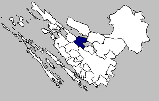
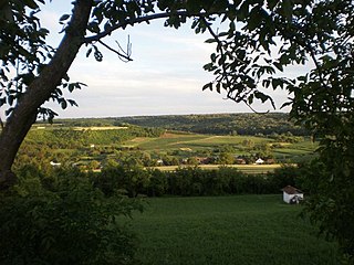
Skradnik | |
|---|---|
Village | |
| Country | |
| County | Karlovac County |
| Area | |
| • Total | 11.7 km2 (4.5 sq mi) |
| Population (2021) [2] | |
| • Total | 374 |
| • Density | 32/km2 (83/sq mi) |
| Time zone | UTC+1 (CET) |
| • Summer (DST) | UTC+2 (CEST) |
Skradnik | |
|---|---|
Village | |
| Country | |
| County | Karlovac County |
| Area | |
| • Total | 11.7 km2 (4.5 sq mi) |
| Population (2021) [2] | |
| • Total | 374 |
| • Density | 32/km2 (83/sq mi) |
| Time zone | UTC+1 (CET) |
| • Summer (DST) | UTC+2 (CEST) |
Posedarje is a municipality in Zadar County of Croatia with 3,607 inhabitants.
Sot is a village located in Syrmia, Vojvodina, Serbia. It is situated in the Šid municipality, in the Syrmia District. The village is ethnically mixed and its population numbering 791 people.
Dubrava is a village and a municipality ("općina") in Zagreb County, Croatia.
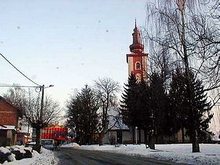
Podcrkavlje is a municipality in Brod-Posavina County, Croatia. There are 2,553 inhabitants of which 98.8% declare themselves Croats.

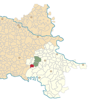
Vojnić is a municipality in Karlovac County, Croatia. There are 4,764 inhabitants, 45% of whom are Serbs and 37% of whom are Croats. The municipality is part of Kordun. Vojnić is underdeveloped municipality which is statistically classified as the First Category Area of Special State Concern by the Government of Croatia.
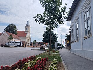
Andrijaševci is a village and a municipality in Vukovar-Syrmia County in eastern Croatia. Despite its name, the seat of the municipality is in the village of Rokovci.

Orolik is a village in the Stari Jankovci municipality, Vukovar-Syrmia County, in eastern Croatia. The village is connected with the rest of the country by the D46 state road connecting it with the town of Vinkovci and continuing into Serbia as the State Road 120 to the nearest town of Šid, D57 road and by the M105 railway.
Novi Varoš is a village in Croatia. It is connected by the D5 highway.
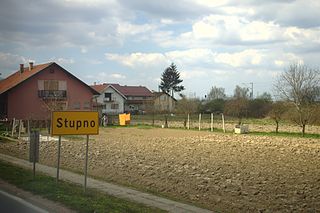
Stupno is a village in Croatia. It is connected by the D36 highway.

Oštarije is a village in the municipality Josipdol in Karlovac County, Croatia. It is connected by the D42 highway.

Slakovci is a village in Stari Jankovci municipality of Vukovar-Syrmia County in eastern Croatia. It is connected by the D46 state road. The village is physically connected with the village of Srijemske Laze. The village is connected with the rest of the country by the D46 state road connecting it with the town of Vinkovci and continuing into Serbia as the State Road 120 to the nearest town of Šid.
Donja Brusovača is a village in central Croatia, located in the Vojnić municipality in Karlovac County. It is located on the D216 road, which connects Vojnić to the Maljevac border crossing into Bosnia and Herzegovina. The village is located 8 kilometres away from the border.
Jagrovac is a village in Croatia. It is connected by the D216 highway.
Beletinec is a village in Croatia.

Jurdani is a village in Croatia.
Stara Drenčina is a village in Croatia, part of the municipality of Sisak, which itself is a part of Sisak-Moslavina County.
Šeovica is a village in Croatia.
Prkovci is a village in Croatia.
Bukevje is a settlement (naselje) in the Sveti Ivan Zelina administrative territory of Zagreb County, Croatia. As of 2011 it had a population of 84 people.
Negovec is a settlement (naselje) in the Vrbovec administrative territory of Zagreb County, Croatia. As of 2011 it had a population of 176 people.
45°13′N15°19′E / 45.217°N 15.317°E
| | This Karlovac County geography article is a stub. You can help Wikipedia by expanding it. |