Sogn og Fjordane is a county in western Norway, bordering Møre og Romsdal, Oppland, Buskerud, and Hordaland. The county administration is in the village of Hermansverk in Leikanger municipality. The largest town in the county is Førde.

Fjærvatnet or Indre Fjærvatn is a lake that lies in the municipality of Bodø in Nordland county, Norway. The 2.48-square-kilometre (0.96 sq mi) lake is located about 3 kilometres (1.9 mi) south of the village of Kjerringøy, near the village of Fjære.
Langvatnet (Norwegian) or Tjoaddnejávrre (Lule Sami) is a lake that lies on the border between Norway and Sweden. Almost all of the lake is located in Tysfjord Municipality in Nordland county, Norway with a very small part of the lake in Jokkmokk Municipality in Norrbotten County, Sweden. The 5.46-square-kilometre (2.11 sq mi) lake is located about 20 kilometres (12 mi) southeast of the village of Kjøpsvik in Tysfjord.

Ramsgjelvatnet is a lake that lies in the municipality of Beiarn in Nordland county, Norway. The lake is located about 5 kilometres (3.1 mi) northeast of the village of Høyforsmoen and about 15 kilometres (9.3 mi) southeast of the village of Moldjord.
Sausvatnet is a lake that is located in Brønnøy municipality in Nordland county, Norway. There is also a small village on the eastern shore called Sausvatn. The lake is located about 7 kilometres (4.3 mi) south of Hommelstø and about 15 kilometres (9.3 mi) northwest of Lande.
Sildhopvatnet (Norwegian) or Silldavuopjávrre (Lule Sami) is a lake located in the municipality of Sørfold in Nordland county, Norway. The 2.16-square-kilometre (0.83 sq mi) lake is located on the east side of the village of Mørsvikbotn.

Malmsjøen is a lake in the municipality of Skaun in Trøndelag county, Norway. It is located about 1.5 kilometres (0.93 mi) southeast of the village of Skaun, about 7 kilometres (4.3 mi) north of the village of Korsvegen, and about 10 kilometres (6.2 mi) southwest of the village of Melhus. The Norwegian County Road 709 runs along the northern shore of the lake.
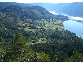
Åraksfjorden is a lake in the municipality of Bygland in Aust-Agder county, Norway. The 11.96-square-kilometre (4.62 sq mi) lake is part of the Otra drainage basin. The northern part of the lake is fed directly by the river Otra. The southern part of the lake goes through a narrow channel which leads into the Byglandsfjorden. The villages of Frøysnes and Skåmedal are located along the western side of the lake and on the eastern side are the villages of Sandnes and Åraksbø. The Norwegian National Road 9 runs along the eastern side of the lake.

Rosskreppfjorden is a lake in Norway. The 29.51-square-kilometre (11.39 sq mi) lake lies on the border between the municipalities of Valle and Sirdal. The lake is part of the Kvina river system and has a hydroelectric power plant in a dam on the south end of the lake. The dam keeps the lake at an elevation of about 929 to 890 metres above sea level.

Longerakvatnet or Longeraksvatnet is a lake in the municipality of Bygland in Aust-Agder county, Norway. It has a small dam on the southwest side to regulate the water level for hydro-electric power generation at a plant located down the hill. The lake discharges into the Longeraksåni river which flows into the Byglandsfjorden near the village of Longerak. The 3.4-square-kilometre (1.3 sq mi) lake is located about 6 kilometres (3.7 mi) southeast of the village of Lauvdal and about 10 kilometres (6.2 mi) northeast of the village of Byglandsfjord.
Kolsvatnet is a lake in the municipality of Valle in Aust-Agder county, Norway. It is located about 14 kilometres (8.7 mi) southwest of the village of Valle and about 15 kilometres (9.3 mi) northwest of the village of Rysstad. The lake is located south of the lake Botnsvatnet, east of the mountain Urddalsknuten, and northeast of the lake Rosskreppfjorden. The lake has an area of 2.72 square kilometres (1.05 sq mi) and sits at an elevation of 1,034 metres (3,392 ft) above sea level.
Høvringsvatnet or Høvringsvatn is a lake in the municipality of Evje og Hornnes in Aust-Agder county, Norway. It's located about 10 kilometres (6.2 mi) northeast of the village area of Evje and about 6 kilometres (3.7 mi) southeast of the village area of Byglandsfjord. The lake Homstølvatnet in Froland municipality is located about 5 kilometres (3.1 mi) to the northeast.
Botsvatn or Bossvatn is a lake in the municipality of Bykle in Aust-Agder county, Norway. The 14.6-kilometre (9.1 mi) long, narrow reservoir is located just to the southeast of the large lake Blåsjø and northeast of the lake Ytre Storevatnet. The lake holds water for the Brokke Hydroelectric Power Station, located in nearby Valle municipality. The water from the lake can flow out into the nearby river Otra, but only when water is released from the dam.
Skyvatn is a lake in the northern part of the municipality of Bykle in Aust-Agder county, Norway. The lake is located south of the lake Holmavatnet and northwest of the lake Hartevatnet. The village of Hovden in Bykle is the nearest village, located about 9 kilometres (5.6 mi) southeast of the lake.

Røldalsvatnet is a lake in the municipality of Odda in Hordaland county, Norway. The 6.99-square-kilometre (2.70 sq mi) lake is located about 35 kilometres (22 mi) south of the town of Odda. The village of Røldal is located at the northern tip of the lake and the village of Botnen is located at the southern end. The European route E134 highway runs along the northern end of the lake, and the Norwegian National Road 13 runs along the western shore of the lake.

Oppstrynsvatn is a lake in the municipality of Stryn in Sogn og Fjordane county, Norway. It is located about 8 kilometres (5.0 mi) east of the village of Stryn. The villages of Flo, Oppstryn, and Erdal are located on the shores of the lake.

Dingevatn or Dingevatnet is the 18th deepest lake in Norway, reaching a maximum depth of 220 metres (720 ft). It is located in the municipality of Gulen in Sogn og Fjordane county. The 2.84-square-kilometre (1.10 sq mi) lake is located just east of the village of Dingja, about 1 kilometre (0.62 mi) southeast of the mouth of the Sognefjorden. The lake lies about 4 kilometres (2.5 mi) north of the municipal center of Eivindvik. The lake flows out into the small Dingjaelva river, which runs past the village of Dingja before emptying into the Sognesjøen strait.

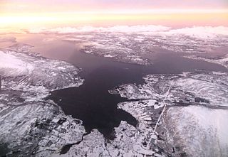
Kovvannet or Kovvatnet (Norwegian) or Buođgajávri (Northern Sami) is a lake in Alta Municipality in Finnmark county, Norway. It is located on the mainland, immediately north of the Langfjorden and about 6 kilometres (3.7 mi) straight east of the village of Øksfjordbotn. The lake has two small dams on the southeast end of the lake. The dams are part of a hydroelectric power plant, located just east of the lake.
Bjelleklang is a Norwegian a cappella vocal group, formed in Lørenskog in 1986, who have released several albums.