Related Research Articles

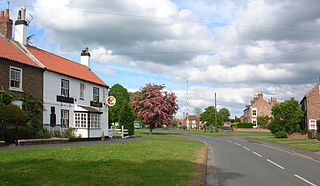
Upper Poppleton is a village and civil parish in the unitary authority of the City of York in North Yorkshire, England. It is situated by the west bank of the River Ouse adjacent to Nether Poppleton, and west of York close to the A59 from York to Harrogate. The village is served by Poppleton railway station on the Harrogate Line. According to the 2001 census, the parish had a population of 1,961, increasing to 1,997 at the 2011 Census. Before 1996, it was part of the Borough of Harrogate.

Nether Providence Township is a first class township in Delaware County, Pennsylvania, United States. Many residents refer to the township by the name of its largest community, Wallingford, because the Wallingford postal code is used for most of the township. The population of the township was 13,706 at the 2010 census.

Ecclesall Ward—which includes the neighbourhoods of Banner Cross, Bents Green, Carterknowle, Ecclesall, Greystones, Millhouses, and Ringinglow—is one of the 28 electoral wards in the Sheffield district, in the county of South Yorkshire, England. It is located in the southwestern part of the city and covers an area of 3.6 square miles. The population of this ward in 2007 was 19,211 people in 7,626 households, reducing to 6,657 at the 2011 Census. Ecclesall ward is one of the four wards that make up the South West Community Assembly and one of five wards that make up the Sheffield Hallam Parliamentary constituency. The Member of Parliament is Olivia Blake, a Labour MP. Ecclesall is one of the least socially deprived wards in the entire country, with a 2002 deprivation score of 4.7—making it the 8,105th most deprived ward out of 8,414 wards in the country. The demographic consists largely of white, middle-class families.

Pencoed is a town and community in the county borough of Bridgend, Wales. It straddles the M4 motorway north east of Bridgend and is situated on the Ewenny River. At the 2011 census it had a population of around 9,166.

Nether Edge and Sharrow Ward, which includes the districts of Nether Edge, Sharrow, Abbeydale, Brincliffe and parts of Banner Cross, Heeley and Highfield, is one of the 28 electoral wards in the City of Sheffield, England. It is located in the south west of the city and covers an area of 1.31 square miles (3.4 km2). In 2011, the population of this ward was 18,890 people in 7,592 households. Nether Edge & Sharrow ward is one of the wards that make up the Sheffield Central parliamentary constituency.

The River Cerne is a 10 mi (16 km) river in Dorset, England, which rises in the Chalk hills of the Dorset Downs at Minterne Magna, between High Stoy and Dogbury Hill, flows down a valley through Cerne Abbas and Charminster, and flows into the River Frome in Dorchester. The Cerne Valley lies in the Dorset National Landscape.

Turgis Green is a hamlet in the English county of Hampshire. It is split between the civil parishes of Hartley Wespall and Stratfield Turgis. It contains six Grade II listed buildings and a Grade II listed milestone.

Mynydd Isa is a village in Flintshire, in north-east Wales. It lies between the county town of Mold, and Buckley in the community of Argoed which had a population of 5837 according to the 2011 census. Mynydd Isa was originally a small hamlet on the north side of the Mold to Buckley road just downhill from the now demolished Calvinist chapel. It did not appear on Ordnance Survey maps until 1912.

Over Whitacre is a village containing the hamlets of Botts Green, Furnace End and Monwode Lea in North Warwickshire, Warwickshire, England. The population of the village at the 2011 census was 411. It is located near other villages, Nether Whitacre and Whitacre Heath, although Whitacre heath is actually the heath of Nether Whitacre and not a separate parish. The nearby hamlet of Furnace End probably derives its name from iron smelting furnaces owned by the Jennens of Nether Whitacre. The village today is mainly residential and agricultural, but there is some light industry.

Capel-y-ffin is a hamlet near the English-Welsh border, a couple of miles north of Llanthony in Powys, Wales. It lies within the Black Mountains and within the Brecon Beacons National Park. The nearest town is Hay-on-Wye, some 8 miles (13 km) to the northwest.
Heartsease is a small settlement or hamlet in Powys, Wales. It is close to the border with England and lies near the junction of the two counties of Herefordshire and Shropshire.

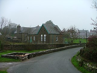
Bryncroes is a hamlet and former civil parish in Gwynedd in Wales, and lies on the Llŷn Peninsula approximately 2 km west of Sarn Meyllteyrn. The parish was abolished in 1934 and divided between Botwnnog and Aberdaron. The village was the scene of fierce protests between 1969 and 1972 when it was proposed to close the village school. However, the protests were in vain and the school closed, and is now a village community centre.

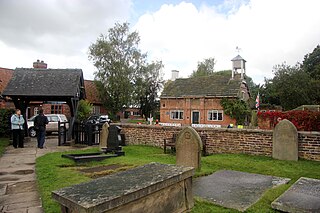
Peover Inferior is a civil parish in the Borough of Cheshire East and the ceremonial county of Cheshire, England. The village is known for its picturesque surrounding countryside and surprisingly convenient location. The name Peover is pronounced 'Peever' and derives from the Anglo-Saxon 'Peeffer' meaning 'a bright river', this 'bright river' being the River Peover which runs through the parish. The village and its neighbour Peover Superior lie on the river Peover, 'Inferior' here meaning downstream. The parish is situated on the B5081 roughly 25 km south south west of Manchester between Knutsford and Holmes Chapel and within five miles of junction 19 on the M6. Together with Nether Peover, it forms part of the village of Lower Peover, Lower Peover being the parish council. Peover Inferior is in Cheshire East, however Nether Peover is in Cheshire West, this often causes complications for the Lower Peover parish council. According to the 2011 census, it had a population of 220.

Nether Skyborry is a Grade 2 listed country house and lies within the parish of Llanfair Waterdine, South Shropshire.

Skyborry Green is a hamlet consisting of a small number of houses and a farm in Shropshire, England, 2 miles (3 km) northwest of Knighton. The hamlet population taken at the 2011 census can be found under Llanfair Waterdine. The Welsh border lies very close.

Nether Kellet is a village and civil parish in the City of Lancaster in Lancashire, England, a few miles south of Carnforth. It had a population of 646 recorded in the 2001 census, increasing to 663 at the 2011 Census, and again to 738 at the 2021 census. The parish includes the small hamlet of Addington, to the east.

Garneddwen is a hamlet in the south of the county of Gwynedd, Wales. It lies in the historic county of Merionethshire/Sir Feirionnydd, in the valley of the Afon Dulas.

Nether Exe or Netherexe is a very small village and civil parish in Devon, England. It lies near the River Exe, as its name suggests, about 5 miles (8 km) north of Exeter.
Llanfair Waterdine is a civil parish in Shropshire, England. It contains 30 listed buildings that are recorded in the National Heritage List for England. All the listed buildings are designated at Grade II, the lowest of the three grades, which is applied to "buildings of national importance and special interest". The parish contains the village of Llanfair Waterdine and the hamlet of Skyborry Green, and is otherwise entirely rural. Most of the listed buildings are houses and associated structures, cottages, farmhouses and farm buildings, a high proportion of which are timber framed, some also with cruck construction, dating from the 14th to the 18th century. The other listed buildings are a bridge, a church, and memorials in the churchyard.
References
- ↑ Mark Nodine. "Welsh/English translation". Archived from the original on 25 October 2007. Retrieved 11 March 2008.