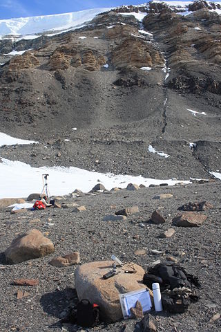
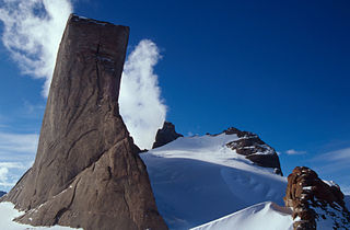
The Deep Freeze Range is a rugged mountain range, over 128 km (80 mi) long and about 16 km (10 mi) wide, rising between Priestley and Campbell Glaciers in Victoria Land, Antarctica, and extending from the edge of the polar plateau to Terra Nova Bay. Peaks in the low and mid portions of the range were observed by early British expeditions to the Ross Sea.
Kohler Glacier is a distributary of the Smith Glacier in Marie Byrd Land, Antarctica, flowing northward through the middle of the Kohler Range into Dotson Ice Shelf. It was mapped by the U.S. Geological Survey from surveys and U.S. Navy air photos, 1959–65, and was named by the Advisory Committee on Antarctic Names in association with the Kohler Range.

The Usarp Mountains are a major mountain range in North Victoria Land, Antarctica. They are west of the Rennick Glacier and trend north to south for about 190 kilometres (118 mi). The mountains are bounded to the north by Pryor Glacier and the Wilson Hills.

The Prince Charles Mountains are a major group of mountains in Mac. Robertson Land in Antarctica, including the Athos Range, the Porthos Range, and the Aramis Range. The highest peak is Mount Menzies, with a height of 3,228 m (10,591 ft). Other prominent peaks are Mount Izabelle and Mount Stinear. These mountains, together with other scattered peaks, form an arc about 420 km (260 mi) long, extending from the vicinity of Mount Starlight in the north to Goodspeed Nunataks in the south.

Liv Glacier is a steep valley glacier, 40 nautical miles long, emerging from the Antarctic Plateau just southeast of Barnum Peak and draining north through the Queen Maud Mountains to enter Ross Ice Shelf between Mayer Crags and Duncan Mountains. It was discovered in 1911 by Roald Amundsen, who named it for the daughter of Fridtjof Nansen.
Explorers Range is a large mountain range in the Bowers Mountains of Victoria Land, Antarctica, extending from Mount Bruce in the north to Carryer Glacier and McLin Glacier in the south. Named by the New Zealand Antarctic Place-Names Committee (NZ-APC) for the northern party of New Zealand Geological Survey Antarctic Expedition (NZGSAE), 1963–64, whose members carried out a topographical and geological survey of the area. The names of several party members are assigned to features in and about this range. All of the geographical features listed below lie situated on the Pennell Coast, a portion of Antarctica lying between Cape Williams and Cape Adare.
Haas Glacier is a steep tributary glacier draining northward from Rawson Plateau to enter the south side of Bowman Glacier, in the Queen Maud Mountains of Antarctica. It was mapped by the United States Geological Survey from surveys and U.S. Navy air photos, 1960–64, and was named by the Advisory Committee on Antarctic Names for Charles G. Haas, a meteorologist in the South Pole Station winter party, 1960.
Habermehl Peak is a peak 2,945 metres (9,660 ft) high, 5 km (3 mi) south of Gessner Peak in the northeast part of the Mühlig-Hofmann Mountains of Queen Maud Land, Antarctica. It was discovered by the Third German Antarctic Expedition (1938–1939), led by Captain Alfred Ritscher, and named for Richard Habermehl, the director of the German Weather Service. It was remapped from air photos taken by the Sixth Norwegian Antarctic Expedition, 1958–59.
The Bigler Nunataks are a cluster of notable nunataks in Antarctica. They lie southeastward of Pomerantz Tableland between Keim Peak and Lovejoy Glacier. They were mapped by the United States Geological Survey from surveys and from U.S. Navy aerial photographs, 1960–62, and named by the Advisory Committee on Antarctic Names for John C. Bigler, United States Antarctic Research Program biologist at McMurdo Station, 1966–67.

Carey Glacier is a glacier on the east side of Miller and Fruzhin Peaks and west of Ruset and Malkoch Peaks in Petvar Heights at the southeast end of the Sentinel Range, Ellsworth Mountains, flowing southeast to Minnesota Glacier. It was mapped by the United States Geological Survey from surveys and from U.S. Navy air photos, 1957–59, and named by the Advisory Committee on Antarctic Names for Lieutenant David W. Carey, pilot with U.S. Navy Squadron VX-6, who was killed in the crash of a P2V Neptune airplane at McMurdo Sound in October 1956.

The Kurze Mountains are a range of mainly bare rock peaks, ridges and mountains about 20 nautical miles (40 km) long and 6 nautical miles (11 km) wide in the Orvin Mountains of Queen Maud Land, Antarctica. The feature stands between the Drygalski Mountains on the west and the Gagarin Mountains and Conrad Mountains on the east.
Deschanel Peak is the summit of an isolated, partly ice-covered mountain, 750 metres (2,460 ft) high, rising from the south part of the glacier close southeast of Cape Berteaux on the west coast of the Antarctic Peninsula. The approved name derives from "Sommet Deschanel" given by J.B. Charcot, leader of the French Antarctic Expedition, in January 1909.
Duffy Peak is a peak southeast of Hageman Peak in the Staccato Peaks, southwest Alexander Island, Antarctica. Dargomyzhsky glacier extends and flows west from the base of Duffy Peak and enters the nearby Bach Ice Shelf. The peak was photographed from the air by Lincoln Ellsworth in 1935, and was named by the Advisory Committee on Antarctic Names for Lieutenant Commander Joseph A. Duffy, a U.S. Navy aircraft pilot in Squadron VXE-6 during Operation Deep Freeze, 1969 and 1970.

The Morozumi Range is a spectacular mountain range of unusual scenic beauty in the Usarp Mountains of North Victoria Land, Antarctica. It extends northwest–southeast for 25 miles (40 km), with its northern elevations overlooking the convergence of Gressitt Glacier and Rennick Glacier.
Humboldt Graben is a glacier-filled valley, 20 nautical miles (37 km) long, trending north–south between the Humboldt Mountains and the Petermann Ranges in Queen Maud Land, Antarctica. The feature was discovered and mapped by the Third German Antarctic Expedition under Alfred Ritscher, 1938–39, who named it in association with the adjacent Humboldt Mountains.
Mount Schumacher is a mountain, 1,230 m, standing 6 nautical miles (11 km) southwest of Nils Jorgen Peaks on the west side of Ahlmann Ridge in Queen Maud Land. Mapped by Norwegian cartographers from surveys and air photos by Norwegian-British-Swedish Antarctic Expedition (NBSAE) (1949–52) and air photos by the Norwegian expedition (1958–59). Named for Nils Jorgen Schumacher, senior meteorologist with the NBSAE.
Smalegga Spur is a small rock spur 3 nautical miles (6 km) south-southeast of Morkenatten Peak, Shcherbakov Range, in the Orvin Mountains of Queen Maud Land. Mapped by Norway from air photos and surveys by Norwegian Antarctic Expedition, 1956–60, and named Smalegga.
Spraglegga Ridge is a ridge that is partly rock and partly covered by snow, surmounted by Stenka Mountain, standing 4.5 nautical miles (8 km) southeast of Kvaevefjellet Mountain in the Payer Mountains, Queen Maud Land. Discovered and plotted from air photos by German Antarctic Expedition, 1938–39. Replotted from air photos and surveys by Norwegian Antarctic Expedition, 1956 60, and named Spraglegga.

Holtanna Peak is a peak, 2,650 metres (8,700 ft) high, whose eastern portion is occupied by a small cirque glacier, standing 1 nautical mile (2 km) north of the Mundlauga Crags in the eastern part of Fenriskjeften Mountain in Queen Maud Land, Antarctica. It was mapped from surveys and air photos by the Sixth Norwegian Antarctic Expedition (1956–60) and named Holtanna.
Ravel Peak is an isolated peak, rising to about 1,300 m, surmounting Debussy Heights situated in the northern portion of Alexander Island, Antarctica. The peak is markedly pyramid shaped when viewed from the east side. First mapped from air photos taken by the Ronne Antarctic Research Expedition (RARE), 1947–48, by Searle of the Falkland Islands Dependencies Survey (FIDS) in 1960. Named by the United Kingdom Antarctic Place-Names Committee (UK-APC) after Maurice Ravel (1875–1937), French composer and in association with the nearby landforms named after composers in this area.
![]() This article incorporates public domain material from "Slettefjellet". Geographic Names Information System . United States Geological Survey.
This article incorporates public domain material from "Slettefjellet". Geographic Names Information System . United States Geological Survey. 


