
Amadok Point is a point on the south coast of Livingston Island, Antarctica which projects 400 m into the Bransfield Strait. The point was named after the Thracian King Amadokos, 415-384 BC. It is snow-free in the summer.

Bezmer Point is on the northwest coast of the Varna Peninsula on Livingston Island in the South Shetland Islands, Antarctica. The point is situated 9.6 km east-northeast of Siddins Point and 3 km southwest of Kotis Point and 4.9 km west-southwest of Miziya Peak. The feature was named after the settlement of Bezmer in Southeastern Bulgaria, in association with the Bulgarian ruler Khan Bezmer.
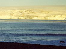
Emona Anchorage is a roughly square embayment, the internal part of South Bay, Livingston Island in the South Shetland Islands, Antarctica used as an anchorage for ships visiting the Bulgarian base St. Kliment Ohridski.
Karavelova Point or Nos Karavelova ( is on the northeast coast of Varna Peninsula, Livingston Island in the South Shetland Islands, Antarctica forming the south side of the entrance to Lister Cove. It is named after Ekaterina Karavelova, translator, author and woman activist.
Kotis Point is a point on the northwest coast of Varna Peninsula on Livingston Island in the South Shetland Islands, Antarctica forming the south side of the entrance to Eliseyna Cove. The point is featuring a conspicuous rock at its tip, situated 3 km northeast of Bezmer Point, 6.6 km southwest of Williams Point and 12.6 km east-northeast of Siddins Point. It was named after the Thracian King Kotis I, 384-359 BC.

Magura Glacier on the southeast side of Tangra Mountains on Livingston Island in the South Shetland Islands, Antarctica is located to the north of M'Kean Point, northeast of Srebarna Glacier, south of Iskar Glacier and southwest of Dobrudzha Glacier. It is bounded by Great Needle Peak to the west, Vitosha Saddle, Vihren Peak and Helmet Peak to the northwest, Plovdiv Peak and Shishman Peak to the north, and Devin Saddle and Kuber Peak to the northeast. The glacier extends 3.5 km in southwest-northeast direction and 1.9 km in northwest-southeast direction, and flows southeastward into Bransfield Strait.
Pimpirev Beach is the portion of the northwest coast of South Bay, Livingston Island, Antarctica bounded to the southwest by Ereby Point and to the northeast by the north corner of the bay marked by an ice sea cave located 5.8 km east-northeast of Ereby Point and 1.45 km northwest of Aleko Point.
Pomorie Point is a point on the coast of McFarlane Strait forming the north side of the entrance to Lister Cove, Varna Peninsula, Livingston Island in the South Shetland Islands, Antarctica.
Rongel Point is an ice-covered headland on the northwest coast of South Bay, Livingston Island in the South Shetland Islands, Antarctica. The area was visited by 19th century sealers operating from nearby Johnsons Dock.

Spanish Point is located on Bulgarian Beach on Hurd Peninsula, eastern Livingston Island in the South Shetland Islands, Antarctica formed by an offshoot of Spanish Knoll.

Ficheto Point is an ice-free point on the northeast coast of Varna Peninsula, Livingston Island, Antarctica forming the southeast side of the entrance to Dragon Cove. Channel Rock is lying in the adjacent northwestern part of McFarlane Strait, 1.3 km (0.81 mi) northeast of Ficheto Point and 920 m (1,010 yd) south-southwest of Meade Islands. The area was visited by 19th century sealers.
Sigritsa Point is an ice-free point on the northeast coast of Varna Peninsula, Livingston Island in the South Shetland Islands, Antarctica forming the northwest side of the entrance to Dragon Cove. The area was visited by 19th century sealers.

Elemag Reef is the 100 m long in southeast-northwest direction and 40 m wide moraine reef in Moon Bay, Livingston Island in the South Shetland Islands, with a narrow shoal extending for over 400 m eastwards. Surface area 0.33 ha. Situated 5.4 km south-southwest of Edinburgh Hill, 5.95 km west of Half Moon Island, 5.18 km northwest of Rila Point, 3.3 km northeast of Zlatograd Rock and 1.85 km east-southeast of Sindel Point. Formed at the terminus of merging Struma and Huron Glaciers, it was originally named Elemag Point. The current reef configuration is due to glacier retreat of up to 1.8 km in the area in the late 20th and early 21st century. Bulgarian mapping in 2009. Bulgarian topographic survey Tangra 2004/05 and mapping in 2009.
Ballester Point is a point forming the south side of the entrance to Johnsons Dock and the northeast side of the entrance to Española Cove in Hurd Peninsula, Livingston Island in the South Shetland Islands, Antarctica. The area was visited by early 19th century sealers operating from Johnsons Dock.
Hespérides Point is a rocky point of land projecting into South Bay north-northwest of Johnsons Dock, Livingston Island in the South Shetland Islands, Antarctica and forming the southwest side of the entrance to Emona Anchorage. Surmounted by Hesperides Hill. The area was visited by 19th century sealers operating from nearby Johnsons Dock.
Bilyar Point is a rounded ice-free point on Ivanov Beach in western Livingston Island, the South Shetland Islands in Antarctica projecting 350 m into Barclay Bay. Situated 3 km southwest of Rowe Point, northwest of Rotch Dome, 1.7 km northeast of Nedelya Point and 4.5 km east-northeast of Lair Point.

Ugain Point is the point on the west coast of Rugged Island in the South Shetland Islands, Antarctica separating Smyadovo Cove to the north and Bogomil Cove to the south. Situated 1.76 km north-northwest of Benson Point, 970 m north of Kokalyane Point and 1.55 km south of Cape Sheffield.
Yana Point is the point forming the west side of the entrance to Bruix Cove in eastern Livingston Island in the South Shetland Islands, Antarctica. The point separates the glacier termini of Huron Glacier to the northwest and Iskar Glacier to the southeast. The feature is named after the settlement of Yana in western Bulgaria.

Raquelia Rocks is a group of three adjacent rocks in eastern South Bay, Livingston Island in the South Shetland Islands, Antarctica formed by an offshoot of Atlantic Club Ridge halfway along the Zodiac boat route linking the Spanish Antarctic Base and the Bulgarian Antarctic Base on the island. The area was visited by early 19th century sealers operating from nearby Johnsons Dock.
Belomortsi Point is the sharp and low ice-free point projecting 140 m northwestwards from Gerlovo Beach on Ioannes Paulus II Peninsula, Livingston Island in Antarctica. The feature is named after the settlement of Belomortsi in Northeastern Bulgaria.


