Primorje-Gorski Kotar County is a county in western Croatia that includes the Bay of Kvarner, the surrounding Northern Croatian Littoral, and the mountainous region of Gorski kotar. Its center is Rijeka. The county's population was 315,000 in the 2018 census.

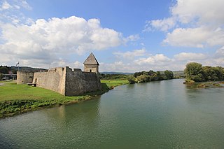
Hrvatska Kostajnica, often just Kostajnica, is a small town in central Croatia. It is located on the Una river in the Sisak-Moslavina County, south of Petrinja and Sisak and across the river from Bosanska Kostajnica in Bosnia and Herzegovina.

Delnice is a town in western Croatia, the largest settlement in the mountainous region of Gorski Kotar, in the Primorje-Gorski Kotar County. The town has a population of 4,379, and total municipality population is 5,952 (2011). Delnice is Gorski Kotar's main town.

Stenjevec is one of the districts of Zagreb, Croatia. It is located in the western part of the city and has 510 inhabitants.

Krašić is a village and municipality in central Croatia, located near Jastrebarsko and Ozalj, south of Žumberak and north of Kupa, about 50 km southwest of Zagreb. Krašić comprises an area of about 3.63 km2. In the 2011 census, the total population was 2,640, in the following settlements:

Voćin is a village and municipality in western Slavonia, Croatia, located southwest of Slatina and east of Daruvar. The population of the municipality is 2,384, with 1,161 people living in Voćin itself.

Babina Greda is a village and a municipality in Vukovar-Srijem County in eastern Croatia. The 2011 census listed 3,572 inhabitants in Babina Greda.

Punat is a municipality in the Primorje-Gorski Kotar County in western Croatia on the island of Krk. There are 1,973 inhabitants, with 90% Croats (2011). The town first appears in writings from AD 1377, but the exact date of foundation is not known. In the bay there is the little island of Košljun.
Skrad is a municipality in the Primorje-Gorski Kotar County in western Croatia. There are 1,062 inhabitants, with 97% Croats (2011).

Barilović is a village and a municipality in central Croatia, in the Karlovac County.

Netretić is a village and a municipality in Karlovac County, Croatia. There are 2,862 inhabitants, 99% of whom are Croats.

Ribnik is a village and a municipality in Karlovac County, Croatia. There are a total of 475 inhabitants in the municipality, 98.74% of whom are Croats.

Petrijevci is a municipality in Slavonia, in the Osijek-Baranja County of northeastern Croatia. There are 2439 inhabitants, of which 97.39% are Croats.
Nemetin is a village in eastern Slavonia, Croatia, located near Osijek. It has a population of 139. It is administratively located within the area of the city of Osijek.
Gorači is a village in Croatia. It is connected by the D32 highway.
Makov Hrib is a village in Croatia. It is connected by the D32 highway.
Gerovski Kraj is a village in Croatia. It is connected by the D32 highway.
Crni Lug is a village in Croatia. It is connected by the D32 highway.
Zamost is a village in Croatia.

The Church of St. Nicholas is a Serbian Orthodox church in Rijeka, Croatia. The church is dedicated to Saint Nicholas. The building of the church was completed in 1790.


