Related Research Articles
The Beech River is a 38.3-mile-long (61.6 km) stream draining the east-central portion of West Tennessee in the United States. The Beech rises about 5 miles (8 km) northwest of Lexington, Tennessee. In the same area are the headwaters of two other West Tennessee rivers, the Big Sandy River and the Middle Fork of the Forked Deer River. The Big Sandy, like the Beech, is part of the Tennessee River system, whereas the Forked Deer system drains into the Mississippi River.
The Tuscumbia River is a 44.4-mile-long (71.5 km) tributary of the Hatchie River in northern Mississippi and western Tennessee in the United States. It rises in Prentiss County, Mississippi, near Booneville. It flows through Alcorn County, then into McNairy County, Tennessee, where it is joined by a major tributary, Cypress Creek, and then flows into the Hatchie River, just before it reaches Hardeman County, near Pocahontas, Tennessee.

The Piney River is a stream that drains a portion of Tennessee's Cumberland Plateau generally known as Walden Ridge. The Piney River rises near the Rhea County – Bledsoe County line and is referred to as Piney Creek in its upper reaches roughly until its confluence with Duskin Creek. Its major tributary, Little Piney Creek, flows over two spectacular waterfalls which are located in Piney Falls State Natural Area near the community of Grandview. A tributary of Little Piney Creek is Soak Creek, Tennessee's newest State Scenic River. The confluence of the two streams occurs below the falls of the smaller stream in an area referred to as "Shut-in Gap". The stream flows out of the gap and is bridged by State Route 68 just before that road begins its steep climb up the Cumberland Escarpment onto Waldens Ridge. The stream flows north of Spring City, Tennessee and becomes slack just east of the town at a headland of Watts Bar Lake, an impoundment of the Tennessee River formed by the Tennessee Valley Authority's Watts Bar Dam project. The mouth of the Piney is one of the larger bays of Watts Bar Lake and contains several small islands.
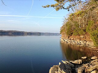
Watts Bar Lake is a reservoir on the Tennessee River created by Watts Bar Dam as part of the Tennessee Valley Authority system.
Powell Mountain is a mountain ridge of the Ridge-and-valley Appalachians of the Appalachian Mountains. It is a long and narrow ridge, running northeast to southwest, from about Norton, Virginia to near Tazewell, Tennessee. It separates the Clinch River basin and the Powell River basin of Powell Valley. It was named for an 18th-century explorer.

Roan Creek is a tributary of the Watauga River that rises near the border between the U.S. states of Tennessee and North Carolina. Its source is located along the slopes of Snake Mountain near Trade in Johnson County, Tennessee. From its source, Roan Creek flows north, then turns west around the northern end of Stone Mountain. Then it flows south and west through Cherokee National Forest in the valley between Stone Mountain and Doe Mountain, until entering the Watauga River and Watauga Lake, the reservoir behind Watauga Dam. Its waters eventually flow through the Watauga River, the Holston River, the Tennessee River, the Ohio River, and the Mississippi River to the Gulf of Mexico.
Lick Creek is a stream in Hickman, Maury and Williamson counties, Tennessee, in the United States. It is a tributary of Duck River.
Taylor Creek is a stream in Hickman County, Tennessee, United States. It is a tributary of Duck River.
Snake Creek is a stream in the U.S. state of South Dakota. It is a tributary of James River.
Cripple Creek is a stream in the U.S. state of Tennessee. It is a tributary of East Fork Stones River.
Horse Creek is a stream in the U.S. state of Tennessee. It is a tributary of the Tennessee River.
Short Creek is a stream in the U.S. state of Tennessee. It is a tributary to the Tennessee River.
Mud Creek is a stream in the U.S. state of Tennessee. It is a tributary to the Tennessee River.
Dry Creek is a stream in the U.S. states of Alabama and Tennessee. It is a tributary to the Tennessee River.
Chambers Creek is a stream in the U.S. state of Tennessee. It is a tributary to the Tennessee River.
Indian Creek is a stream in the U.S. state of Tennessee. It is a tributary to the Tennessee River.
Big Creek is a stream in the U.S. state of Tennessee. It is a tributary to the Beech River.
Wolf Creek is a stream in the U.S. state of Tennessee. It is a tributary to the Beech River.
Cub Creek is a stream in the U.S. state of Tennessee. It is a tributary to the Tennessee River.

Bear Creek is a stream in the U.S. states of Mississippi and Alabama. The stream flows approximately 80 miles (130 km) before it empties into the Tennessee River.
References
- ↑ U.S. Geological Survey Geographic Names Information System: Snake Creek (Tennessee River tributary)
- ↑ History of Tennessee from the Earliest Time to the Present. Southern Historical Press. 1886. p. 819.
Coordinates: 35°09′35″N88°19′05″W / 35.159805°N 88.318096°W