The Beaver River is a tributary of the Ohio River in Western Pennsylvania in the United States with a length of approximately 21 mi (34 km). It flows through a historically important coal-producing region north of Pittsburgh. The Beaver River is formed in Lawrence County by the confluence of the Mahoning and Shenango rivers in the Mahoningtown neighborhood of New Castle. It flows generally south, past West Pittsburg and Homewood. It receives Connoquenessing Creek west of Ellwood City and flows past Beaver Falls and New Brighton. It joins the Ohio at Bridgewater and Rochester at the downstream end of a sharp bend in the Ohio approximately 20 mi (32 km) northwest of Pittsburgh. In the lower reaches near the Ohio River, the Beaver cuts through a gorge of underlying sandstone. The river is roughly parallel to the border with the state of Ohio, with both Interstate 376 and Pennsylvania Route 18 running parallel to the river itself.

Slippery Rock Creek is a small stream in Western Pennsylvania, a tributary of Connoquenessing Creek. From its source in Hilliards in Butler County, it flows through McConnells Mill State Park before flowing into the Connoquenessing in Ellwood City. Then, the Connoquenessing flows into the Beaver River just three miles south from the mouth of Slippery Rock.

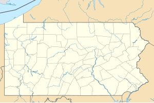
Raccoon Creek is a tributary of the Ohio River in Beaver County, Pennsylvania, United States.

The Shenango River is a principal tributary of the Beaver River, approximately 100 mi (160 km) long, in western Pennsylvania in the United States. It also briefly flows through small portions of northeastern Ohio. Via the Beaver and Ohio Rivers, it is part of the watershed of the Mississippi River.

Tenmile Creek is a stream in Washington and Greene Counties, Pennsylvania, USA. It is a tributary of the Monongahela River.
Camp Run is a tributary of Connoquenessing Creek in western Pennsylvania. The stream rises in southeastern Lawrence County and flows south entering Connoquenessing Creek at Fombell, Pennsylvania. The watershed is roughly 39% agricultural, 55% forested and the rest is other uses.
McDonald Run is a 3.07 mi (4.94 km) long tributary to Slippery Rock Creek that rises near Forestville in Butler County, Pennsylvania and flows south to meet Slippery Rock Creek near Branchton.
Edwards Run is a tributary of the Beaver River in western Pennsylvania. The stream rises in western Lawrence County and flows east entering the Beaver River at Moravia, Pennsylvania. The watershed is roughly 60% agricultural, 33% forested and the rest is other uses.
Jenkins Run is a tributary of the Beaver River in western Pennsylvania. The stream rises in western Lawrence County and flows east entering the Beaver River south of Moravia, Pennsylvania. The watershed is roughly 60% agricultural, 31% forested and the rest is other uses.
McKee Run is a tributary of the Beaver River in western Pennsylvania. The stream rises in south-central Lawrence County and flows west entering the Beaver River at West Pittsburg, Pennsylvania. The watershed is roughly 29% agricultural, 62% forested and the rest is other uses.
Eckles Run is a tributary of the Beaver River in western Pennsylvania. The stream rises in south-central Lawrence County and flows east entering the Beaver River at Wampum, Pennsylvania. The watershed is roughly 35% agricultural, 54% forested and the rest is other uses. This is the only stream of this name in the United States.
Wampum Run is a tributary of the Beaver River in western Pennsylvania. The stream rises in south-central Lawrence County and flows northeast entering the Beaver River at Wampum, Pennsylvania. The watershed is roughly 11% agricultural, 83% forested and the rest is other uses.
Stockman Run is a tributary of the Beaver River in western Pennsylvania. The stream rises in north-central Beaver County and flows generally east entering the Beaver River at Koppel, Pennsylvania. The watershed is roughly 16% agricultural, 70% forested and the rest is other uses.
Clarks Run is a tributary of the Beaver River in western Pennsylvania. The stream rises in north-central Beaver County and flows generally east entering the Beaver River at Homewood, Pennsylvania. The watershed is roughly 20% agricultural, 62% forested and the rest is other uses.
Thompson Run is a tributary of the Beaver River in western Pennsylvania. The stream rises in north-central Beaver County and flows west entering the Beaver River at Homewood, Pennsylvania. The watershed is roughly 12.5% agricultural, 54% forested and the rest is other uses.
Wallace Run is a tributary of the Beaver River in western Pennsylvania. The stream rises in north-central Beaver County then flows east entering the Beaver River at Morado, Pennsylvania. The watershed is roughly 23% agricultural, 48% forested and the rest is other uses.
Bennett Run is a tributary of the Beaver River in western Pennsylvania. The stream rises in north-central Beaver County then flows southwest entering the Beaver River at Morado, Pennsylvania. The watershed is roughly 25% agricultural, 53% forested and the rest is other uses.
Brady Run is a tributary of the Beaver River in western Pennsylvania. The stream rises in central Beaver County then flows southeast entering the Beaver River at Fallston, Pennsylvania. The watershed is roughly 21% agricultural, 61% forested and the rest is other uses.
Pine Run is a tributary to Neshannock Creek in western Pennsylvania. The stream rises in south-central Mercer County and flows southeast entering Neshannock Creek south and downstream of Mercer, Pennsylvania. The watershed is roughly 46% agricultural, 45% forested and the rest is other uses.
Beaver Run is a 9.33 mi (15.02 km) long tributary to South Branch French Creek in Erie County, Pennsylvania and is classed as a 2nd order stream on the EPA waters geoviewer site.