
Point Pinole Regional Shoreline is a regional park on the shores of the San Pablo Bay, California, in the United States. It is approximately 2,315 acres (9.37 km2) in area, and is operated by the East Bay Regional Park District. It includes the Dotson Family Marsh and the Point Pinole Lagoon and hosts the North Richmond Shoreline Festival.

Claremont Canyon Regional Preserve is a small regional park mainly located in the city of Oakland, California, and administered by the East Bay Regional Park District. The park is named for the canyon in which it's situated, Claremont Canyon, out of which Claremont Creek flows on its way to its confluence with Temescal Creek. Originally, the canyon was named "Harwood's Canyon", then "Telegraph Canyon". The name was changed to Claremont by a developer of the nearby Claremont district.
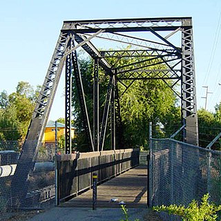
The Iron Horse Regional Trail is a rail trail for pedestrians, horse riders and bicycles in the East Bay Area in California.

Morgan Territory is a region in California on the east side of Mount Diablo in the San Francisco East Bay's Contra Costa County. The area is named for settler Jeremiah Morgan.
Kennedy Grove Regional Recreation Area,(KGRRA), also known simply as Kennedy Grove, is located in West Contra Costa County, California at the base of San Pablo Dam. The nearest city is El Sobrante, California. Created in 1967, it contains a three-mile hiking trail with an elevation of 760 feet (230 m). The Grove features many large eucalyptus trees, picnic areas, volleyball nets, playgrounds, and horseshoe pits. Bird watching is popular here because hawks are almost always spotted. Some hikers have reported seeing golden and bald eagles around the reservoir. There is no camping allowed. Parking is $5 with an extra $2 fee for a dog. Dogs have to be on the leash around the lawn but they are allowed off the leash in remote parts of the park. The park is open from 8 a.m. to dusk.
Sobrante Ridge Regional Park, or simply Sobrante Ridge, is a regional park of the East Bay Regional Parks District in Richmond, California. It covers 277 acres (1.1 km2) and protects the extremely endangered Alameda Manzanita, a native plant of the area. The park has 2 1⁄2 miles (4.0 km) of trails.The endangered manzanita grow on 9 acres (0.036 km2).
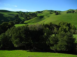
Briones Regional Park is a 6,117-acre (24.75 km2) regional park in the East Bay Regional Park District (EBRPD) system, located in the Briones Hills of central Contra Costa County of the San Francisco Bay Area in California.
Bishop Ranch Regional Preserve (BRRP), also known as Bishop Ranch Regional Open Space Preserve is a 444-acre (1.80 km2) regional park on a ridge top at the edge of San Ramon, CA. It is near residential area, west of San Ramon Valley Road and South of Bollinger Canyon Road. Trails are steep and there are no facilities other than a trailhead. It is part of the East Bay Regional Parks system.
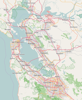
Brushy Peak Regional Preserve is a regional park that is part of the East Bay Regional Parks (EBRPD) and the Livermore Area Recreation and Park District (LARPD) systems. It is located in unincorporated land in Alameda County, just north of Livermore, California.
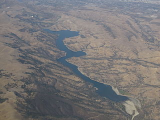
Del Valle Regional Park is a part of the East Bay Regional Park District (EBRPD) in an unincorporated region of Alameda County, California, 10 miles (16 km) south of the city of Livermore. The park covers 4,316 acres.
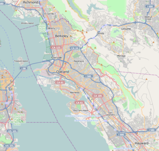
Huckleberry Botanic Regional Preserve is a 241 acres (0.98 km2) regional park and nature reserve in the Berkeley Hills, in the eastern East Bay region of the San Francisco Bay Area of California. It is within Alameda and Contra Costa Counties. It is a park within the East Bay Regional Parks District system. The Preserve is named after the California Huckleberry which grows abundantly within its habitat.
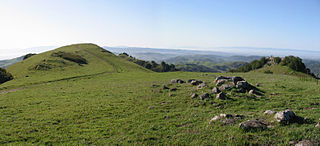
Las Trampas Regional Wilderness is a 5,342-acre (21.62 km2) regional park located in Alameda and Contra Costa counties in Northern California. The nearest city is Danville, California Las Trampas is Spanish for the traps, or the snares. The park belongs to the East Bay Regional Park District (EBRPD).
Morgan Territory Regional Preserve is a regional park located north of Danville and Livermore, California, bordering on Mt. Diablo State Park, that is part of the East Bay Regional Park District. Since EBRPD acquired the Viera tract, it encompassed 5,230 acres (2,120 ha). The main access road runs from Livermore.

Ohlone Wilderness is a 9,737 acres (39.40 km2) regional park in the United States that is part of the East Bay Regional Parks (EBRPD) system. It is located in southern Alameda County, near the cities of Fremont, CA and Sunol, CA. It is located between Mission Peak and Sunol Regional Wilderness.

Arctostaphylos pallida, commonly known as Pallid Manzanita, Oakland Hills Manzanita, and Alameda Manzanita, is an upright Manzanita shrub from the Ericaceae, or heath family. It is endemic to the eastern San Francisco Bay Area of Northern California.
Oyster Bay Regional Shoreline is a park in San Leandro, California, part of the East Bay Regional Park District (EBRPD). It is located along the eastern shore of San Francisco Bay directly to the south of Oakland International Airport. The property was originally used as a landfill for 37 years, until it was filled to capacity in 1977, when it was capped with a clay cover. EBRPD bought the property in 1980, intending to use it as a park.
Vargas Plateau Regional Park sits on a plateau in the Fremont Hills of Alameda County, California that overlooks the San Francisco Bay, Niles Canyon, and the cities of Fremont, Union City and Newark. The elevation of the park is about 1,000 feet (300 m), making it an important link with nearby ridge-top parks such as Garin Regional Park, Pleasanton Ridge Regional Park, Mission Peak Regional Preserve, and Sunol Regional Wilderness.
Dublin Hills Regional Park covers 654 acres (2,650,000 m2) in Alameda County, California, west of the city of Dublin. It is part of the East Bay Regional Park District (EBRPD). The park is accessible from the Donlon Hill Staging Area, which is on Dublin Boulevard near Dublin, California.

Five Canyons Open Space (FCOS) is located in Castro Valley, in Alameda County, California. Five Canyons is a multi-agency collaboration between East Bay Regional Parks District (EBRPD), Alameda County Public Works, Hayward Area Recreation and Parks District (HARD), and several homeowners associations. EBRPD is the lead agency for this open space. FCOS opened in 1998, consists of 300 acres (1.2 km2) and 5 miles (8.0 km) of trails and has almost no amenities. The main visitors are hikers, bicyclists, equestrians and dog walkers. Restrooms and drinking water are available at HARD's nearby Five Canyons Park.


