
Belozersky District is the name of several administrative and municipal districts in Russia. The name literally means "pertaining to white lakes".
Mezhdurechensky District is the name of several administrative and municipal districts in Russia:

Nikolsky District is the name of several administrative and municipal districts in Russia:

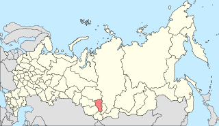
Spassky District is the name of several administrative and municipal districts in Russia. The name is generally derived from or related to the root "spas" ("savior")—usually alluding to the concept of the Christian faith.
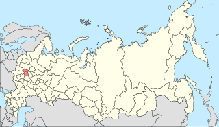
Voskresensky District is the name of several administrative and municipal districts in Russia. The name is generally derived from or related to the root "voskreseniye" (resurrection).

Sheksna is an urban locality and the administrative center of Sheksninsky District of Vologda Oblast, Russia, located along the left bank of the Sheksna River, 83 kilometers (52 mi) from Vologda. Municipally, it is incorporated as Sheksninskoye Urban Settlement, one of the two urban settlements in the district. Population: 20,953 (2010 Census); 21,615 (2002 Census); 15,928 (1989 Census).

Sokol is a town in the center of Vologda Oblast, Russia, located on both banks of the Sukhona River. Population: 38,452 (2010 Census); 43,042 (2002 Census); 46,604 (1989 Census).; 36,000 (1970).
Kadnikov is a town in Sokolsky District of Vologda Oblast, Russia, located on the bank of the Sodima River, 43 kilometers (27 mi) southeast of Vologda, the administrative center of the oblast. Population: 4,796 (2010 Census); 5,362 (2002 Census); 5,312 (1989 Census).
Chagoda is an urban locality and the administrative center of Chagodoshchensky District of Vologda Oblast, Russia, situated on the Chagodoshcha River 326 kilometers (203 mi) from Vologda. Municipally, it is incorporated as Chagoda Urban Settlement, one of the two urban settlements in the district. Population: 6,920 (2010 Census); 7,432 (2002 Census); 8,171 (1989 Census).

Babushkinsky District is the name of several administrative and municipal districts in Russia.

Volodarsky District is the name of several administrative and municipal districts in Russia. The districts are generally named for V. Volodarsky, a Russian revolutionary and politician.

Belozersky District is an administrative and municipal district (raion), one of the twenty-six in Vologda Oblast, Russia. It is located in the northwest of the oblast and borders with Vytegorsky District in the north, Vashkinsky District in the northeast, Kirillovsky District in the southeast, Cherepovetsky and Kaduysky Districts in the south, and with Babayevsky District in the west. The area of the district is 5,400 square kilometers (2,100 sq mi). Its administrative center is the town of Belozersk. Population: 17,271 (2010 Census); 21,648 ; 24,777 (1989 Census). The population of Belozersk accounts for 55.7% of the district's total population.

Cherepovetsky District is an administrative and municipal district (raion), one of the twenty-six in Vologda Oblast, Russia. It is located in the northeast of the oblast and borders with Belozersky District in the north, Kirillovsky District in the northwest, Sheksninsky District in the east, Poshekhonsky District of Yaroslavl Oblast in the southeast, Breytovsky District of Yaroslavl Oblast in the south, Vesyegonsky District of Tver Oblast in the southwest, Ustyuzhensky District in the west, and with Kaduysky District in the northwest. The area of the district is 7,640 square kilometers (2,950 sq mi). Its administrative center is the city of Cherepovets. Population: 41,025 (2010 Census); 40,871 ; 48,336 (1989 Census).

Kharovsky District is an administrative and municipal district (raion), one of the twenty-six in Vologda Oblast, Russia. It is located in the center of the oblast and borders with Vozhegodsky District in the north, Syamzhensky District in the east, Sokolsky District in the south, and with Ust-Kubinsky District in the west. The area of the district is 3,600 square kilometers (1,400 sq mi). Its administrative center is the town of Kharovsk. Population: 16,622 (2010 Census); 20,576 ; 25,219 (1989 Census). The population of Kharovsk accounts for 60.6% of the district's total population.

Vashkinsky District is an administrative and municipal district (raion), one of the twenty-six in Vologda Oblast, Russia. It is located in the northwest of the oblast and borders with Vytegorsky District in the north, Kirillovsky District in the east, and with Belozersky District in the south and west. The area of the district is 2,900 square kilometers (1,100 sq mi). Its administrative center is the rural locality of Lipin Bor. District's population: 8,089 (2010 Census); 10,002 ; 11,977 (1989 Census). The population of Lipin Bor accounts for 45.4% of the district's total population.

Vozhegodsky District is an administrative and municipal district (raion), one of the twenty-six in Vologda Oblast, Russia. It is located in the north of the oblast and borders with Konoshsky District of Arkhangelsk Oblast in the north, Verkhovazhsky District in the east, Syamzhensky District in the southeast, Kharovsky District in the south, Ust-Kubinsky District in the southwest, and with Kirillovsky District in the west. The area of the district is 5,500 square kilometers (2,100 sq mi). Its administrative center is the urban locality of Vozhega. Population: 16,790 (2010 Census); 18,976 ; 22,470 (1989 Census). The population of Vozhega accounts for 40.1% of the district's total population.
Kuzino is an urban locality under the administrative jurisdiction of the town of oblast significance of Veliky Ustyug, Vologda Oblast, Russia, located on the right bank of the Northern Dvina River at the confluence of the Sukhona and the Yug Rivers, opposite to Veliky Ustyug. Municipally, it is incorporated as Kuzino Urban Settlement, one of the three urban settlements in Velikoustyugsky Municipal District. Population: 1,131 (2010 Census); 1,451 (2002 Census); 2,042 (1989 Census).
Imeni Babushkina, formerly Ledengskoye, is a rural locality and the administrative center of Babushkinsky District of Vologda Oblast, Russia, located on the banks of the Ledenga River. It also serves as the administrative center of Babushkinsky Selsoviet, one of the fifteen selsoviets into which the district is administratively divided. Municipally, it is the administrative center of Babushkinskoye Rural Settlement. Population: 4,035 (2010 Census); 4,105 (2002 Census); 4,487 (1989 Census).
Nikolsk Urban Settlement is the name of several municipal formations in Russia.


