
The Zuid-Willemsvaart is a canal in the south of the Netherlands and the east of Belgium.
Helmond is a city and municipality in the Metropoolregio Eindhoven of the province of North Brabant in the Southern Netherlands.

Nederweert is a municipality and a town in southeastern Netherlands with a population of 17,171 as of 2021 and has an area of 101.78 km2 (39.30 sq mi) of which 1.80 km2 (0.69 sq mi) is water.

Sint-Michielsgestel is a municipality in the southern part of the Netherlands. It is named for the village of Sint-Michielsgestel located within its boundaries.

Someren is a municipality and town in the province of North Brabant in the Southern Netherlands. As of January 2019, the municipality had 19,322 inhabitants, with over half of the population residing in the town. Someren, just south of Helmond and to the north of Weert, Limburg, is located on the provincial border with Limburg.
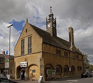
Moreton-in-Marsh is a market town in the Evenlode Valley, within the Cotswolds district and Area of Outstanding Natural Beauty in Gloucestershire, England.
Bayside is a small residential suburb on the Northside of Dublin, Ireland, purpose-built from 1967 on lands previously part of Kilbarrack. It has a planned central service area with retail facilities and lies inshore of Bull Island. It absorbed a neighbouring development, Sutton Park, Dublin, also on Kilbarrack lands adjacent to Baldoyle. Established under Dublin Corporation, it was later moved to the jurisdiction of Fingal County Council.
Voorburg is a town and former municipality in the west part of the province of South Holland, Netherlands. Together with the town Leidschendam and the village Stompwijk, it merged into the municipality of Leidschendam-Voorburg in 2002. Situated adjacent to the city of The Hague, it is often regarded as one of its suburbs.
Mytchett is a village in the Borough of Surrey Heath in Surrey, England, approximately 30 mi (48 km) southwest of central London. It is 2 miles (3 km) to the east of Farnborough, the nearest town. Much of the village dates from the first half of the twentieth century. Mytchett had a population of 4,624 in the 2011 Census.
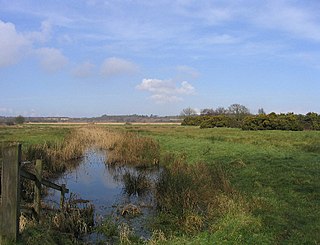
Minsmere is a place in the English county of Suffolk. It is located on the North Sea coast around 3.5 miles (5.6 km) north of Leiston and 1.5 miles (2.4 km) south-east of Westleton within the Suffolk Coast and Heaths AONB. It is the site of the Minsmere RSPB reserve and the original site of Leiston Abbey.

Yerseke is a village situated on the southern shore of the Oosterschelde estuary in the Dutch province of Zeeland. A separate municipality until 1970, it today forms part of the municipality of Reimerswaal. As of 2010 Yerseke had a recorded population of 6,695 inhabitants, living in 2,680 households.

New Buckenham is a village and civil parish in the English county of Norfolk.

Beek en Donk is a town in the province North Brabant, Netherlands. There are 10,028 inhabitants. The spoken language is Peellands.

The Aa is a small river in the Netherlands. It rises near Nederweert in the southeastern province of Limburg, in the Peel region. It flows northwest through the province of North Brabant towards 's-Hertogenbosch, roughly along the Zuid-Willemsvaart canal. In 's-Hertogenbosch, at the confluence of the Aa and the Dommel, the river Dieze is formed, which flows into the Meuse a few km further. The main cities and towns along the Aa's course are Asten, Helmond, Veghel and 's-Hertogenbosch.

Bad Wurzach is a spa town in the state of Baden-Württemberg in southern Germany. It is a well known health-resort destination, and home to the oldest bog spa in Baden-Württemberg, as well as one of the largest contiguous raised bog areas in Europe. It is situated 25 kilometres (16 mi) northeast of Ravensburg and part of Ravensburg County, located in the Upper Swabia region. Since 1950 the town has carried the predicate Bad (spa). It is the third-largest municipality by area in the state of Baden-Württemberg, second only to Stuttgart, which is the capital of the state, and Baiersbronn.
Berlicum is a town in the south of the Netherlands, located in North Brabant's Meierij region near the city of 's-Hertogenbosch and the river Aa. The town was most likely founded between 600 and 700 AD. It was a municipality along with the village of Middelrode until a large-scale municipal reorganisation in 1996, when Berlicum and neighbouring Den Dungen merged with the municipality of Sint-Michielsgestel. In 2009, Berlicum had 9,743 inhabitants.

Chapel-en-le-Frith is a town and civil parish in the Borough of High Peak in Derbyshire, England.

Grañón is a village in the province and autonomous community of La Rioja, Spain. The municipality covers an area of 31.01 square kilometres (11.97 sq mi) and as of 2011 had a population of 307 people. It belongs to the comarca of Santo Domingo de la Calzada and the judicial district of Haro. Its residents, known as Grañoneros or Grañoneras, work primarily in agriculture and the cattle industry, with many young people being forced to leave the village to look for other forms of work in Logroño, the capital of La Rioja.

The Máxima Canal dates from 2014 and runs from the Zuid-Willemsvaart near Den Dungen to the Meuse near Gewande.

Wessem-Nederweert Canal is a canal connecting the Zuid-Willemsvaart at Nederweert to the Meuse near Wessem. Here it meets the wide Juliana Canal that connects to Maastricht.


