
Tomahawk is a city in Lincoln County, Wisconsin, United States. The population was 3,346 at the 2010 census. The city is located to the northeast of the Town of Tomahawk and is not contiguous with it.
Mill Creek or Millcreek may refer to:
Little River may refer to several places:

The Feather River is the principal tributary of the Sacramento River, in the Sacramento Valley of Northern California. The river's main stem is about 73 miles (117 km) long. Its length to its most distant headwater tributary is just over 210 miles (340 km). The main stem Feather River begins in Lake Oroville, where its four long tributary forks join together—the South Fork, Middle Fork, North Fork, and West Branch Feather Rivers. These and other tributaries drain part of the northern Sierra Nevada, and the extreme southern Cascades, as well as a small portion of the Sacramento Valley. The total drainage basin is about 6,200 square miles (16,000 km2), with approximately 3,604 square miles (9,330 km2) above Lake Oroville.

The Etowah River is a 164-mile-long (264 km) waterway that rises northwest of Dahlonega, Georgia, north of Atlanta. On Matthew Carey's 1795 map the river was labeled "High Town River". On later maps, such as the 1839 Cass County map, it was referred to as "Hightower River", a name that was used in most early Cherokee records.
Back Creek is a 59.5-mile-long (95.8 km) tributary of the Potomac River that flows north from Frederick County, Virginia, to Berkeley County in West Virginia's Eastern Panhandle. Back Creek originates along Frederick County's border with Hampshire County, West Virginia, at Farmer's Gap in the Great North Mountain. Its name reflects its location to the west of North Mountain. The perspective of colonists from the east in the 18th century led them to call it "Back Creek", because it lay to the back of North Mountain.
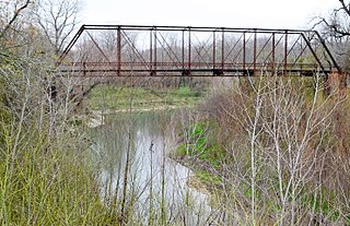
The Little River is a river in Central Texas in the Brazos River watershed. It is formed by the confluence of the Leon River and the Lampasas River near Little River, Texas in Bell County. It flows generally southeast for 75 miles (121 km) until it empties into the Brazos River about 5 miles (8.0 km) southwest of Hearne, at a site called Port Sullivan in Milam County. The Little River has a third tributary, the San Gabriel River, which joins the Little about 8 miles (13 km) north of Rockdale and five miles southwest of Cameron. Cameron, the county seat of Milam County and the only city of any significant size on the Little River, was established in 1846.

Black River is a 78.8-mile-long (126.8 km) river in the U.S. state of Michigan, flowing mostly northward through four Northern Michigan counties: Otsego, Montmorency, Presque Isle, and Cheboygan. The Black River flows into the Cheboygan River at 45°36′13″N84°27′47″W, just south of the city of Cheboygan, and then into Lake Huron. The main branch of the Black River rises in Charlton Township in east-central Otsego County near the boundary with Montmorency County. The East Branch of the Black River rises less than a mile to the east in Vienna Township in Montmorency County. The other major tributaries, Canada Creek, Tomahawk Creek and the Rainy River all rise in northern Montmorency County.

The Chowchilla River is a river in central California, United States and a minor tributary of the San Joaquin River. It flows for 54.2 miles (87.2 km) from the western side of the Sierra Nevada Range to the San Joaquin River system in the San Joaquin Valley.

The Ontonagon River is a river flowing to Lake Superior on the western Upper Peninsula of Michigan in the United States. The main stem of the river is 25 miles (40 km) long and is formed by a confluence of several longer branches, portions of which have been collectively designated as a National Wild and Scenic River. Several waterfalls occur on the river including Agate Falls and Bond Falls.

The Little River is a 29.3-mile-long (47.2 km) tributary of the Etowah River in the U.S. state of Georgia in the United States.
The Naches River is a tributary of the Yakima River in central Washington in the United States. Beginning as the Little Naches River, it is about 75 miles (121 km) long. After the confluence of the Little Naches and Bumping River the name becomes simply the Naches River. The Naches and its tributaries drain a portion of the eastern side of the Cascade Range, east of Mount Rainier and northeast of Mount Adams. In terms of discharge, the Naches River is the largest tributary of the Yakima River.
The Fisher River is a tributary of the Kootenay River in the U.S. state of Montana. The Fisher River properly begins at the confluence of its two main tributaries, the Pleasant Valley Fisher River and the Silver Butte Fisher River. Of the two tributaries, the Pleasant Valley Fisher River is the larger and is sometimes considered part of the Fisher River proper. A variant name of the Fisher River is Pleasant Valley River, and a variant name of the Pleasant Valley Fisher River is Fisher River.

The Miller River is a river in King County, Washington. Named for 1890s prospector John Miller, it is a tributary of the Skykomish River, which it joins near the community of Miller River. The Miller River is about 3.5 miles (5.6 km) long from the confluence of its main tributaries, the East Fork and West Fork. Miller River Campground is located just downriver from the confluence.
The East Branch South Fork Eel River, a tributary of the South Fork Eel River, is formed by the confluence of Cruso Cabin Creek and Elkhorn Creek, in Mendocino County in the U.S. state of California. The river is roughly 25 miles (40 km) long, meandering west to its confluence with the South Fork Eel at Benbow Lake State Recreation Area. Major tributaries of the East Branch include Buck Mountain Creek, Squaw Creek, Rays Creek, and Tom Long Creek. The river flows west, turns north, and flows west again, through rugged terrain in the Coast Range of California. The East Branch is the South Fork Eel's largest tributary.
Lake Mohawksin is the name of the reservoir on the Wisconsin River formed by the Tomahawk Dam. The dam is located about one mile south of the city limits of Tomahawk, Wisconsin. Lake Mohawksin was originally called Lake Tomahawk, but the name was changed to avoid confusion with the town of Lake Tomahawk as well as the lake near that town. The name Mohawksin is derived from a concatenation of the last syllables of the three rivers which flow into it – the Somo, the Tomahawk and the Wisconsin. The name came via a contest won by Herbert Atcherson in 1926.

The Spirit River is a tributary of the Wisconsin River with headwaters in Price County and a confluence with the Wisconsin in Lincoln County just downstream from Lake Mohawksin. The source is Spirit Lake near Timms Hill. The Ojibwe name for the river was Manatokikewe Sebe . The river flows nearly west to east. About one mile from its mouth, the Wisconsin Valley Improvement Company maintains a dam which forms the Spirit River Flowage.

The Jersey City Flowage is an artificial lake on the Tomahawk River, located about one mile above the confluence with the Wisconsin River in Tomahawk, Wisconsin. The dam and the flow are controlled by the Wisconsin Valley Improvement Company. The dam was originally built in 1910 to provide power for a tannery.


