Sonora Reef

Last updated

Sonora Reef is a reef off the west coast of Grays Harbor County, Washington, United States. [1] It is located near the mouth of the Quinault River. Sonora reef was named for the Sonora, a Spanish schooner captained by Juan Francisco de la Bodega y Quadra in his and Bruno de Heceta's 1775 expedition from Mexico to the Pacific Northwest.

Reef A bar of rock, sand, coral or similar material, lying beneath the surface of water

A reef is a bar of rock, sand, coral or similar material, lying beneath the surface of water. Many reefs result from abiotic processes, but the best known reefs are the coral reefs of tropical waters developed through biotic processes dominated by corals and coralline algae.
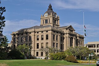
Grays Harbor County, Washington county in the U.S. state of Washington

Grays Harbor County is a county in the U.S. state of Washington. As of the 2010 census, the population was 72,797. The county seat is Montesano, and its largest city is Aberdeen.
Washington (state) State of the United States of America

Washington, officially the State of Washington, is a state in the Pacific Northwest region of the United States. Named for George Washington, the first president of the United States, the state was made out of the western part of the Washington Territory, which was ceded by Britain in 1846 in accordance with the Oregon Treaty in the settlement of the Oregon boundary dispute. It was admitted to the Union as the 42nd state in 1889. Olympia is the state capital; the state's largest city is Seattle. Washington is sometimes referred to as Washington State, to distinguish it from Washington, D.C., the capital of the United States, which is often shortened to Washington.

Related Research Articles

Stonewood, West Virginia City in West Virginia, United States

Stonewood is a city in Harrison County, West Virginia, United States. The population was 1,806 at the 2010 census.

Huehuetenango Municipality in Guatemala

Huehuetenango is a city and a municipality in the highlands of western Guatemala. It is also the capital of the department of Huehuetenango. The municipality's population was over 81,000 people in 2002. The city is 269 kilometres (167 mi) from Guatemala City, and is the last departmental capital on the Pan-American Highway before the Mexican border at La Mesilla.

Montlake Playfield

Montlake Playfield is a 27 acre park and playfield on Portage Bay in the Montlake neighborhood of Seattle, Washington, USA.

Zion, Missouri unincorporated community in Missouri

Zion is an unincorporated community in Central Township in southern Madison County, Missouri, United States. It is located on U.S. Route 67 about ten miles south of Fredericktown. The community is on the banks of Twelve Mile Creek.

Atolia is a town in the Mojave Desert near Randsburg, in northwestern San Bernardino County, California.

Etchohuaquila human settlement in Sonora, Mexico

Etchohuaquila is a small town within the municipality of Navojoa, in the Mexican state of Sonora. 27°18′53″N109°45′37″W. It is about 25 km (16 mi) southeast of Ciudad Obregón. It is known for being the birthplace and hometown of former Major League Baseball pitcher Fernando Valenzuela.

Daisie, California Unincorporated community in California, United States

Daisie is an unincorporated community in Yolo County, California. It lies at an elevation of 16 feet.

Poladlı, Qubadli Place in Qubadli

Poladlı is a village in the Qubadli Rayon of Azerbaijan.

Aşağı Qobuüstü Place in Agdash, Azerbaijan

Aşağı Qobuüstü is a village in the Agdash Rayon of Azerbaijan. The village forms part of the municipality of Qobuüstü.

Hopewell is an unincorporated community in St. Mary's County, Maryland, United States. It lies at an elevation of 7 feet.

Date City, California Unincorporated community in California, United States

Date City is an unincorporated community in Imperial County, California. It is located 4.25 miles (6.8 km) east-southeast of Holtville.

The 596-kilometre (370 mi) long Naoli River flows through Heilongjiang Province in northeast China and is the longest tributary to the Ussuri River.

Scapegoat Mountain is a summit in the Scapegoat Wilderness of Lewis and Clark County, Montana, in the United States. With an elevation of 9,186 feet (2,800 m), Scapegoat Mountain is the 443rd highest summit in the state of Montana.

Ella is an unincorporated community in Jefferson County, in the U.S. state of Pennsylvania.

Vales Mills is an unincorporated community in Vinton County, in the U.S. state of Ohio.

Roundstone is an unincorporated community in Rockcastle County, in the U.S. state of Kentucky.

Moss Run is an unincorporated community in Washington County, in the U.S. state of Ohio.

Bengal was an unincorporated community in Christian County, in the U.S. state of Missouri. It was located along Tory Creek about one mile upstream (south) of Montague along the road to Ponce de Leon which is approximately three miles to the southwest. Spokane was about 2.5 miles to the south-southeast. The location is within South Galloway Township. The elevation of Bengal is 1,243 feet.

Alfeus Island

Alfeus Island is the 310 m long in west-southwest to east-northeast direction and 120 m wide rocky island lying off the north coast of Smith Island in the South Shetland Islands, Antarctica.

References

Coordinates: 47°18′53″N124°18′36″W / 47.31472°N 124.31000°W / 47.31472; -124.31000

Geographic coordinate system Coordinate system

A geographic coordinate system is a coordinate system that enables every location on Earth to be specified by a set of numbers, letters or symbols. The coordinates are often chosen such that one of the numbers represents a vertical position and two or three of the numbers represent a horizontal position; alternatively, a geographic position may be expressed in a combined three-dimensional Cartesian vector. A common choice of coordinates is latitude, longitude and elevation. To specify a location on a plane requires a map projection.