Sonora State Highway 100

Last updated

Sonora 100.svg

Sonora State Highway 100
Carretera Estatal de Sonora 100
Major junctions
From Hermosillo
To El Desemboque
Highway system
Highways in Sonora

Sonora State Highway 100 (Carretera Estatal 100) is a highway in the center of the Mexican state of Sonora.

Mexico country in the southern portion of North America

Mexico, officially the United Mexican States, is a country in the southern portion of North America. It is bordered to the north by the United States; to the south and west by the Pacific Ocean; to the southeast by Guatemala, Belize, and the Caribbean Sea; and to the east by the Gulf of Mexico. Covering almost 2,000,000 square kilometres (770,000 sq mi), the nation is the fifth largest country in the Americas by total area and the 13th largest independent state in the world. With an estimated population of over 120 million people, the country is the eleventh most populous state and the most populous Spanish-speaking state in the world, while being the second most populous nation in Latin America after Brazil. Mexico is a federation comprising 31 states and Mexico City, a special federal entity that is also the capital city and its most populous city. Other metropolises in the state include Guadalajara, Monterrey, Puebla, Toluca, Tijuana and León.

Sonora State of Mexico

Sonora, officially Estado Libre y Soberano de Sonora, is one of 31 states that, with Mexico City, comprise the 32 federal entities of United Mexican States. It is divided into 72 municipalities; the capital city is Hermosillo. Sonora is bordered by the states of Chihuahua to the east, Baja California to the northwest and Sinaloa to the south. To the north, it shares the U.S.–Mexico border with the states of Arizona and New Mexico, and on the west has a significant share of the coastline of the Gulf of California.

It runs from Hermosillo to El Desemboque, connecting also the beach town of Bahía de Kino. [1]

Hermosillo City in Sonora, Mexico

Hermosillo, formerly called Pitic, is a city located centrally in the northwestern Mexican state of Sonora. It is the capital and largest city as well as the main economic center for the state and region. As of 2015, the city has a population of 812,229 inhabitants, making it the 16th largest city in Mexico. The recent city population spur is due to its recent strong industrialization, especially in the automotive industry.

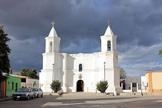
El Desemboque is a town located 376 km from Hermosillo on the shore of Gulf of California in the Mexican state of Sonora; coordinates N 29° 30' 13", W 112° 23' 43". It is part of the Municipality of Pitiquito, and is one of two major villages on the Seri Indian communal property, the other being Punta Chueca. The Spanish name refers to the fact that the Río San Ignacio meets the sea near that point. The Seri name is literally where the clams lie. It has been a good location to find the small clams Protothaca grata (haxöl). According to the Mexican census of 2010, the town had a population of 287 inhabitants. (The town of El Desemboque described in the prior text is not located in the Pitiquito municipality of Sonora. It is a Seri village about 120 km north of Punta Chueca north of Bahia Kino where the dry Rio Ignacio meets the Gulf of California. The El Desemboque in Pitiquito is west of Caborca at the mouth of Rio Concepcion and is a small village catering to weekenders from Caborca. The Seri may have lived at the El Desemboque west of present day Caborca in prehistoric times before Spanish arrived as well as the current Seri town north of Bahia Kino. Their oral history has them living as far north as present day Puerto Penasco which was also an O'Odham settlement as well as present-day Bahia Kino and Isla Tiburon .)

Related Research Articles

Sonora, California City in California, United States

Sonora is the county seat of Tuolumne County, California. The city population was 4,904 during the 2010 Census, an increase of 100 from the 4,804 counted during the 2000 Census. Sonora is the only incorporated community in Tuolumne County.

Huatabampo Place in Sonora, Mexico

Huatabampo is a city in Huatabampo Municipality in the state of Sonora, in northwestern Mexico. It is situated on the Gulf of California, near the mouth of the Mayo River. It is located at latitude 26°49′N109°40′W. Huatabampo is 34 km southwest of Navojoa via Sonora State Highway 56 and Sonora State Highway 149. Mexican Federal Highway 15 can be accessed via Sonora State Highway 176. It is notable as the home of revolutionary general Álvaro Obregón, a successful chickpea farmer before the Mexican Revolution, and now his burial site.

Sonoyta Town in Sonora, Mexico

Sonoyta, Sonora is a town in the northern Mexican state of Sonora. It stands on the U.S.-Mexico border, facing Lukeville, Arizona, in the United States. It is the municipal seat of the municipality of Plutarco Elías Calles.

Federal Highway 8 is a free part of the federal highways corridors in Sonora. It is connected to the roadway that transitions from the border post at Lukeville, Arizona where it connects with Arizona State Route 85, proceeds south through Puerto Peñasco with Sonoyta, Sonora, and intersects with Fed. 2. It continues through the El Pinacate and Gran Desierto de Altar Biosphere Reserve until ending at Puerto Peñasco, a length of 100 km (62 mi).

Sonora Pass

Sonora Pass is the second-highest highway pass in the Sierra Nevada, lower by 321 ft. than Tioga Pass to the south. State Route 108 traverses the pass.

New York State Route 226 highway in New York

New York State Route 226 (NY 226) is a north–south state highway in the Finger Lakes region of New York in the United States. The southern terminus of the route is at an interchange with the Southern Tier Expressway just west of the Savona village line in the town of Bath. Its northern terminus is at an intersection with NY 14A in the town of Reading.

Ohio State Route 797 highway in Ohio

State Route 797 was a very short, unsigned north–south state highway in the eastern portion of the U.S. state of Ohio. At the time of its deletion of the route from the state highway system, SR 797 ran from its southern terminus at the U.S. Route 22/U.S. Route 40 concurrency about 4.75 miles (7.64 km) northeast of Zanesville to its northern terminus less than 0.40 miles (0.64 km) to the northwest at Interstate 70 at its exit 160, a diamond interchange. North of the interchange, the road continues to Sonora on Muskingum County Road 52, Sonora Road.

State Route 286 is a highway in southern Arizona that runs from its junction with State Route 86 west of Tucson to the U.S.-Mexico border at Sasabe. It is largely a north–south route.

Aconchi Place in Sonora, Mexico

Aconchi is a small city in Aconchi Municipality that surrounds it, located in the center of the Mexican state of Sonora. The population of the municipality was 2,452 in 2005 in an area of 358.74 square kilometers. It became a municipality in 1932 but was founded in 1639 the Jesuit missionary Bartolomé Castaño.

Quiriego human settlement in Mexico

Quiriego is a small town and the county seat of the Municipality of Quiriego, located in the southeast of the Mexican state of Sonora.

Sonora State Highway 149 is a highway in the south of the Mexican state of Sonora.

Sonora State Highway 162 is a highway in the south of the Mexican state of Sonora.

Sonora State Highway 56 is a highway in the south of the Mexican state of Sonora.

Sonora State Highway 40 is a highway in the north-west of the Mexican state of Sonora.

Sonora State Highway 176 is a highway in the south of the Mexican state of Sonora.

Sonora State Highway 37 is a highway in the Mexican state of Sonora.

Federal Highway 17 is a free part of the federal highways corridors of Mexico. The route runs from the Mexico – United States border at Agua Prieta, Sonora south to Moctezuma. The northern terminus of Fed. 17 transitions north into the United States at Douglas, Arizona as U.S. Route 191. The total length of the highway is about 169 km.

Sonora State Highway 155 is a highway in the south of the Mexican state of Sonora.

Sonora State Highway 147 is a highway in the south of the Mexican state of Sonora.

References

  1. Google Maps (2008). "Overview of Sonora State Highway 100". [Map]. Retrieved 2008-12-16.