Huatabampo is a city in Huatabampo Municipality in the state of Sonora, in northwestern Mexico. It is situated on the Gulf of California, near the mouth of the Mayo River. It is located at latitude 26°49′N109°40′W. Huatabampo is 34 km southwest of Navojoa via Sonora State Highway 56 and Sonora State Highway 149. Mexican Federal Highway 15 can be accessed via Sonora State Highway 176. It is notable as the home of revolutionary general Álvaro Obregón, a successful chickpea farmer before the Mexican Revolution, and now his burial site.

Navojoa is the fifth-largest city in the northern Mexican state of Sonora and is situated in the southern part of the state. The city is the administrative seat of Navojoa Municipality, located in the Mayo River Valley.

Sonoyta, Sonora is a town in the northern Mexican state of Sonora. It stands on the U.S.-Mexico border, facing Lukeville, Arizona, in the United States. It is the municipal seat of the municipality of Plutarco Elías Calles.

New York State Route 149 (NY 149) is an east–west state highway that runs for 32.20 miles (51.82 km) through the Capital District of New York in the United States. It begins at exit 20 on the Adirondack Northway in the Warren County town of Queensbury and intersects U.S. Route 9 (US 9), US 4, and NY 22, among other routes, as it progresses eastward to its eastern end at the Vermont state line in the Washington County village of Granville. Here, the highway becomes Vermont Route 149 (VT 149) and continues for an additional 1.302 miles (2.095 km) to an intersection with VT 30 in Rutland County. Both NY 149 and VT 149 traverse mostly rural areas.
Federal Highway 8 is a free part of the federal highways corridors in Sonora. It is connected to the roadway that transitions from the border post at Lukeville, Arizona where it connects with Arizona State Route 85, proceeds south through Puerto Peñasco with Sonoyta, Sonora, and intersects with Fed. 2. It continues through the El Pinacate and Gran Desierto de Altar Biosphere Reserve until ending at Puerto Peñasco, a length of 100 km (62 mi).
State Route 149 is a short state highway that helps to connect Oroville and Chico through rural Butte County. Connecting State Route 70 at Wicks Corner with State Route 99 east of Durham, it forms part of the primary north–south highway through the eastern Sacramento Valley, a Focus Route of the Interregional Road System. SR 149 was formerly part of the Oroville-Chico Highway; the majority of the latter was merged into other routes. In the mid-1970s, the highway was reallocated onto a newer two-lane alignment. A project to widen the two-lane road to a four-lane expressway was completed in late 2008, removing the bottleneck from the Oroville-Chico highway.

Sonora Pass is the second-highest highway pass in the Sierra Nevada, lower by 321 ft. than Tioga Pass to the south. State Route 108 traverses the pass.

M-149 is a 10.605-mile (17.07 km) north–south state trunkline highway in the Upper Peninsula of the US state of Michigan. It connects US Highway 2 (US 2) in Thompson with the Palms Book and Indian Lake state parks. The highway was originally designed in the 1930s and extended a few years later. The last major changes to the highway were made in the 1960s when it was completely paved for the first time.

State Route 797 was a very short, unsigned north–south state highway in the eastern portion of the U.S. state of Ohio. At the time of its deletion of the route from the state highway system, SR 797 ran from its southern terminus at the U.S. Route 22/U.S. Route 40 concurrency about 4.75 miles (7.64 km) northeast of Zanesville to its northern terminus less than 0.40 miles (0.64 km) to the northwest at Interstate 70 at its exit 160, a diamond interchange. North of the interchange, the road continues to Sonora on Muskingum County Road 52, Sonora Road.
Aconchi is a small city in Aconchi Municipality that surrounds it, located in the center of the Mexican state of Sonora. The population of the municipality was 2,452 in 2005 in an area of 358.74 square kilometers. It became a municipality in 1932 but was founded in 1639 the Jesuit missionary Bartolomé Castaño.
Sonora State Highway 162 is a highway in the south of the Mexican state of Sonora.
Sonora State Highway 100 is a highway in the center of the Mexican state of Sonora.
Sonora State Highway 40 is a highway in the north-west of the Mexican state of Sonora.
Sonora State Highway 176 is a highway in the south of the Mexican state of Sonora.
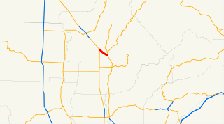
Sonora State Highway 37 is a highway in the Mexican state of Sonora.
Federal Highway 17 is a free part of the federal highways corridors of Mexico. The route runs from the Mexico – United States border at Agua Prieta, Sonora south to Moctezuma. The northern terminus of Fed. 17 transitions north into the United States at Douglas, Arizona as U.S. Route 191. The total length of the highway is about 169 km.
Sonora State Highway 155 is a highway in the south of the Mexican state of Sonora.
Sonora State Highway 147 is a highway in the south of the Mexican state of Sonora.