The Snake River is a major river in the interior Pacific Northwest region of the United States. About 1,080 miles (1,740 km) long, it is the largest tributary of the Columbia River, which is the largest North American river that empties into the Pacific Ocean. Beginning in Yellowstone National Park, western Wyoming, it flows across the arid Snake River Plain of southern Idaho, the rugged Hells Canyon on the borders of Idaho, Oregon and Washington, and finally the rolling Palouse Hills of southeast Washington. It joins the Columbia River just downstream from the Tri-Cities, Washington, in the southern Columbia Basin.
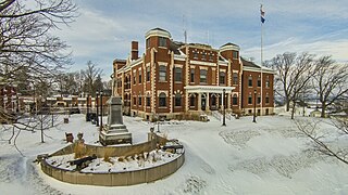
Kewaunee County is a county located in the U.S. state of Wisconsin. As of the 2020 census, the population was 20,563. Its county seat is Kewaunee. The county was created in 1852 and organized in 1859. Its Menominee name is Kewāneh, an archaic name for a species of duck. Kewaunee County is part of the Green Bay, WI Metropolitan Statistical Area as well as the Green Bay-Shawano, WI Combined Statistical Area.

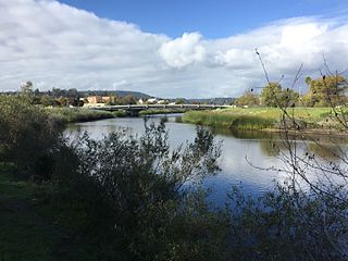
The Humber River is a river in Southern Ontario, Canada. It is in the Great Lakes Basin, is a tributary of Lake Ontario and is one of two major rivers on either side of the city of Toronto, the other being the Don River to the east. It was designated a Canadian Heritage River on September 24, 1999.

The Rogue River in southwestern Oregon in the United States flows about 215 miles (346 km) in a generally westward direction from the Cascade Range to the Pacific Ocean. Known for its salmon runs, whitewater rafting, and rugged scenery, it was one of the original eight rivers named in the Wild and Scenic Rivers Act of 1968. Beginning near Crater Lake, which occupies the caldera left by the explosive volcanic eruption and collapse of Mount Mazama, the river flows through the geologically young High Cascades and the older Western Cascades, another volcanic province. Further west, the river passes through multiple exotic terranes of the more ancient Klamath Mountains. In the Kalmiopsis Wilderness section of the Rogue basin are some of the world's best examples of rocks that form the Earth's mantle. Near the mouth of the river, the only dinosaur fragments ever discovered in Oregon were found in the Otter Point Formation, along the coast of Curry County.

The Little Miami River is a Class I tributary of the Ohio River that flows 111 miles (179 km) through five counties in southwestern Ohio in the United States. The Little Miami joins the Ohio River east of Cincinnati. It forms parts of the borders between Hamilton and Clermont counties and between Hamilton and Warren counties. The Little Miami River is one of 156 American rivers designated by the U.S. Congress or the Secretary of the Interior as a National Wild and Scenic River and lends its name to the adjacent Little Miami Scenic Trail.

The Sammamish River flows through north King County, Washington for about 14 miles (23 km), draining Lake Sammamish into Lake Washington. Along its course, the Sammamish River flows through Redmond, Woodinville, Bothell, and Kenmore.
The San Lorenzo River is a 29.3-mile-long (47.2 km) river in the U.S. state of California. The name San Lorenzo derives from the Spanish language for "Saint Lawrence" due to its reported sighting on that saint's feast day by Spanish explorers. Its headwaters originate in Castle Rock State Park in the Santa Cruz Mountains and flow south by southeast through the San Lorenzo Valley before passing through Santa Cruz and emptying into Monterey Bay and the Pacific Ocean.

The Kern River is an Endangered, Wild and Scenic river in the U.S. state of California, approximately 165 miles (270 km) long. It drains an area of the southern Sierra Nevada mountains northeast of Bakersfield. Fed by snowmelt near Mount Whitney, the river passes through scenic canyons in the mountains and is a popular destination for whitewater rafting and kayaking. It is the southernmost major river system in the Sierra Nevada, and is the only major river in the Sierra that drains in a southerly direction.

Lake Oroville is a reservoir formed by the Oroville Dam impounding the Feather River, located in Butte County, northern California. The lake is situated 5 miles (8 km) northeast of the city of Oroville, within the Lake Oroville State Recreation Area, in the western foothills of the Sierra Nevada. Known as the second-largest reservoir in California, Lake Oroville is treated as a keystone facility within the California State Water Project by storing water, providing flood control, recreation, freshwater releases to assist in controlling the salinity intrusion into the Sacramento-San Joaquin Delta and protecting fish and wildlife.
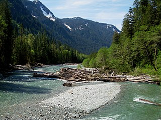
The Baker River is an approximately 30-mile (48 km), southward-flowing tributary of the Skagit River in northwestern Washington in the United States. It drains an area of the high North Cascades in the watershed of Puget Sound north of Seattle, and east of Mount Baker. With a watershed of approximately 270 square miles (700 km2) in a complex of deep valleys partially inside North Cascades National Park, it is the last major tributary of the Skagit before the larger river reaches its mouth on Skagit Bay. The river flows through Concrete, Washington, near its mouth and has two hydroelectric dams owned by Puget Sound Energy.

Lake Natoma is a small lake in the Western United States, along the lower American River, between Folsom and Nimbus Dams in Sacramento County, California. The lake is located within the Folsom Lake State Recreation Area which maintains the facilities and bike trails surrounding the lake. Lake Natoma is located 15 miles (24 km) east of Sacramento, and has 500 surface acres of water. The total length of lake Natoma is 4 miles (6.4 km).

The Los Gatos Creek runs 24 miles (39 km) in California through Santa Clara Valley Water District's Guadalupe Watershed from the Santa Cruz Mountains northward through the Santa Clara Valley until its confluence with the Guadalupe River in downtown San Jose. The Guadalupe River then continues onward into San Francisco Bay.

Issaquah Creek is a small stream flowing through the city of Issaquah and nearby communities, in the U.S. state of Washington. Its headwaters are on the slopes of Cougar, Squak, Tiger, and Taylor mountains in the Issaquah Alps. Tributaries of Issaquah Creek include Holder Creek, Carey Creek, Fifteen-mile Creek, McDonald Creek, East Fork Issaquah Creek, and North Fork Issaquah Creek. The creek empties into the south end of Lake Sammamish. The lake's outlet is the Sammamish River, which in turn empties into Lake Washington and ultimately Puget Sound.

Uvas Creek is a 29.5-mile-long (47.5 km) mainly southward-flowing stream originating on Loma Prieta peak of the Santa Cruz Mountains, in Santa Clara County, California, United States. The creek descends through Uvas Canyon County Park into Uvas Reservoir near Morgan Hill, and on through Uvas Creek Preserve and Christmas Hill Park in Gilroy. Upon passing U.S. Highway 101 it is known as Carnadero Creek, shortly before the confluence with the Pajaro River at the Santa Clara County - San Benito County boundary.
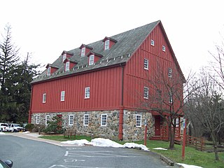
Gunpowder Falls State Park is a public recreation area comprising six non-contiguous areas covering 15,088 acres (6,106 ha) in northeastern Baltimore County and western Harford County, Maryland. The state park is primarily made up of the stream valleys of the Big and Little Gunpowder Falls and the Gunpowder River; its natural features range from tidal marshes to rugged interior slopes. The park has over 120 miles of trails for hiking, biking, horseback riding, and cross-country skiing plus facilities for picnicking, tubing, canoeing and kayaking, tide-water fishing and crabbing, fly fishing, and hunting, among other activities. It is managed by the Maryland Department of Natural Resources.

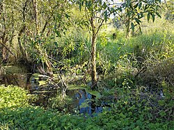
Boeing Creek is a stream in the U.S. state of Washington, located in the city of Shoreline, just north of Seattle. It is about 1.6 miles (2.6 km) long and empties into Puget Sound. The creek is heavily modified along its course, and in many places has been diverted into culverts. The watershed of Boeing Creek is about 11.2 square miles (29 km2) in size, with two main tributaries aside from the mainstem. The creek takes its name from William Boeing, who built a mansion along the creek in 1913. Despite the river modifications and stormwater pollution, the creek supports a variety of riparian habitats, native animals and fishes.

Big Butte Creek is a 12-mile-long (19 km) tributary of the Rogue River in the U.S. state of Oregon. It drains approximately 245 square miles (635 km2) of Jackson County. Its two forks, the North Fork and the South Fork, both begin high in the Cascade Range near Mount McLoughlin. Flowing predominantly west, they meet near the city of Butte Falls. The main stem flows generally northwest until it empties into the Rogue Falls was incorporated in 1911, and remains the only incorporated town within the watershed's boundaries.

Saint Martins is a geographic parish in Saint John County, New Brunswick, Canada.

Honey Creek State Park is located in Appanoose County, Iowa. The park has a hunting unit, a resort, and a fish hatchery.
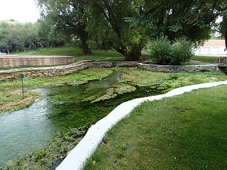
Big Spring Creek is a tributary of the Judith River in Fergus County, Montana near Lewistown, Montana. The creek originates from a first magnitude artesian spring approximately 6 miles (9.7 km) south of Lewistown and flows north, northwest for 30 miles (48 km) to its confluence with the Judith River. The spring is one of the largest in the world flowing at approximately 50,000 to 64,000 US gallons per minute out of the Madison-Limestone formation in the foothills of the Big Snowy Mountains. The creek flows through and under the town of Lewistown. For three blocks spanning Main Street, the creek runs underneath the town in a man-made channel that was created as the town was built over the creek. The spring provides Lewistown's water supply, which requires no treatment for use by consumers.