Fairwood, King County, Washington

Last updated
Fairwood, Washington
King County Washington Incorporated and Unincorporated areas Cascade-Fairwood Highlighted.svg
Location of Fairwood, Washington
Coordinates: 47°26′49″N122°08′37″W / 47.44694°N 122.14361°W / 47.44694; -122.14361 Coordinates: 47°26′49″N122°08′37″W / 47.44694°N 122.14361°W / 47.44694; -122.14361
Country United States
State Washington
County King
Area
[1]
  Total4.86 sq mi (12.60 km2)
  Land4.86 sq mi (12.60 km2)
  Water0.0 sq mi (0.0 km2)
Elevation
500 ft (200 m)
Population
 (2010)
  Total19,102
  Density3,927/sq mi (1,516.4/km2)
Time zone UTC-8 (Pacific (PST))
  Summer (DST) UTC-7 (PDT)
FIPS code 53-23160 [1]
GNIS feature ID2407983 [2]

Fairwood is an unincorporated community and census-designated place (CDP) in King County, Washington, United States. As of the 2010 census the population was 19,102. [1]

Contents

Geography

Fairwood is located at 47°26′49″N122°08′37″W / 47.44694°N 122.14361°W / 47.44694; -122.14361 (47.447062, -122.143586), [3] 16 miles (26 km) southeast of downtown Seattle. The Fairwood CDP is bordered to the north and west by the city of Renton and to the east by the Maple Heights-Lake Desire CDP, which shares a ZIP Code (Renton's 98058) with Fairwood. Population and demographic statistics in this article are only for the Fairwood CDP, not the larger mailing area.

According to the United States Census Bureau, the CDP has a total area of 4.9 square miles (12.6 km2). [1]

The Fairwood area occupies a plateau which extends from the bluffs of the Cedar River valley on the north down toward State Route 167 and the Kent Valley on the west.

Climate

Fairwood's climate features cool/mild wet winters and dry summers. The warmest month of the year is July, and the coldest is December.

Autumn, winter, and spring are frequently characterized by rain in the Seattle area, while the summers are fairly dry and warm by comparison. Fairwood's location closer to downslope winds from the Cascade Range means it can get fairly hot in the summers. An exception to the damp weather occurs in El Niño years when the Seattle area stays fairly dry. Fairwood typically receives some snowfall on an annual basis, but heavy snow is rare.

Geographic location

Parks and recreation

The following parks and recreation areas are within the Fairwood CDP:

Other areas outside the CDP but still considered within the Fairwood area are:

Education

The Fairwood CDP is served by two school districts, Renton and Kent. The Tahoma School District covers parts of the Fairwood ZIP code area that are within the neighboring Maple Heights-Lake Desire CDP.

Schools serving the Fairwood area are:

High schools

Middle schools

Elementary schools

Major roads

There are three major arterials that run through Fairwood. Petrovitsky Road runs east/west through Fairwood's commercial core and many of its neighborhoods. It stretches from downtown Renton, near the Boeing Renton Factory, and Boeing Commercial Aviation; where many Fairwood residents work, to Maple Valley, winding through the rural timberland, ranches, and farms of eastern Fairwood. 140th Avenue runs north/south adjacent to the Fairwood shopping centers and Soos Creek. It stretches from Maple Valley highway on the north and leads 9 miles to Green River Community College by way of Kent's east hill. State Route 169 (Maple Valley highway) on the northern end of Fairwood provides short access to Interstate 405.

Public safety

Fairwood fire protection and emergency medical services are provided by Fire Districts 40 and 37. The Fire District 40 station is located on Petrovitsky Road in the center of Fairwood. The King County Sheriff provides policing services to the area.

Demographics

As of the census of 2010, there were 19,102 people, 7,101 households, and 5,235 families residing in the CDP. The population density was 3,927 people per square mile (1,516.4/km²). There were 7,367 housing units, of which 266, or 3.6%, were vacant. The racial makeup of the CDP was 65.3% White, 7.4% African American, 0.5% Native American, 17.6% Asian, 0.6% Pacific Islander, 2.4% some other race, and 6.3% from two or more races. Hispanic or Latino of any race were 6.5% of the population. [10]

Of the 7,101 households, 37.0% had children under the age of 18 living with them, 58.5% were headed by married couples living together, 10.8% had a female householder with no husband present, and 26.3% were non-families. 19.8% of all households were made up of individuals, and 4.7% were someone living alone who was 65 years of age or older. The average household size was 2.68, and the average family size was 3.10. [10]

In the CDP, 24.6% of the population were under the age of 18, 7.6% were from 18 to 24, 28.0% were from 25 to 44, 29.6% were from 45 to 64, and 10.3% were 65 years of age or older. The median age was 38.3 years. For every 100 females there were 97.5 males. For every 100 females age 18 and over, there were 94.1 males. [10]

For the period 2013-17, the estimated median annual income for a household in the CDP was $93,810, and the median income for a family was $102,333. Male full-time workers had a median income of $67,019 versus $49,907 for females. The per capita income for the CDP was $41,134. About 3.5% of families and 4.8% of the total population were below the poverty line, including 9.4% of those under age 18 and 2.3% of those age 65 or over. [11]

Economy

Residents are employed at a slightly higher rate than the rest of the County and the median income is $85,000 (versus $69,000 for King County). More than half of the workers in the Fairwood area work in south King County with less than a 30-minute commute. A significant number of Fairwood workers are in professional, management and sales jobs (70%).

Politics

On the national level, Cascade-Fairwood leans towards candidates of the Democratic Party. Democrat John Kerry received about 56 percent of the vote in 2004 to Republican George W. Bush's 43 percent. Despite this, there are a number of pockets where the Republican Party often wins marginal majorities.

The Cascade area (approximately a population of 17,000), which included much of unincorporated Benson Hill north of SE 200 Street and west of 128th Avenue SE, voted to be annexed by the city of Renton in 2007, effective March 1, 2008. The remaining unincorporated area of King County, which is primarily the Fairwood community, has the option of annexing to the city of Renton or incorporating as a city.

In February 2005, the Fairwood Task Force filed a Notice of Intent to Incorporation with King County, to establish a new City of Fairwood. This attempt to incorporate was narrowly defeated in the election held on September 19, 2006. In that election, 48.22% of the votes were for incorporation; a swing of only 136 votes in the election would have changed the result.

The process to form a City of Fairwood was restarted by the Fairwood Municipal Initiative when it filed another Notice of Proposed Incorporation with King County, Washington on April 16, 2007. [12] As of October 2008, the incorporation effort is now under the jurisdiction of the King County Boundary Review Board (BRB) [13] and a consulting firm hired by the BRB is conducting an economic feasibility study for the proposed city of Fairwood.

On November 3, 2009 Proposition 1 to incorporate a city of Fairwood failed again, as it did in 2006.

Efforts are also ongoing to annex the Fairwood area into the city of Renton. [14] Additionally, the Red Mill area of the Fairwood PAA is presently undertaking a separate petition-method annexation. [15]

On November 2, 2010, 57.6% of voters voted against a proposition to annex Fairwood to Renton. [16]

Related Research Articles

<span class="mw-page-title-main">SeaTac, Washington</span> City in King County, Washington, United States

SeaTac is a city in southern King County, Washington, United States. The city is an inner-ring suburb of Seattle and part of the Seattle metropolitan area. The name "SeaTac" is derived from the Seattle–Tacoma International Airport, itself a portmanteau of Seattle and Tacoma.

<span class="mw-page-title-main">Skamania County, Washington</span> County in Washington, United States

Skamania County is a county located in the U.S. state of Washington. As of the 2020 census, the population was 12,036. The county seat and largest incorporated city is Stevenson, although the Carson River Valley CDP is more populous. Skamania County is included in the Portland-Vancouver-Hillsboro, OR-WA Metropolitan Statistical Area.

<span class="mw-page-title-main">King County, Washington</span> County in Washington, United States

King County is located in the U.S. state of Washington. The population was 2,269,675 in the 2020 census, making it the most populous county in Washington, and the 13th-most populous in the United States. The county seat is Seattle, also the state's most populous city.

<span class="mw-page-title-main">Jones County, Iowa</span> County in Iowa, United States

Jones County is a county in the U.S. state of Iowa. As of the 2020 census the population was 20,646. The county seat is Anamosa. The county was founded in 1837 and named after George Wallace Jones, a United States senator and member of Congress.

<span class="mw-page-title-main">Munds Park, Arizona</span> CDP in Coconino County, Arizona

Munds Park is an unincorporated census-designated place (CDP) in Coconino County, Arizona, United States. The year round population was 631 at the 2010 census.

<span class="mw-page-title-main">Glenn Dale, Maryland</span> CDP in Maryland

Glenn Dale is an unincorporated area and census-designated place (CDP) in Prince George's County, Maryland, United States. The population was 14,698 at the 2020 census. Glenn Dale is home to the Glenn Dale Hospital, an abandoned sanatorium, and the USDA Plant Introduction Station.

<span class="mw-page-title-main">East Renton Highlands, Washington</span> Census-designated place in Washington, United States

East Renton Highlands is a census-designated place (CDP) in King County, Washington, United States, located between Issaquah and Renton. The population was 11,937 at the 2020 census.

<span class="mw-page-title-main">Hobart, Washington</span> Census-designated place in Washington, United States

Hobart is an unincorporated community and census-designated place (CDP) in King County, Washington, United States. The population was 6,767 at the 2020 census.

<span class="mw-page-title-main">Lake Morton-Berrydale, Washington</span> Census-designated place in Washington, United States

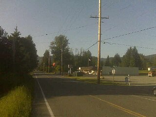
Lake Morton-Berrydale is a census-designated place (CDP) in King County, Washington, United States. The population was 10,474 at the 2020 census.

<span class="mw-page-title-main">Maple Heights-Lake Desire, Washington</span> Census-designated place in Washington, United States

Maple Heights-Lake Desire is a census-designated place (CDP) in King County, Washington, United States. At the 2010 census, the population was 3,152.

<span class="mw-page-title-main">Maple Valley, Washington</span> City in Washington, United States

Maple Valley is a city in King County, Washington, United States. The population was 28,013 at the 2020 census. The city functions as a commuter town for residents, though there is an increasing amount of commercial activity in the area.

<span class="mw-page-title-main">Mirrormont, Washington</span> Census-designated place in Washington, United States

Mirrormont is a census-designated place (CDP) in King County, Washington, United States, south of Issaquah. The population was 3,858 at the 2020 census. Within the last decade, the area has seen a shift in development as larger homes have been constructed in Cedar Grove, the Highlands at Tiger Mountain and Mirrormont.

<span class="mw-page-title-main">Newcastle, Washington</span> City in Washington, United States

Newcastle is an Eastside city in King County, Washington, United States. The population was 10,380 at the 2010 census and an estimated 12,292 in 2019.

<span class="mw-page-title-main">Renton, Washington</span> City in Washington, United States

Renton is a city in King County, Washington, United States, and an inner-ring suburb of Seattle. Situated 11 miles (18 km) southeast of downtown Seattle, Renton straddles the southeast shore of Lake Washington, at the mouth of the Cedar River. As of the 2020 census, the population of Renton was 106,785, up from 90,927 at the 2010 census. The city is currently the sixth-largest municipality in greater Seattle and the ninth-largest in Washington state.

<span class="mw-page-title-main">Sammamish, Washington</span> City in Washington, United States

Sammamish is a city in King County, Washington, United States. The population was 67,455 at the 2020 census. Located on a plateau, the city is bordered by Lake Sammamish to the west and the Snoqualmie Valley to the east. Sammamish is situated 20 miles east of Seattle, is a member of the Eastside, and is a part of the Seattle metropolitan area.

<span class="mw-page-title-main">Snoqualmie Pass, Washington</span> Census-designated place in Washington, United States

Snoqualmie Pass is a census-designated place (CDP) in Kittitas County, Washington, United States. It includes the unincorporated community of Hyak. The population was 311 at the 2010 census.

<span class="mw-page-title-main">South Hill, Washington</span> CDP in Washington, United States

South Hill is a census-designated place (CDP) in Pierce County, Washington, immediately south of Puyallup. The population was 64,708 at time of the 2020 census, up from 52,431 in 2010. The area primarily consists of suburban housing and shopping with several retail shopping centers, residential neighborhoods, and apartment/condo complexes throughout.

<span class="mw-page-title-main">Fairwood, Spokane County, Washington</span> CDP in Washington, United States

Fairwood is a census-designated place (CDP) in Spokane County, Washington, United States. The population was 10,541 at the 2020 census.

<span class="mw-page-title-main">Sudden Valley, Washington</span> Census-designated place in Washington, United States

Sudden Valley is a census-designated place (CDP) just outside of Bellingham in Whatcom County, Washington.

Shadow Lake is a census-designated place (CDP) in King County, Washington, United States. The population was 2,262 at the 2010 census.

References

  1. 1 2 3 4 "Geographic Identifiers: 2010 Census Summary File 1 (G001), Fairwood CDP (King County), Washington". American FactFinder. U.S. Census Bureau. Archived from the original on February 13, 2020. Retrieved June 7, 2019.
  2. "Fairwood Census Designated Place". Geographic Names Information System . United States Geological Survey, United States Department of the Interior.
  3. "US Gazetteer files: 2010, 2000, and 1990". United States Census Bureau. 2011-02-12. Retrieved 2011-04-23.
  4. "Services > Swim & Fitnes". Fairwood Golf & Country Club. Retrieved 15 February 2013.
  5. "Fairwood Golf & Country Club, Fairwood Golf Course". GolfLink. Demand Media, Inc. Retrieved 15 February 2013.
  6. Milan, Frana. "Shiny new fields coming to Petrovitsky Park". King County Parks Plog. WordPress. Retrieved 15 February 2013.
  7. "PETROVITSKY PARK". thespotsport.com. The Spot Sport. Archived from the original on 2010-09-16. Retrieved 15 February 2013.
  8. "Spring Lake / Lake Desire Park" (PDF). your.kingcounty.gov. King County, Washington. Archived from the original (PDF) on 2013-01-27. Retrieved 15 February 2013.
  9. Hite, Will. "McGarvey Park, Renton – Cedar Mountain". WillhiteWeb.com. WillhiteWeb. Retrieved 15 February 2013.
  10. 1 2 3 "Profile of General Population and Housing Characteristics: 2010 Census Summary File 1 (DP-1), Fairwood CDP (King County), Washington". American FactFinder. U.S. Census Bureau. Archived from the original on February 13, 2020. Retrieved June 7, 2019.
  11. "Selected Economic Characteristics: 2013-2017 American Community Survey 5-Year Estimates (DP03), Fairwood CDP (King County), Washington". American FactFinder. U.S. Census Bureau. Archived from the original on February 13, 2020. Retrieved June 7, 2019.
  12. Fairwood Municipal Initiative Archived 2008-08-20 at the Wayback Machine
  13. "King County Boundary Review Board". Archived from the original on 2008-11-20. Retrieved 2008-10-27.
  14. "Choose Renton". Archived from the original on 2017-09-14. Retrieved 2018-07-17.
  15. Red Mill Annexation Map [ permanent dead link ]
  16. "Results – King County Elections". Archived from the original on 2011-09-07. Retrieved 2011-05-20.