Riverton, Washington

Last updated
Riverton, Washington
Former CDP
Tukwila - Duwamish River footbridge - 01.jpg
The 119th Street footbridge over the upper portion of the Duwamish River leading to historic Riverton, seen here from the Allentown side
USA Washington location map.svg
Red pog.svg
Riverton
Location in Washington and the United States
Usa edcp location map.svg
Red pog.svg
Riverton
Riverton (the United States)
Coordinates: 47°29′41″N122°18′40″W / 47.49472°N 122.31111°W / 47.49472; -122.31111 Coordinates: 47°29′41″N122°18′40″W / 47.49472°N 122.31111°W / 47.49472; -122.31111
Country United States
State Washington
County King
Area
  Total1.182 sq mi (3.061 km2)
  Land1.182 sq mi (3.061 km2)
  Water0.000 sq mi (0.000 km2)
Elevation
330 ft (100 m)
Population
 (2010)
  Total6,407
  Density5,421/sq mi (2,092.9/km2)
Time zone UTC-8 (Pacific (PST))
  Summer (DST) UTC-7 (PDT)
GNIS feature ID1507825 [1]
FIPS code 53-58865

Riverton was a census-designated place (CDP) in King County, Washington, United States. The population was 6,407 at the 2010 census. [2] Riverton was formerly part of the Riverton-Boulevard Park CDP, which was split up for the 2010 census into Riverton and Boulevard Park. [3] In April 2010 the community was annexed by the city of Burien and is no longer a CDP.

Contents

Riverton also refers to a neighboring former community in part of what is now Tukwila in the Duwamish River Valley. It was on the left bank of the Duwamish, not far from the location on the right bank of the present-day Tukwila Community Center. [4]

History

Riverton lent its name to an early 20th-century bridge, variously known as the Riverton Draw Bridge, the Riverton Drawspan, and King County Bridge 622-A. Built 1903, the bridge developed a reputation for being rather unsafe. It closed to vehicles 1919, and was demolished 1927. A remnant of the central pier can still be seen in the river as of 2009, visible either from the riverbank [5] or from the 119th St. S. pedestrian bridge or the Allentown Bridge. [6]

Geography

Riverton is located at 47°29′41″N122°18′40″W / 47.49472°N 122.31111°W / 47.49472; -122.31111 (47.494614, -122.311248). [7]

According to the United States Census Bureau, the CDP had a total area of 1.182 square miles (3.06 km2), of which, 1.182 square miles (3.06 km2) of it is land and 0.000 square miles (0 km2) of it (0%) is water.

Related Research Articles

<span class="mw-page-title-main">King County, Washington</span> County in Washington, United States

King County is located in the U.S. state of Washington. The population was 2,269,675 in the 2020 census, making it the most populous county in Washington, and the 13th-most populous in the United States. The county seat is Seattle, also the state's most populous city.

<span class="mw-page-title-main">Funny River, Alaska</span> Census-designated place in Alaska, United States

Funny River is a census-designated place (CDP) in Kenai Peninsula Borough, Alaska, United States. At the 2010 census the population was 877, up from 636 in 2000.

<span class="mw-page-title-main">Natural Bridge, New York</span> Census-designated place in New York, United States

Natural Bridge is a hamlet and census-designated place (CDP) in Jefferson County, New York, United States. As of the 2010 census it had a population of 365.

<span class="mw-page-title-main">Brinnon, Washington</span> Census-designated place in Washington, United States

Brinnon is a census-designated place (CDP) in Jefferson County, Washington, United States. The population was 797 at the 2010 census. The community is named for Ewell P. Brinnon, who in 1860 took a donation land claim at the mouth of the Duckabush River. Its known landmarks include Dosewallips State Park and Black Point Marina. Camp Parsons, founded in 1919 and the oldest Boy Scout camp west of the Mississippi River, sits just outside the north end of the CDP.

<span class="mw-page-title-main">Bryn Mawr-Skyway, Washington</span> Census-designated place in Washington, United States

Bryn Mawr-Skyway is a census-designated place (CDP) in King County, Washington, United States. The population was 17,397 at the 2020 census.

<span class="mw-page-title-main">Burien, Washington</span> City in Washington, United States

Burien is a suburban city in King County, Washington, United States, located south of Seattle on Puget Sound. As of the 2020 census, Burien's population was 52,066, which is a 56.3% increase since incorporation in 1993. An annexation in 2010 increased the city's population significantly.

<span class="mw-page-title-main">Cottage Lake, Washington</span> Census-designated place in Washington, United States

Cottage Lake is a census-designated place (CDP) in King County, Washington, United States. The population was 22,494 at the 2010 census. The lake itself falls within the 98072 ZIP code, while the developments east of the lake fall under the 98077 ZIP code.

<span class="mw-page-title-main">Riverton-Boulevard Park, Washington</span> Former CDP in Washington, United States

Riverton-Boulevard Park is a former census-designated place (CDP) in King County, Washington, United States. The population was 11,188 at the 2000 census. For the 2010 census, the CDP was separated into the Riverton and Boulevard Park CDPs, with part of the area now being in the city of Tukwila.

<span class="mw-page-title-main">Tukwila, Washington</span> City in Washington, United States

Tukwila is a suburban city in King County, Washington, United States, located immediately to the south of Seattle. The population was 21,798 at the 2020 census.

<span class="mw-page-title-main">Vantage, Washington</span> CDP in Washington, United States

Vantage is a census-designated place (CDP) in Kittitas County, Washington, United States. The population was 74 at the 2010 census.

<span class="mw-page-title-main">High Bridge, Washington</span> CDP in Washington, United States

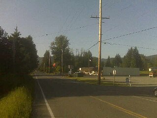
High Bridge is a census-designated place (CDP) in Snohomish County, Washington, United States. The population was 2,994 at the 2010 census. High Bridge includes the Echo Lake community and the former Echo Lake CDP, which was superseded by the larger High Bridge CDP in 2010.

<span class="mw-page-title-main">Alum Creek, West Virginia</span> Census-designated place in West Virginia, United States

Alum Creek is a census-designated place (CDP) in Kanawha and Lincoln counties along the Coal River in the U.S. state of West Virginia. It includes the unincorporated communities of Alum Creek, Forks of Coal, and Priestley. The CDP had a population of 1,749 at the 2010 census, down from 1,839 at the 2000 census.

<span class="mw-page-title-main">Allentown, Tukwila, Washington</span>

Allentown is a neighborhood of Tukwila, Washington, on the Duwamish River. It is situated between the Rainier View neighborhood of southern Seattle and the Boulevard Park neighborhood of unincorporated King County.

<span class="mw-page-title-main">Dorneyville, Pennsylvania</span> Census-designated place in Pennsylvania, United States

Dorneyville is a census-designated place in Lehigh County, Pennsylvania. As of the 2020 census the population was 4,850. Dorneyville is located just west of Allentown in South Whitehall Township and Salisbury Township.

<span class="mw-page-title-main">Wescosville, Pennsylvania</span> Census-designated place in Pennsylvania, United States

Wescosville is a census-designated place located in Lehigh County, Pennsylvania. It is located between Allentown and Trexlertown in Lower Macungie Township. It is part of the Lehigh Valley, which had a population of 861,899 and was the 68th most populous metropolitan area in the U.S. as of the 2020 census.

<span class="mw-page-title-main">Green River Trail</span> Washington state bicycle and pedestrian trail

The Green River Trail is a 19.6-mile (31.5 km) pedestrian and bicycle trail in King County, Washington, USA. It runs along the banks of the Duwamish and Green Rivers, crossing the river several times on bridges. The trail goes through a variety of landscapes, ranging from industrial to rural.

Boulevard Park is a census-designated place (CDP) in King County, Washington, United States. The population was 5,287 at the 2010 census. Boulevard Park was part of the Riverton-Boulevard Park CDP in 2000 but was split for the 2010 census into its own CDP.

Lake Holm is a census-designated place (CDP) in King County, Washington, United States. The population was 3,221 at the 2010 census.

Shadow Lake is a census-designated place (CDP) in King County, Washington, United States. The population was 2,262 at the 2010 census.

Eastmont is a census-designated place (CDP) in Snohomish County, Washington, United States. The population was 20,101 at the 2010 census. Eastmont is one of two CDPs that were created out of the former Seattle Hill-Silver Firs CDP in 2010, the other being Silver Firs. Eastmont is the location of Community Transit's Eastmont Park & Ride, which is serviced by Sound Transit Express route 513.

References

  1. "Riverton". Geographic Names Information System . United States Geological Survey, United States Department of the Interior.
  2. "Geographic Identifiers: 2010 Census Summary File 1 (G001), Riverton CDP, Washington". American FactFinder. U.S. Census Bureau. Archived from the original on February 13, 2020. Retrieved June 20, 2019.
  3. "Washington: 2010 Population and Housing Unit Counts" (PDF). United States Census Bureau. Retrieved 26 February 2013.
  4. The Green-Duwamish River: Connecting people with a diverse environment. Duwamish River Cleanup Coalition/TAG. No date, appears to be 2008 or 2009.
  5. Paula Becker, Riverton Draw Bridge is built across the Duwamish River in 1903, HistoryLink, October 16, 2003. Accessed online 2009-04-16.
  6. Photo from 119th St. S. pedestrian bridge, Photo from Green River Trail below Allentown Bridge.
  7. "US Gazetteer files: 2010, 2000, and 1990". United States Census Bureau. 2011-02-12. Retrieved 2011-04-23.