Grotto, Washington

Last updated

Grotto, Washington
Street scene at Grotto, ca 1913 (PICKETT 759).jpeg
1913 street scene at Grotto
USA Washington location map.svg
Red pog.svg
Grotto
Location in Washington and the United States
Usa edcp location map.svg
Red pog.svg
Grotto
Grotto (the United States)
Coordinates: 47°44′11″N121°25′19″W / 47.73639°N 121.42194°W / 47.73639; -121.42194
Country United States
State Washington
County King
Time zone UTC-8 (Pacific (PST))
  Summer (DST) UTC-7 (PDT)
GNIS feature ID1520375 [1]

Grotto is a small unincorporated community in King County, Washington, United States. It is located on U.S. Route 2 west of Stevens Pass in the Cascade Mountains, near the town of Skykomish. Grotto is known for its scenic mountain environment.

A post office called Grotto was established in 1910. [2] The community was named for gorges near the original town site. [3]

Related Research Articles

<span class="mw-page-title-main">Mount Washington, Massachusetts</span> Town in Massachusetts, United States

Mount Washington is a town in Berkshire County, Massachusetts, United States. It is part of the Pittsfield, Massachusetts Metropolitan Statistical Area. The population was 160 at the 2020 census, making it the least populous town in Berkshire County and, after Gosnold and Monroe, the third least populous in Massachusetts. The name of the town is a tribute to George Washington, who at the time of incorporation was Commander-in-Chief of the Continental Army during the American Revolutionary War.

<span class="mw-page-title-main">Grottoes, Virginia</span> Town in Virginia, United States

Grottoes is an incorporated town in Augusta and Rockingham counties in the U.S. state of Virginia. The population was 2,668 at the 2010 census.

<span class="mw-page-title-main">Mazama, Washington</span> Unincorporated community

Mazama is an unincorporated community in Okanogan County located in the Methow Valley of Washington, on the east slopes of the North Cascades and North Cascades National Park. It is located along the North Cascades Highway, 14 miles (23 km) northwest of Winthrop and about 28 miles (45 km) south of the Canada–United States border. Mazama's town center elevation is 2,106 feet (642 m), and it is located 2.7 miles (4.3 km) south of and 4,895 feet (1,492 m) below Goat Peak.

<span class="mw-page-title-main">Mount St. Mary's University</span> Catholic liberal arts university in Maryland

Mount St. Mary's University is a private Roman Catholic university in Emmitsburg, Maryland. It has the largest Catholic seminary in the United States. Undergraduate programs are divided between the College of Liberal Arts, the Richard J. Bolte School of Business, and the School of Natural Science and Mathematics. "The Mount" has over 40 undergraduate majors, minors, concentrations, and special programs, as well as bachelor's/master's combinations in partnership with other universities, 8 master's programs, and 6 postgraduate certificate programs.

<span class="mw-page-title-main">Snowmass, Colorado</span> Unincorporated community in Colorado, United States

Snowmass is an unincorporated community and a U.S. Post Office located in Pitkin County, Colorado, United States. It is situated in the valley of the Roaring Fork River, near the mouth of Snowmass Creek along State Highway 82 between Aspen and Basalt. It consists largely of a post office, several commercial businesses, and surrounding houses and ranches. The Snowmass Post Office has the ZIP Code 81654.

Cowiche is a census-designated place and unincorporated community northwest of Yakima, Washington, near the eastern foothills of the Cascade Mountain range, in central Washington State (US). Cowiche, sometimes spelled Cowychee, is said to mean "footbridge between the valley and the mountains." The town had 428 people at the 2010 census.

<span class="mw-page-title-main">Santa's workshop</span> Legendary workshop in the story of Santa Claus

Santa's Workshop is the legendary workshop where Santa Claus and his elves live and make the toys and presents given out at Christmas. The exact location of Santa's workshop varies depending upon local culture. There are at least eight claimed locations for his workshop. For example, people in Canada send letters to Santa's Workshop at his North Pole location in Canada, with the unique postal code of "H0H 0H0". People in the United States believe the workshop is a sprawling commune located at the North Pole. Some people in the United Kingdom and Finland believe that Father Christmas' Workshop is located in Finland in Korvatunturi, Lapland. In addition to housing the factory where toys are either manufactured or distributed by the elves, the complex also houses the residence of Santa, his wife, companions, and all of the reindeer.

<span class="mw-page-title-main">Preston, Washington</span> Unincorporated community in Washington, United States

Preston is an unincorporated and exurban community in the northwest United States, located 22 miles (35 km) east of Seattle in King County, Washington. It was named after railway official William T. Preston.

<span class="mw-page-title-main">North River (South Fork Shenandoah River tributary)</span>

The North River is a 55.3-mile-long (89.0 km) river in the mountains and Shenandoah Valley of northern Virginia, the United States. It joins the South River at Port Republic to form the South Fork Shenandoah River.

<span class="mw-page-title-main">Elk, Washington</span> Unincorporated community in Washington, United States

Elk is an unincorporated rural community in northern Spokane County, Washington, United States.

<span class="mw-page-title-main">Intervale, New Hampshire</span> Unincorporated community in New Hampshire, United States

Intervale is an unincorporated community in Carroll County, New Hampshire, located on the boundary between the towns of Bartlett and Conway in the White Mountains Region. The village is part of the Mount Washington Valley, a resort area that also includes the communities of North Conway and Jackson. The village has a separate ZIP code (03845) from surrounding communities in the Bartlett/Conway area.

The Skykomish Valley, nicknamed Sky Valley, is a region of Snohomish County, Washington, United States, that lies along the Skykomish River. It stretches from Snohomish to the Cascade Mountains, terminating near Skykomish, Washington. The towns from east to west include Skykomish, Baring, Grotto, Index, Gold Bar, Startup, Sultan and Monroe.

<span class="mw-page-title-main">Beaver Creek, Maryland</span> Census-designated place in Maryland, United States

Beaver Creek is an unincorporated community in eastern Washington County, Maryland, United States. Its population was 251 as of the 2010 census. It is located southeast of Hagerstown and north of Boonsboro near U.S. Route 40 and Maryland Route 66. The community is officially included in the Hagerstown Metropolitan Area. This town was founded in 1766.

Woody is an unincorporated community in Kern County, California, in the United States. It is located in the foothills of the Greenhorn Mountains, 25 miles (40 km) north-northeast of Bakersfield at an elevation of 1,654 feet (504 m).

Pond Gap is an unincorporated community in Kanawha County, West Virginia, United States. Pond Gap is 7 miles (11 km) north-northeast of Smithers. Pond Gap has a post office with ZIP code 25160.

Grotto Glacier is a glacier on the east coast of Alexander Island, Antarctica, which flows east into George VI Sound between Belemnite Point and Ablation Point. It is 46 km (29 mi) long, 6 km (4 mi) wide where it emerges from the coastal mountains, and 13 km (8.1 mi) wide at its mouth. It was first photographed from the air on 23 November 1935, by Lincoln Ellsworth and mapped from these photographs by W.L.G. Joerg. It was roughly surveyed in 1936 by the British Graham Land Expedition and resurveyed in 1949 by the Falkland Islands Dependencies Survey (FIDS). The glacier was so named by the FIDS because a sledge dog was rescued from a grotto-like crevasse in the glacier.

Alder is a census-designated place (CDP) in Pierce County, Washington, United States. The population was 227 at the 2010 census. The community is located along the shore of Alder Lake on State Route Highway 7 near the entrance to Mount Rainier National Park.

Quinnimont is an unincorporated community in Fayette County, West Virginia, United States. Quinnimont is located on West Virginia Route 41 near the New River, 7.1 miles (11.4 km) east-southeast of Mount Hope. Quinnimont had a post office, which opened on February 23, 1874, and closed on February 1, 1997.

<span class="mw-page-title-main">Tyler, Washington</span> Unincorporated community in Washington, United States

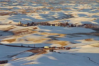
Tyler is an unincorporated community in Spokane County, Washington, United States. Tyler is located on Washington State Route 904 near Interstate 90, 10.4 miles (16.7 km) west-southwest of Cheney.

<span class="mw-page-title-main">Dewey, South Dakota</span> Unincorporated community in South Dakota, United States

Dewey is an unincorporated community near the southwest corner of Custer County, South Dakota, United States, less than one mile from the Wyoming border in a prairie region of the Black Hills. There are approximately five or six homes in town. Dewey has a volunteer fire department in the Edgemont city district.

References

  1. "Grotto". Geographic Names Information System . United States Geological Survey, United States Department of the Interior.
  2. "Post Offices". Jim Forte Postal History. Retrieved August 7, 2016.
  3. Meany, Edmond S. (1923). Origin of Washington geographic names. Seattle: University of Washington Press. p. 105.