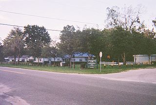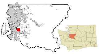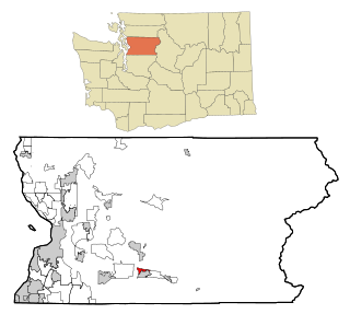
Istachatta is an unincorporated community and census-designated place (CDP) in Hernando County, Florida, United States. The population was 116 at the 2010 census, up from 65 at the 2000 census. The name "Istachatta" is derived from a Seminole word meaning "man snake".

Palm Springs North is an unincorporated community and census-designated place (CDP) in Miami-Dade County, Florida, United States. It is part of the Miami metropolitan area of South Florida. The population was 5,030 at the 2020 census.

Lakeland Highlands is an unincorporated community and census-designated place (CDP) in Polk County, Florida, United States. The population was 11,056 at the 2010 census. It is part of the Lakeland–Winter Haven Metropolitan Statistical Area. It is an affluent residential community located south of the Lakeland city limits, and north of the Mulberry city limits. Lakeland Highlands neighbors Medulla, and together the two communities make up much of what is known as South Lakeland (unincorporated).

White City is a census-designated place (CDP) in St. Lucie County, Florida, United States. The population was 3,719 at the 2010 census. It is part of the Port St. Lucie Metropolitan Statistical Area.

Dayton is an unincorporated community and census-designated place (CDP) in Lake County, Montana, United States. The population was 84 at the 2010 census.

Cottage Lake is a census-designated place (CDP) in King County, Washington, United States. The population was 22,494 at the 2010 census. The lake itself falls within the 98072 ZIP code, while the developments east of the lake fall under the 98077 ZIP code.

East Hill-Meridian is a former census-designated place (CDP) in King County, Washington. The population was 29,878 at the time of the 2010 census. The majority of the census area is now within the limits of Kent and Renton.

Lake Morton-Berrydale is a census-designated place (CDP) in King County, Washington, United States. The population was 10,474 at the 2020 census.

Lakeland South is a census-designated place (CDP) in King County, Washington, United States. The population was 13,169 at the 2020 census.

Mirrormont is a census-designated place (CDP) in King County, Washington, United States, south of Issaquah. The population was 3,858 at the 2020 census. Within the last decade, the area has seen a shift in development as larger homes have been constructed in Cedar Grove, the Highlands at Tiger Mountain and Mirrormont.

Union Hill-Novelty Hill is a census-designated place (CDP) in King County, Washington, United States. The area was first recognized by the Census Bureau in the 2000 census. The population was 22,683 at the 2020 census.

Parkwood is a census-designated place (CDP) in Kitsap County, Washington, United States. The population was 7,635 at the 2020 census.

Prairie Ridge is a census-designated place (CDP) in Pierce County, Washington, United States. The population was 12,288 at the 2020 census.

High Bridge is a census-designated place (CDP) in Snohomish County, Washington, United States. The population was 3,140 at the 2020 census, up from 2,994 at the 2010 census. High Bridge includes the Echo Lake community and the former Echo Lake CDP, which was superseded by the larger High Bridge CDP in 2010.

Martha Lake is a census-designated place (CDP) in Snohomish County, Washington, United States. The population was 21,129 at the 2020 census. It lies west of Mill Creek and northeast of Lynnwood, near the lake of the same name.

North Sultan is a census-designated place (CDP) in Snohomish County, Washington, United States. The population was 256 at the 2020 census.

Lake Stickney is a census-designated place (CDP) in Snohomish County, Washington, United States. The population was 15,413 at the 2020 census. The CDP was known as Paine Field-Lake Stickney prior to 2010. The new Lake Stickney CDP no longer contains the Paine Field airport.

Picnic Point-North Lynnwood is a former census-designated place (CDP) in Snohomish County, Washington, United States. The population was 22,953 at the 2000 census. For the 2010 census, the CDP was separated into Picnic Point and North Lynnwood, with a small part going to the new Meadowdale CDP.
Clearview Acres is a census-designated place (CDP) in Sweetwater County, Wyoming, United States. The population was 795 at the 2010 census.

Bangor Base is a census-designated place (CDP) in Kitsap County, Washington, within U.S. Naval Base Kitsap on the Kitsap Peninsula. Its population was 5,482 at the 2020 census.


